Mc Allen - Mcallen Miller Intl
Airport details
| Country | United States of America |
| State | Texas |
| Region | K4 |
| Airspace | Houston Oceanic Ctr |
| Municipality | McAllen |
| Elevation | 104ft (32m) |
| Timezone | GMT -6 |
| Coordinates | 26.17583, -98.23861 |
| Magnetic var | |
| Type | land |
| Available since | X-Plane v10.40 |
| ICAO code | KMFE |
| IATA code | MFE |
| FAA code | MFE |
Communication
| McAllen Miller Intl ATIS | 128.500 |
| McAllen Miller Intl CTAF | 118.500 |
| McAllen Miller Intl UNICOM | 122.950 |
| McAllen Miller Intl Ground Control | 121.800 |
| McAllen Miller Intl Tower | 118.500 |
| McAllen Miller Intl VALLEY Approach/Departure | 121.000 |
Approach frequencies
| ILS-cat-I | RW32 | 111.7 | 18.00mi |
| ILS-cat-I | RW14 | 111.7 | 18.00mi |
| 3° GS | RW32 | 111.7 | 18.00mi |
| 3° GS | RW14 | 111.7 | 18.00mi |
Nearby Points of Interest:
M and J Nelson Building
-La Lomita Chapel
-First Lift Station
-Mission Citrus Growers Union Packing Shed
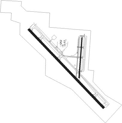
Runway info
Runway 14 / 32  | ||
| length | 2174m (7133ft) | |
| bearing | 138° / 318° | |
| width | 46m (150ft) | |
| surface | asphalt | |
| displ threshold | 42m (138ft) / 0m (0ft) | |
| blast zone | 61m (200ft) / 61m (200ft) | |
| Runway 18 / 36 | ||
| length | 807m (2648ft) | |
| bearing | 190° / 10° | |
| width | 18m (60ft) | |
| surface | asphalt | |
| blast zone | 15m (49ft) / 15m (49ft) | |
Nearby beacons
| code | identifier | dist | bearing | frequency |
|---|---|---|---|---|
| MFE | MC ALLEN VOR/DME | 0.1 | 228° | 117.20 |
| MF | MISSI (MC ALLEN) NDB | 6 | 317° | 330 |
| REX | REYNOSA VOR/DME | 9.9 | 178° | 112.40 |
| HRL | HARLINGEN VOR/DME | 31.7 | 85° | 113.65 |
| HR | SEBAS (HARLINGEN) NDB | 32.2 | 77° | 338 |
| EOC | COYOTE (ENCINO) NDB | 40.6 | 2° | 232 |
| BR | DEPOO (BROWNSVILLE) NDB | 41 | 105° | 393 |
| MAM | MATAMOROS VOR/DME | 45.6 | 120° | 114.30 |
| BRO | BROWNSVILLE VORTAC | 48.9 | 106° | 116.30 |
Instrument approach procedures
| runway | airway (heading) | route (dist, bearing) |
|---|---|---|
| RW14 | HARGI (221°) | HARGI CUYAB (16mi, 264°) 2000ft ECUVE (8mi, 233°) 2000ft |
| RNAV | ECUVE 2000ft FOLUL (7mi, 138°) 2000ft EYOVE (4mi, 138°) 660ft KMFE (2mi, 136°) 167ft (5849mi, 105°) 1500ft FLATZ (5831mi, 285°) 3000ft FLATZ (turn) | |
| RW32 | FLATZ (265°) | FLATZ HOGIP (7mi, 211°) 2400ft FOVUD (8mi, 233°) 2100ft |
| RNAV | FOVUD 2100ft GASHS (7mi, 318°) 1800ft CUYAN (4mi, 318°) 660ft KMFE (2mi, 319°) 151ft (5849mi, 105°) 800ft SANCA (5842mi, 285°) 2000ft SANCA (turn) |
Disclaimer
The information on this website is not for real aviation. Use this data with the X-Plane flight simulator only! Data taken with kind consent from X-Plane 12 source code and data files. Content is subject to change without notice.