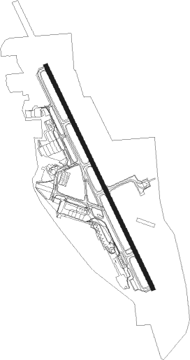
Medford - Rogue Valley Intl Medford
Airport details
| Country | United States of America |
| State | Oregon |
| Region | K1 |
| Airspace | Seattle Ctr |
| Municipality | Medford |
| Elevation | 1333ft (406m) |
| Timezone | GMT -8 |
| Coordinates | 42.37191, -122.87617 |
| Magnetic var | |
| Type | land |
| Available since | X-Plane v10.40 |
| ICAO code | KMFR |
| IATA code | MFR |
| FAA code | MFR |
Communication
| Rogue Valley Intl Medford ATIS | 127.250 |
| Rogue Valley Intl Medford UNICOM | 122.950 |
| Rogue Valley Intl Medford Ground Control | 121.800 |
| Rogue Valley Intl Medford MEDFORD Tower | 119.400 |
| Rogue Valley Intl Medford CASCADE Departure | 124.300 |
Approach frequencies
| ILS-cat-I | RW14 | 110.3 | 18.00mi |
| 3° GS | RW14 | 110.3 | 18.00mi |
Nearby Points of Interest:
Conro Fiero House
-Elks Lodge
-Medford Southern Pacific Railroad Passenger Depot
-James A. Redden Federal Courthouse
-Medford Carnegie Library
-Jackson County Courthouse
-Frank Chamberlain Clark House
-South Oakdale Historic District
-Camp White Station Hospital Administration Building
-Bear Creek Greenway
-Patrick F. McManus House
-Chavner Family House
-Ashland Oregon National Guard Armory
-Women's Civic Improvement Clubhouse
-Ashland Downtown Historic District
-First Baptist Church
-Squaw Peak Lookout
-Jacksonville-to-Fort Klamath Military Wagon Road
-John and Susanna Ahlf House
-Old Grants Pass City Hall
-Grants Pass Supervisor's Warehouse
-Willow Prairie Cabin
-Pacific Crest Trail
-Nils Ahlstrom House
-Hugo Community Baptist Church
Nearby beacons
| code | identifier | dist | bearing | frequency |
|---|---|---|---|---|
| MEF | MEDFORD NDB | 1.1 | 352° | 356 |
| OED | ROGUE VALLEY (MEDFORD) VORTAC | 6.6 | 341° | 113.60 |
| MOG | MONTAGUE NDB | 42.5 | 149° | 404 |
| RBG | ROSEBURG VOR/DME | 53 | 330° | 108.20 |
| FJS | FORT JONES VOR/DME | 55.4 | 176° | 109.60 |
Departure and arrival routes
| Transition altitude | 18000ft |
| Transition level | 18000ft |
| SID end points | distance | outbound heading | |
|---|---|---|---|
| RW14 | |||
| GNATS7 | 13mi | 181° | |
| BRUTE7 | 22mi | 347° | |
| RW32 | |||
| EAGLE6 | 56mi | 105° | |
| GNATS7 | 13mi | 181° | |
| BRUTE7 | 22mi | 347° | |
Instrument approach procedures
| runway | airway (heading) | route (dist, bearing) |
|---|---|---|
| RW14-Y | SAMIE (153°) | SAMIE 7000ft FISTA (3mi, 152°) 5700ft AMASE (4mi, 152°) 4600ft |
| RNAV | AMASE 4600ft OSSAJ (2mi, 152°) 3900ft JUROD (7mi, 152°) 1628ft (6825mi, 109°) 1735ft SAMIE (6824mi, 289°) 7000ft SAMIE (turn) 7000ft | |
| RW32 | ACLOB (283°) | ACLOB KUSNE (9mi, 246°) 7700ft INITY (4mi, 259°) 7600ft HIDVO (5mi, 286°) 6100ft FILPU (5mi, 303°) 4600ft |
| RW32 | BAYTS (38°) | BAYTS OMACO (15mi, 106°) 9100ft NIGEE (7mi, 81°) 7800ft IPAGY (7mi, 18°) 7400ft HIDVO (3mi, 319°) 6100ft FILPU (5mi, 303°) 4600ft |
| RW32 | SAMIE (153°) | SAMIE RURTE (25mi, 119°) 7300ft ZIDAX (9mi, 172°) 7300ft WONIG (2mi, 239°) 6600ft PUNRE (3mi, 259°) 5600ft FILPU (3mi, 282°) 4600ft |
| RW32 | ZUNAS (357°) | ZUNAS NIGEE (13mi, 54°) 7400ft IPAGY (7mi, 18°) 7400ft HIDVO (3mi, 319°) 6100ft FILPU (5mi, 303°) 4600ft |
| RNAV | FILPU 4600ft ERBAW (2mi, 294°) 3800ft CUNBA (5mi, 311°) 2600ft KMFR (4mi, 329°) 1385ft SUYRU (5mi, 335°) TULNE (7mi, 15°) CUTTR (10mi, 52°) 9000ft CUTTR (turn) | |
| RWNVD | CEGAN (281°) | CEGAN BRKET (21mi, 239°) 10000ft BRKET (turn) 10000ft SUXCI (6mi, 339°) 8500ft |
| RWNVD | CONLI (74°) | CONLI BRKET (31mi, 105°) 10000ft BRKET (turn) 10000ft SUXCI (6mi, 339°) 8500ft |
| RWNVD | FJS (356°) | FJS ROMAE (30mi, 12°) 10000ft BRKET (7mi, 339°) 10000ft SUXCI (6mi, 339°) 8500ft |
| RWNVD | OED (161°) | OED BRKET (27mi, 159°) 10000ft BRKET (turn) 10000ft SUXCI (6mi, 339°) 8500ft |
| RNAV | SUXCI 8500ft GOLLD (4mi, 339°) 7400ft HURLO (4mi, 339°) 5800ft KMFR (7mi, 336°) 1390ft OED (7mi, 341°) 7800ft OED (turn) |
Disclaimer
The information on this website is not for real aviation. Use this data with the X-Plane flight simulator only! Data taken with kind consent from X-Plane 12 source code and data files. Content is subject to change without notice.