Moultrie - Moultrie Muni
Airport details
| Country | United States of America |
| State | Georgia |
| Region | K7 |
| Airspace | Jacksonville Ctr |
| Municipality | Colquitt County |
| Elevation | 292ft (89m) |
| Timezone | GMT -5 |
| Coordinates | 31.08492, -83.80325 |
| Magnetic var | |
| Type | land |
| Available since | X-Plane v10.40 |
| ICAO code | KMGR |
| IATA code | MGR |
| FAA code | MGR |
Communication
| Moultrie Muni AWOS 3 | 118.925 |
| Moultrie Muni CTAF/UNICOM | 122.800 |
| Moultrie Muni VALDOSTA Approach/Departure | 119.525 |
| Moultrie Muni VALDOSTA Approach/Departure | 126.600 |
Nearby Points of Interest:
Colquitt County Arts Center
-Colquitt County Jail
-Colquitt County Courthouse
-Moultrie Commercial Historic District
-Carnegie Library of Moultrie
-James W. Coleman House
-D. B. Anderson and Company Building
-Glenwood Historic District
-Joe M. Beutell House
-Burch-Mitchell House
-B'nai Israel Synagogue and Cemetery
-Lapham–Patterson House
-Tockwotton-Love Place Historic District
-Augustine Hansell House
-Judge Henry William and Francesca Hopkins House
-Hardy Bryan House
-Thomasville Commercial Historic District
-Dr. David Brandon House
-Thomas County Courthouse
-Ephraim Ponder House
-Stevens Street Historic District
-Thomasville Depot
-Wright House
-Birdwood
-Millpond Plantation
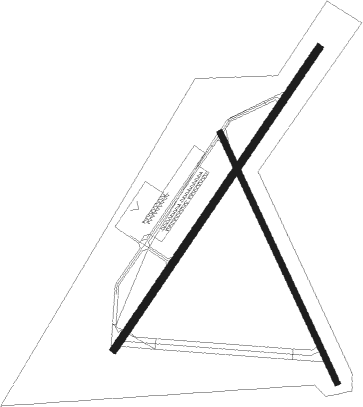
Runway info
Runway 4 / 22  | ||
| length | 1565m (5135ft) | |
| bearing | 43° / 223° | |
| width | 30m (100ft) | |
| surface | asphalt | |
| blast zone | 44m (144ft) / 47m (154ft) | |
| Runway 16 / 34 | ||
| length | 1182m (3878ft) | |
| bearing | 156° / 336° | |
| width | 23m (75ft) | |
| surface | asphalt | |
| blast zone | 61m (200ft) / 0m (0ft) | |
Nearby beacons
| code | identifier | dist | bearing | frequency |
|---|---|---|---|---|
| MGR | DME | 0.1 | 200° | 108.80 |
| GTP | PATON (THOMASVILLE) NDB | 7.7 | 190° | 245 |
| CYR | CAIDY (CAIRO) NDB | 21.8 | 241° | 338 |
| IFM | TIFT MYERS (TIFTON) VOR | 26.2 | 42° | 112.50 |
| GEF | GREENVILLE VORTAC | 32 | 178° | 109 |
| VAD | MOODY (VALDOSTA) TACAN | 32.2 | 102° | 113.30 |
| OTK | VALDOSTA VOR/DME | 32.5 | 120° | 114.80 |
| LYZ | WILLIS (BAINBRIDGE) NDB | 37.7 | 261° | 359 |
| SUR | FITZGERALD NDB | 41.1 | 44° | 362 |
| PZD | PECAN (ALBANY) VOR/DME | 42.4 | 319° | 116.10 |
| SZW | SEMINOLE VORTAC | 43.2 | 227° | 117.50 |
| OWC | COFFEE COUNTY (DOUGLAS) NDB | 49 | 70° | 390 |
| OHY | CONEY (CORDELE) NDB | 54.9 | 356° | 400 |
Instrument approach procedures
| runway | airway (heading) | route (dist, bearing) |
|---|---|---|
| RW04 | YALMI (43°) | YALMI 2500ft |
| RNAV | YALMI 2500ft ZOLGU (7mi, 43°) 2000ft JELGU (4mi, 43°) 840ft KMGR (2mi, 45°) 314ft (5087mi, 110°) 539ft TUMVY (5080mi, 290°) 2500ft TUMVY (turn) | |
| RW22 | TUMVY (223°) | TUMVY 2500ft |
| RNAV | TUMVY 2500ft JUVVE (6mi, 223°) 2000ft BIKVE (4mi, 223°) 880ft KMGR (2mi, 221°) 342ft (5087mi, 110°) 569ft YALMI (5094mi, 290°) 2500ft YALMI (turn) |
Disclaimer
The information on this website is not for real aviation. Use this data with the X-Plane flight simulator only! Data taken with kind consent from X-Plane 12 source code and data files. Content is subject to change without notice.