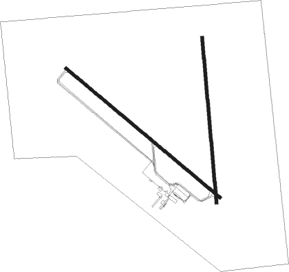
Mitchell - Mitchell Muni
Airport details
| Country | United States of America |
| State | South Dakota |
| Region | K3 |
| Airspace | Minneapolis Ctr |
| Municipality | Mitchell |
| Elevation | 1304ft (397m) |
| Timezone | GMT -6 |
| Coordinates | 43.77483, -98.03861 |
| Magnetic var | |
| Type | land |
| Available since | X-Plane v10.40 |
| ICAO code | KMHE |
| IATA code | MHE |
| FAA code | MHE |
Communication
| Mitchell Muni ASOS | 124.175 |
| Mitchell Muni CTAF/UNICOM | 122.800 |
Approach frequencies
| ILS-cat-I | RW31 | 109.7 | 18.00mi |
| 3° GS | RW31 | 109.7 | 18.00mi |
Nearby Points of Interest:
Whittier School
-Raesly House
-Aurora County Courthouse
-William P. Smith House (Stickney, South Dakota)
-Lincoln House (Stickney, South Dakota)
-Downtown Salem Historic District
-St. Mary's Catholic Church
Nearby beacons
| code | identifier | dist | bearing | frequency |
|---|---|---|---|---|
| MHE | MITCHELL VOR/DME | 0.1 | 26° | 109.20 |
| HON | DME | 41.6 | 338° | 117.60 |
| HO | BEADY (HURON) NDB | 42.1 | 336° | 302 |
| AGZ | WAGNER NDB | 44.1 | 200° | 392 |
| YKN | YANKTON VOR/DME | 58.8 | 143° | 111.40 |
| YK | CAGUR (YANKTON) NDB | 64.5 | 142° | 347 |
Instrument approach procedures
| runway | airway (heading) | route (dist, bearing) |
|---|---|---|
| RW13 | KAATS (107°) | KAATS NUSCI (15mi, 95°) 3500ft |
| RW13 | MHE (206°) | MHE NUSCI (12mi, 304°) 3500ft NUSCI (turn) 3500ft |
| RW13 | WELEK (158°) | WELEK NUSCI (7mi, 235°) 3500ft |
| RNAV | NUSCI 3500ft CUDGA (6mi, 125°) 3200ft KMHE (6mi, 124°) 1342ft (5753mi, 114°) 1575ft JUTUB (5746mi, 294°) 3200ft JUTUB (turn) | |
| RW18 | WUNTI (181°) | WUNTI 3500ft |
| RNAV | WUNTI 3500ft XESCU (6mi, 179°) 3000ft YOXED (3mi, 179°) 2200ft KMHE (3mi, 184°) 1338ft (5753mi, 114°) 1548ft AVAME (5754mi, 294°) 3500ft AVAME (turn) | |
| RW31 | MHE (206°) | MHE JUTUB (12mi, 127°) 3200ft JUTUB (turn) 3200ft |
| RW31 | TECUD (322°) | TECUD JUTUB (5mi, 14°) 3200ft |
| RW31 | YUGUL (275°) | YUGUL JUTUB (9mi, 234°) 3200ft |
| RNAV | JUTUB 3200ft WUMGA (6mi, 306°) 3200ft KMHE (6mi, 307°) 1360ft (5753mi, 114°) 1554ft NUSCI (5761mi, 294°) 3500ft NUSCI (turn) | |
| RW36 | AVAME (358°) | AVAME 3500ft |
| RNAV | AVAME 3500ft BEGSE (6mi, 359°) 3000ft CESOT (2mi, 359°) 2200ft KMHE (3mi, 354°) 1353ft (5753mi, 114°) 1554ft WUNTI (5752mi, 294°) 3500ft WUNTI (turn) |
Disclaimer
The information on this website is not for real aviation. Use this data with the X-Plane flight simulator only! Data taken with kind consent from X-Plane 12 source code and data files. Content is subject to change without notice.

