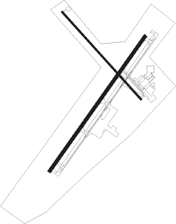
Manhattan - Manhattan Regl
Airport details
| Country | United States of America |
| State | Kansas |
| Region | K3 |
| Airspace | Kansas City Ctr |
| Municipality | Manhattan |
| Elevation | 1057ft (322m) |
| Timezone | GMT -6 |
| Coordinates | 39.14123, -96.67180 |
| Magnetic var | |
| Type | land |
| Available since | X-Plane v10.40 |
| ICAO code | KMHK |
| IATA code | MHK |
| FAA code | MHK |
Communication
| Manhattan Regl ASOS | 119.075 |
| Manhattan Regl CTAF | 118.550 |
| Manhattan Regl Ground Control | 121.850 |
| Manhattan Regl Tower | 118.550 |
| Manhattan Regl KANSAS CITY CNTR | 127.350 |
Approach frequencies
| ILS-cat-I | RW03 | 111.3 | 18.00mi |
| 3° GS | RW03 | 111.3 | 18.00mi |
Nearby Points of Interest:
Goodnow House
-Anderson Hall
-Woman's Club House
-First Territorial Capitol of Kansas
-Manhattan Carnegie Library Building
-E. A. and Ura Wharton House
-Downtown Manhattan Historic District
-Grand Army of the Republic memorial
-Cassius & Adelia Baker House
-Clay County Courthouse
-Atchison, Topeka and Santa Fe Railway 3415
-Lebold Mansion
-Kaw Mission
-Last Chance Store
-First Baptist Church of Council Grove
-Council Grove Historic District

Nearby beacons
| code | identifier | dist | bearing | frequency |
|---|---|---|---|---|
| MHK | MANHATTAN VOR/DME | 0.2 | 36° | 110.20 |
| FRI | FORT RILEY (JUNCTION CITY VOR | 13.5 | 228° | 109.40 |
| HRU | HERINGTON NDB | 27.7 | 197° | 407 |
| TO | BILOY (TOPEKA) NDB | 45.8 | 91° | 521 |
| SLN | SALINA VORTAC | 46.1 | 257° | 117.10 |
| SL | FLORY (SALINA) NDB | 53.2 | 245° | 344 |
| EMP | EMPORIA VORTAC | 56.8 | 148° | 112.80 |
| CA | HARVS (NEWTON) NDB | 66.2 | 211° | 395 |
Departure and arrival routes
| Transition altitude | 18000ft |
| Transition level | 18000ft |
| SID end points | distance | outbound heading | |
|---|---|---|---|
| RW03 | |||
| WILSY2 | 36mi | 180° | |
| RW13 | |||
| WILSY2 | 36mi | 180° | |
| RW21 | |||
| WILSY2 | 36mi | 180° | |
Instrument approach procedures
| runway | airway (heading) | route (dist, bearing) |
|---|---|---|
| RW03 | BELVE (47°) | BELVE 3800ft ZOBEN (4mi, 47°) 3800ft |
| RW03 | DIVBE (65°) | DIVBE BELVE (7mi, 97°) 3800ft ZOBEN (4mi, 47°) 3800ft |
| RW03 | HEYDN (326°) | HEYDN CADEX (23mi, 300°) 3800ft BELVE (5mi, 303°) 3800ft ZOBEN (4mi, 47°) 3800ft |
| RNAV | ZOBEN 3800ft ADEKE (2mi, 47°) 3000ft KMHK (7mi, 46°) 1102ft (5716mi, 112°) 1256ft BIRME (5707mi, 292°) 3100ft BIRME (turn) | |
| RW21 | BIRME (227°) | BIRME 3100ft |
| RW21 | ENUBE (148°) | ENUBE DEBSE (20mi, 122°) 3100ft BIRME (5mi, 123°) 3100ft |
| RW21 | MOPPS (274°) | MOPPS CALKO (23mi, 287°) 3100ft BIRME (5mi, 303°) 3100ft |
| RNAV | BIRME 3100ft AGOKE (6mi, 227°) 2800ft KMHK (6mi, 228°) 1093ft (5716mi, 112°) 1248ft BELVE (5724mi, 292°) 3800ft BELVE (turn) |
Disclaimer
The information on this website is not for real aviation. Use this data with the X-Plane flight simulator only! Data taken with kind consent from X-Plane 12 source code and data files. Content is subject to change without notice.