Metter - Metter Muni
Airport details
| Country | United States of America |
| State | Georgia |
| Region | K7 |
| Airspace | Jacksonville Ctr |
| Municipality | Metter |
| Elevation | 195ft (59m) |
| Timezone | GMT -5 |
| Coordinates | 32.37397, -82.08144 |
| Magnetic var | |
| Type | land |
| Available since | X-Plane v10.40 |
| ICAO code | KMHP |
| IATA code | n/a |
| FAA code | MHP |
Communication
| Metter Muni CTAF/UNICOM | 123.000 |
Nearby Points of Interest:
South Metter Residential Historic District
-Candler County Courthouse
-Metter Downtown Historic District
-Candler County Jail
-First Methodist Episcopal Church
-Upper Lott's Creek Primitive Baptist Church and Cemetery
-Davis-Proctor House
-Twin City Historic District
-Mitchell J. Green Plantation
-John Rountree Log House
-Albert Neal Durden House
-George W. DeLoach House
-Dr. James W. Daniel House
-Evans County Courthouse
-Dr. Madison Monroe Holland House
-James Alonzo Brannen House
-Bulloch County Courthouse
-Josiah Davis House
-Savannah Avenue Historic District
-Donehoo-Brannen House
-Robert and Missouri Garbutt House
-Swainsboro Light and Water Plant
-James Coleman House
-Citizens Bank of Vidalia
-Vidalia Commercial Historic District
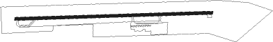
Runway info
| Runway 10 / 28 | ||
| length | 1521m (4990ft) | |
| bearing | 92° / 272° | |
| width | 23m (75ft) | |
| surface | asphalt | |
| blast zone | 46m (151ft) / 0m (0ft) | |
Nearby beacons
| code | identifier | dist | bearing | frequency |
|---|---|---|---|---|
| UQN | ONYUN (VIDALIA) NDB | 14.2 | 235° | 372 |
| BZ | BULLO (STATESBORO) NDB | 21.3 | 84° | 407 |
| EEX | EMANUEL COUNTY (SWAINSBORO) NDB | 25.7 | 308° | 309 |
| JYL | SYLVANIA NDB | 29.6 | 61° | 245 |
| DBN | DUBLIN VORTAC | 39.6 | 284° | 113.10 |
| AZE | HAZLEHURST NDB | 41.3 | 229° | 414 |
| BHC | BAXLEY NDB | 42.7 | 205° | 376 |
| MOQ | MC INTOSH (HINESVILLE) NDB | 43.6 | 134° | 263 |
| MQW | MC RAE NDB | 43.9 | 251° | 280 |
| SAV | SAVANNAH VORTAC | 46.8 | 104° | 115.95 |
| DB | CREKE (DUBLIN) NDB | 47.5 | 277° | 251 |
| SVN | HUNTER (SAVANNAH) VOR/DME | 52.5 | 111° | 111.60 |
| AMG | ALMA VORTAC | 54.7 | 207° | 115.10 |
| AG | BUSHE (AUGUSTA) NDB | 55.2 | 8° | 233 |
| ALD | ALLENDALE VOR | 55.3 | 51° | 116.70 |
| OWC | COFFEE COUNTY (DOUGLAS) NDB | 72.3 | 221° | 390 |
Instrument approach procedures
| runway | airway (heading) | route (dist, bearing) |
|---|---|---|
| RW10 | KLICK (112°) | KLICK GAYEP (16mi, 128°) 2000ft |
| RW10 | TRUET (82°) | TRUET GAYEP (14mi, 73°) 2000ft |
| RNAV | GAYEP 2000ft CERDO (6mi, 92°) 2000ft CABUX (3mi, 92°) 880ft KMHP (2mi, 92°) 248ft (5004mi, 112°) 700ft LOTTS (4992mi, 292°) 3000ft LOTTS (turn) | |
| RW28 | LOTTS (279°) | LOTTS 3000ft |
| RNAV | LOTTS 3000ft JAMEB (7mi, 285°) 1800ft CULIX (3mi, 272°) 920ft KMHP (3mi, 272°) 253ft (5004mi, 112°) 700ft LOTTS (4992mi, 292°) 3000ft LOTTS (turn) |
Disclaimer
The information on this website is not for real aviation. Use this data with the X-Plane flight simulator only! Data taken with kind consent from X-Plane 12 source code and data files. Content is subject to change without notice.