Mojave
Airport details
| Country | United States of America |
| State | California |
| Region | K2 |
| Airspace | Los Angeles Ctr |
| Municipality | Mojave |
| Elevation | 2791ft (851m) |
| Timezone | GMT -8 |
| Coordinates | 35.05894, -118.15061 |
| Magnetic var | |
| Type | land |
| Available since | X-Plane v10.40 |
| ICAO code | KMHV |
| IATA code | MHV |
| FAA code | MHV |
Communication
| Mojave AWOS | 132.225 |
| Mojave CTAF | 127.600 |
| Mojave Ground Control | 123.900 |
| Mojave Tower | 127.600 |
| Mojave JOSHUA Approach/Departure | 133.650 |
Nearby Points of Interest:
Tehachapi Railroad Depot
-Rogers Dry Lake
-Courtlandt Gross House
-Tehachapi Loop
-Last Chance Canyon
-Burro Schmidt Tunnel
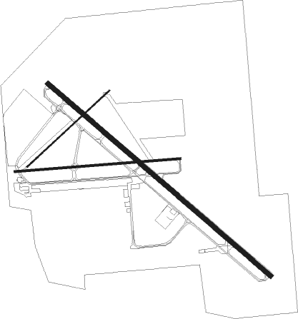
Runway info
Runway 12 / 30  | ||
| length | 3812m (12507ft) | |
| bearing | 130° / 310° | |
| width | 61m (200ft) | |
| surface | asphalt | |
| displ threshold | 183m (600ft) / 274m (899ft) | |
| blast zone | 122m (400ft) / 122m (400ft) | |
| Runway 8 / 26 | ||
| length | 2146m (7041ft) | |
| bearing | 90° / 270° | |
| width | 30m (98ft) | |
| surface | asphalt | |
| blast zone | 91m (299ft) / 91m (299ft) | |
| Runway 4 / 22 | ||
| length | 1456m (4777ft) | |
| bearing | 57° / 237° | |
| width | 15m (49ft) | |
| surface | asphalt | |
| displ threshold | 8m (26ft) / 8m (26ft) | |
| blast zone | 0m (0ft) / 110m (361ft) | |
Nearby beacons
| code | identifier | dist | bearing | frequency |
|---|---|---|---|---|
| EDW | EDWARDS VORTAC | 21 | 100° | 116.40 |
| PMD | PALMDALE VORTAC | 26 | 169° | 114.50 |
| LHS | LAKE HUGHES VORTAC | 30.8 | 229° | 114.35 |
| GMN | GORMAN VORTAC | 38.1 | 250° | 116.10 |
| NID | CHINA LAKE TACAN | 43.9 | 36° | 111.60 |
| VCV | VICTORVILLE VOR/DME | 46.7 | 121° | 109.05 |
| EHF | SHAFTER (BAKERSFIELD) VORTAC | 52.9 | 294° | 115.40 |
| VNY | VAN NUYS VOR/DME | 52.9 | 202° | 113.10 |
| FIM | FILLMORE VORTAC | 55.4 | 226° | 112.50 |
| POM | POMONA VORTAC | 61.5 | 160° | 110.40 |
| TTE | TULE VOR/DME | 66.6 | 314° | 109.20 |
| CMA | CAMARILLO VOR/DME | 68.9 | 228° | 115.80 |
| VTU | VENTURA (OXNARD) VOR/DME | 72 | 224° | 108.20 |
| NTD | POINT MUGU (OXNARD) TACAN | 73.9 | 226° | 110.60 |
Departure and arrival routes
| Transition altitude | 18000ft |
| Transition level | 18000ft |
| SID end points | distance | outbound heading | |
|---|---|---|---|
| RW22 | |||
| JERID5 | 16mi | 231° | |
| RW26 | |||
| JERID5 | 16mi | 231° | |
| RW30 | |||
| JERID5 | 16mi | 231° | |
Instrument approach procedures
| runway | airway (heading) | route (dist, bearing) |
|---|---|---|
| RW04 | LHS (49°) | LHS JERID (15mi, 46°) 8000ft ETFIR (5mi, 48°) 6200ft |
| RW04 | PMD (349°) | PMD JERID (21mi, 307°) 8000ft ETFIR (5mi, 48°) 6200ft |
| RW04 | ZALJE (66°) | ZALJE JERID (5mi, 127°) 8000ft ETFIR (5mi, 48°) 6200ft |
| RNAV | ETFIR 6200ft AGRUF (4mi, 49°) 5300ft MLISA (2mi, 49°) 4700ft YITUY (2mi, 49°) 3820ft UCASU (2mi, 49°) 3016ft (6771mi, 107°) 3300ft ENAMY (6757mi, 287°) 7000ft ENAMY (turn) 7000ft | |
| RW22 | AMONT (102°) | AMONT KEYRO (10mi, 62°) 9100ft PUSLE (25mi, 90°) 9000ft ENAMY (6mi, 91°) 7200ft ENAMY (turn) 6800ft |
| RW22 | ARVIN (107°) | ARVIN KEYRO (14mi, 90°) 9100ft PUSLE (25mi, 90°) 9000ft ENAMY (6mi, 91°) 7200ft ENAMY (turn) 6800ft |
| RW22 | JERID (51°) | JERID UGONE (10mi, 44°) 8000ft ENAMY (22mi, 48°) 7200ft ENAMY (turn) 6800ft |
| RNAV | ENAMY 6800ft MHILL (10mi, 216°) 4700ft KMHV (6mi, 233°) 2829ft (6770mi, 107°) 3200ft UGONE (6775mi, 286°) JERID (10mi, 224°) 6000ft JERID (turn) |
Disclaimer
The information on this website is not for real aviation. Use this data with the X-Plane flight simulator only! Data taken with kind consent from X-Plane 12 source code and data files. Content is subject to change without notice.