Shafter - Shafter Minter Fld
Airport details
| Country | United States of America |
| State | California |
| Region | K2 |
| Airspace | Los Angeles Ctr |
| Municipality | City of Shafter |
| Elevation | 419ft (128m) |
| Timezone | GMT -8 |
| Coordinates | 35.50748, -119.19213 |
| Magnetic var | |
| Type | land |
| Available since | X-Plane v10.40 |
| ICAO code | KMIT |
| IATA code | n/a |
| FAA code | MIT |
Communication
| SHAFTER MINTER FLD CTAF | 122.900 |
| SHAFTER MINTER FLD BAKERSFIELD Approach/Departure | 126.450 |
Nearby Points of Interest:
Santa Fe Passenger and Freight Depot
-Shafter Research Station
-Wasco Union High School
-Jastro Building
-Tevis Block
-Bakersfield California Building
-Baker Branch Library
-The Forty Acres
-Weedpatch Camp
-The Fort (Taft, California)
-Lakeview Gusher
-San Andreas Faults
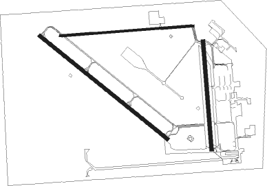
Runway info
Runway 12 / 30  | ||
| length | 1372m (4501ft) | |
| bearing | 128° / 308° | |
| width | 30m (98ft) | |
| surface | asphalt | |
| blast zone | 62m (203ft) / 59m (194ft) | |
| Runway 8 / 26 | ||
| length | 1119m (3671ft) | |
| bearing | 90° / 270° | |
| width | 18m (59ft) | |
| surface | asphalt | |
| Runway 17 / 35 | ||
| length | 907m (2976ft) | |
| bearing | 180° / 0° | |
| width | 30m (100ft) | |
| surface | concrete | |
Nearby beacons
| code | identifier | dist | bearing | frequency |
|---|---|---|---|---|
| EHF | SHAFTER (BAKERSFIELD) VORTAC | 4.8 | 104° | 115.40 |
| TTE | TULE VOR/DME | 25.7 | 23° | 109.20 |
| AVE | AVENAL VOR/DME | 39.3 | 280° | 117.10 |
| FLW | FELLOWS VOR/DME | 41.3 | 238° | 117.50 |
| GMN | GORMAN VORTAC | 45.2 | 155° | 116.10 |
| VIS | VISALIA VOR/DME | 53.5 | 341° | 109.40 |
| LHS | LAKE HUGHES VORTAC | 58 | 143° | 114.35 |
| NLC | NAVY LEMOORE TACAN | 62.7 | 317° | 113.30 |
| RZS | SAN MARCUS (SANTA BARBARA VORTAC | 66.3 | 210° | 114.90 |
| GVO | GAVIOTA VORTAC | 73.4 | 223° | 113.80 |
Instrument approach procedures
| runway | airway (heading) | route (dist, bearing) |
|---|---|---|
| RW12 | COREZ (100°) | COREZ JATLU (8mi, 58°) 2000ft |
| RW12 | PONDD (166°) | PONDD JATLU (12mi, 206°) 2000ft |
| RNAV | JATLU 2000ft SIGRE (6mi, 128°) 2000ft CISUR (3mi, 128°) 900ft KMIT (2mi, 123°) 458ft (6810mi, 107°) 663ft TIPVE (6808mi, 287°) MARIC (15mi, 217°) 3000ft MARIC (turn) |
Disclaimer
The information on this website is not for real aviation. Use this data with the X-Plane flight simulator only! Data taken with kind consent from X-Plane 12 source code and data files. Content is subject to change without notice.