Toms River - Ocean County
Airport details
| Country | United States of America |
| State | New Jersey |
| Region | K6 |
| Airspace | New York Ctr |
| Municipality | Berkeley Township |
| Elevation | 82ft (25m) |
| Timezone | GMT -5 |
| Coordinates | 39.92632, -74.29726 |
| Magnetic var | |
| Type | land |
| Available since | X-Plane v10.40 |
| ICAO code | KMJX |
| IATA code | MJX |
| FAA code | MJX |
Communication
| Ocean County AWOS 3 | 119.875 |
| Ocean County CTAF/UNICOM | 122.700 |
| Ocean County MC GUIRE Approach | 126.475 |
| Ocean County MC GUIRE Departure | 126.475 |
Approach frequencies
| ILS-cat-I | RW06 | 109.9 | 18.00mi |
| 3° GS | RW06 | 109.9 | 18.00mi |
Nearby Points of Interest:
Ocean County Courthouse
-Hangar No. 1, Lakehurst Naval Air Station
-Cedar Bridge Tavern
-U.S. Life Saving Station No. 14
-Orient Baptist Church
-Manahawkin Baptist Church
-Bay Head Historic District
-Glimmer Glass Bridge
-Manasquan Friends Meetinghouse and Burying Ground
-Upper Freehold Baptist Meeting
-Zurbrugg Mansion
-Clarksburg School
-Old Upper Springfield Friends Burying Ground
-Clarksburg Methodist Episcopal Church
-Salter's Mill
-Morris Mansion and Mill
-Martin Maloney Cottage
-Frederic A. Duggan First Aid and Emergency Squad Building
-Audenried Cottage
-Arney's Mount Friends Meetinghouse and Burial Ground
-Roosevelt
-Little Egg Harbor Friends Meeting House
-Hankinson-Moreau-Covenhoven House
-Church Street School
-Court Street School
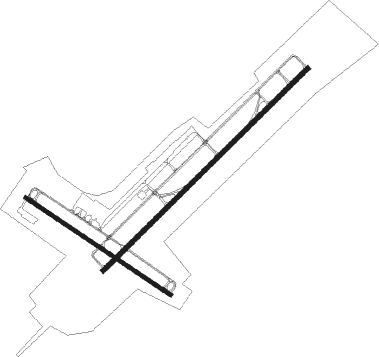
Runway info
Runway 6 / 24  | ||
| length | 1816m (5958ft) | |
| bearing | 57° / 237° | |
| width | 30m (98ft) | |
| surface | asphalt | |
| displ threshold | 0m (0ft) / 36m (118ft) | |
| Runway 14 / 32 | ||
| length | 1097m (3599ft) | |
| bearing | 121° / 301° | |
| width | 23m (75ft) | |
| surface | asphalt | |
Nearby beacons
| code | identifier | dist | bearing | frequency |
|---|---|---|---|---|
| NEL | LAKEHURST TACAN | 7.1 | 333° | 111.80 |
| NEL | LAKEHURST NDB | 7.3 | 342° | 396 |
| CYN | COYLE VORTAC | 9 | 231° | 113.40 |
| GXU | MC GUIRE (WRIGHTSTOWN) VORTAC | 14.6 | 286° | 110.60 |
| RBV | ROBBINSVILLE VORTAC | 18.9 | 324° | 113.80 |
| COL | COLTS NECK VOR/DME | 23.9 | 20° | 115.40 |
| ACY | ATLANTIC CITY VORTAC | 31 | 211° | 108.60 |
| ARD | YARDLEY VOR/DME | 34.2 | 298° | 108.20 |
| VCN | CEDAR LAKE (MILLVILLE) VOR/DME | 38.7 | 240° | 115.20 |
| SBJ | SOLBERG VOR/DME | 44.3 | 326° | 112.90 |
| CRI | CANARSIE VOR/DME | 45.1 | 30° | 112.30 |
| ING | AMBLER NDB | 46.9 | 281° | 275 |
| JFK | KENNEDY (NEW YORK) VOR/DME | 48.7 | 37° | 115.90 |
| CAT | CHATHAM NDB | 49.2 | 351° | 254 |
| RNB | RAINBOW (MILLVILLE) NDB | 49.3 | 239° | 363 |
| TE | TORBY (TETERBORO) NDB | 53.2 | 11° | 214 |
| SIE | SEA ISLE VORTAC | 55 | 211° | 114.80 |
| LGA | LA GUARDIA (NEW YORK) VOR/DME | 55.1 | 27° | 113.10 |
| TEB | TETERBORO VOR/DME | 56.4 | 14° | 108.40 |
| MM | MOREE (MORRISTOWN) NDB | 57.2 | 358° | 392 |
| BWZ | BROADWAY (SCHOOLEY'S MT) VOR/DME | 57.6 | 329° | 114.20 |
| FR | FRIKK (FARMINGDALE) NDB | 63.2 | 44° | 407 |
| DPK | DEER PARK VOR/DME | 69 | 49° | 117.70 |
Departure and arrival routes
| Transition altitude | 18000ft |
| Transition level | 18000ft |
| STAR starting points | distance | inbound heading | |
|---|---|---|---|
| ALL | |||
| WAALK2 | 48.6 | 18° | |
Instrument approach procedures
| runway | airway (heading) | route (dist, bearing) |
|---|---|---|
| RW06 | SOITE (56°) | SOITE 2000ft |
| RNAV | SOITE 2000ft ZOMEV (7mi, 57°) 1600ft XOQUR (3mi, 57°) 720ft KMJX (2mi, 55°) 132ft (4686mi, 118°) 600ft SOITE (4693mi, 298°) 2000ft SOITE (turn) | |
| RW24 | LOYIN (237°) | LOYIN 2000ft |
| RNAV | LOYIN 2000ft JIDPI (5mi, 237°) 2000ft WIYQY (3mi, 237°) 940ft KMJX (3mi, 238°) 116ft (4686mi, 118°) 600ft LOYIN (4678mi, 298°) 2000ft LOYIN (turn) |
Holding patterns
| STAR name | hold at | type | turn | heading* | altitude | leg | speed limit |
|---|---|---|---|---|---|---|---|
| WAALK2 | BUKYY | VHF | right | 248 (68)° | DME 10.0mi | ICAO rules | |
| WAALK2 | JAYBO | VHF | right | 267 (87)° | DME 8.0mi | ICAO rules | |
| WAALK2 | WAALK | VHF | right | 219 (39)° | DME 7.0mi | ICAO rules | |
| *) magnetic outbound (inbound) holding course | |||||||
Disclaimer
The information on this website is not for real aviation. Use this data with the X-Plane flight simulator only! Data taken with kind consent from X-Plane 12 source code and data files. Content is subject to change without notice.