Kansas City - Charles B Wheeler Downtown
Airport details
| Country | United States of America |
| State | Missouri |
| Region | K3 |
| Airspace | Kansas City Ctr |
| Municipality | Kansas City |
| Elevation | 756ft (230m) |
| Timezone | GMT -6 |
| Coordinates | 39.12294, -94.59283 |
| Magnetic var | |
| Type | land |
| Available since | X-Plane v10.40 |
| ICAO code | KMKC |
| IATA code | MKC |
| FAA code | MKC |
Communication
| Charles B Wheeler Downtown ATIS | 120.750 |
| Charles B Wheeler Downtown UNICOM | 122.950 |
| Charles B Wheeler Downtown Clearance DEL | 121.700 |
| Charles B Wheeler Downtown Ground Control | 121.900 |
| Charles B Wheeler Downtown DOWNTOWN Tower | 133.300 |
| Charles B Wheeler Downtown Approach | 119.000 |
| Charles B Wheeler Downtown Departure | 118.400 |
Approach frequencies
| ILS-cat-I | RW03 | 111.75 | 18.00mi |
| ILS-cat-I | RW19 | 109.9 | 18.00mi |
| 3° GS | RW03 | 111.75 | 18.00mi |
| 3° GS | RW19 | 109.9 | 18.00mi |
Nearby Points of Interest:
Kansas City Cold Storage Company Building
-Kansas City Water Department Building
-United States Courthouse and Post Office
-Kansas City, Missouri Western Union Telegraph Building
-Graphic Arts Building
-Buick Automobile Company Building
-Old New England Building
-Kansas City Title and Trust Building
-New York Life Building
-Kansas City Southern Railway Building (Kansas City, Missouri)
-R.A. Long Building
-Wheeling Corrugating Company Building
-Coates House Hotel
-909 Walnut
-Scarritt Building and Arcade
-Fire Department Headquarters; Fire Station No. 2
-Land Bank Building
-Chambers Building
-925 Grand
-Central Library
-Argyle Building
-Professional Building
-Boley Building
-Palace Clothing Company Building
-Kansas City Club Building
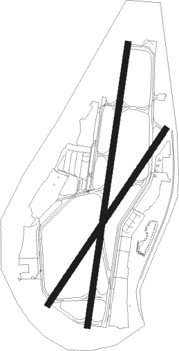
Runway info
Runway 1 / 19  | ||
| length | 2084m (6837ft) | |
| bearing | 16° / 196° | |
| width | 46m (151ft) | |
| surface | concrete | |
| displ threshold | 91m (299ft) / 90m (295ft) | |
| blast zone | 114m (374ft) / 0m (0ft) | |
| Runway 3 / 21 | ||
| length | 1540m (5052ft) | |
| bearing | 46° / 226° | |
| width | 46m (151ft) | |
| surface | asphalt | |
| displ threshold | 152m (499ft) / 213m (699ft) | |
Nearby beacons
| code | identifier | dist | bearing | frequency |
|---|---|---|---|---|
| MCI | KANSAS CITY VORTAC | 11.8 | 318° | 113.25 |
| RN | HUGGY (KANSAS CITY) NDB | 16.1 | 305° | 416 |
| ANX | NAPOLEON VORTAC | 21.6 | 93° | 114 |
| PK | HERBB (OLATHE) NDB | 23.2 | 201° | 420 |
| JZ | NEWBN (LAWRENCE) NDB | 29 | 250° | 338 |
| ST | TARIO (ST JOSEPH) NDB | 36.2 | 330° | 260 |
| TOP | TOPEKA VORTAC | 44.5 | 271° | 117.80 |
| BQS | BRAYMER VOR/DME | 45.1 | 55° | 115.35 |
| OWI | OTTAWA NDB | 46.6 | 229° | 251 |
| AZN | AMAZON (SAINT JOSEPH) NDB | 47.9 | 337° | 233 |
| BUM | BUTLER VORTAC | 51.3 | 173° | 115.90 |
| STJ | SAINT JOSEPH (ST JOSEPH) VORTAC | 52.6 | 338° | 115.50 |
| RBA | DME | 58.2 | 311° | 108.20 |
Departure and arrival routes
| Transition altitude | 18000ft |
| Transition level | 18000ft |
| SID end points | distance | outbound heading | |
|---|---|---|---|
| RW01 | |||
| LAKES3 | 150mi | 80° | |
| RACER7 | 122mi | 145° | |
| WLDCT5 | 142mi | 266° | |
| TIFTO6 | 67mi | 290° | |
| CHIEF7 | 53mi | 338° | |
| ROYAL9 | 70mi | 359° | |
| RW03 | |||
| LAKES3 | 150mi | 80° | |
| RACER7 | 122mi | 145° | |
| WLDCT5 | 142mi | 266° | |
| TIFTO6 | 67mi | 290° | |
| CHIEF7 | 53mi | 338° | |
| ROYAL9 | 70mi | 359° | |
| RW19 | |||
| LAKES3 | 150mi | 80° | |
| RACER7 | 122mi | 145° | |
| WLDCT5 | 142mi | 266° | |
| TIFTO6 | 67mi | 290° | |
| CHIEF7 | 53mi | 338° | |
| ROYAL9 | 70mi | 359° | |
| RW21 | |||
| LAKES3 | 150mi | 80° | |
| RACER7 | 122mi | 145° | |
| WLDCT5 | 142mi | 266° | |
| TIFTO6 | 67mi | 290° | |
| CHIEF7 | 53mi | 338° | |
| ROYAL9 | 70mi | 359° | |
| STAR starting points | distance | inbound heading | |
|---|---|---|---|
| RW01 | |||
| JHAWK6 | 43.1 | 69° | |
| BQS7 | 45.1 | 235° | |
| TYGER6 | 35.5 | 311° | |
| RW03 | |||
| JHAWK6 | 43.1 | 69° | |
| BQS7 | 45.1 | 235° | |
| TYGER6 | 35.5 | 311° | |
| RW19 | |||
| JHAWK6 | 43.1 | 69° | |
| BQS7 | 45.1 | 235° | |
| TYGER6 | 35.5 | 311° | |
| RW21 | |||
| JHAWK6 | 43.1 | 69° | |
| BQS7 | 45.1 | 235° | |
| TYGER6 | 35.5 | 311° | |
Instrument approach procedures
| runway | airway (heading) | route (dist, bearing) |
|---|---|---|
| RW03 | DODSN (48°) | DODSN BEYAV (20mi, 50°) 3000ft |
| RNAV | BEYAV 3000ft DOCAB (6mi, 45°) 2500ft NEDBE (3mi, 45°) 1620ft KMKC (3mi, 45°) 793ft (5619mi, 112°) 994ft HEBKI (5613mi, 293°) LYMES (16mi, 90°) 3000ft LYMES (turn) | |
| RW19 | BQS (235°) | BQS DONNS (10mi, 243°) 3000ft COVRI (25mi, 247°) 3000ft |
| RW19 | COVRI (196°) | COVRI 3000ft |
| RNAV | COVRI 3000ft ZODGA (7mi, 196°) 2600ft ZEGAP (3mi, 196°) 1700ft WALOR (2mi, 196°) 1078ft (5619mi, 112°) 1157ft MIFEV (5628mi, 292°) YETUK (10mi, 243°) 4000ft | |
| RW21 | ANX (273°) | ANX WOTUR (10mi, 310°) 3700ft CEVKO (7mi, 291°) 3700ft |
| RW21 | AYOCI (207°) | AYOCI CEVKO (9mi, 162°) 3700ft |
| RNAV | CEVKO 3700ft OKTUE (7mi, 234°) 2600ft WOWTA (3mi, 234°) 1440ft FISGO (1mi, 234°) 978ft (5619mi, 112°) 1157ft HOTVA (5623mi, 292°) ZADGU (8mi, 167°) ULKEC (10mi, 92°) ANX (18mi, 61°) 3700ft ANX (turn) |
Holding patterns
| STAR name | hold at | type | turn | heading* | altitude | leg | speed limit |
|---|---|---|---|---|---|---|---|
| BQS7 | BQS | NDB | right | 54 (234)° | 1.0min timed | ICAO rules | |
| BQS7 | FONIX | VHF | right | 57 (237)° | 1.0min timed | ICAO rules | |
| JHAWK6 | JHAWK | VHF | left | 223 (43)° | < 17999ft | 1.0min timed | ICAO rules |
| TYGER6 | TYGER | VHF | left | 135 (315)° | < 17999ft | 1.0min timed | ICAO rules |
| *) magnetic outbound (inbound) holding course | |||||||
Disclaimer
The information on this website is not for real aviation. Use this data with the X-Plane flight simulator only! Data taken with kind consent from X-Plane 12 source code and data files. Content is subject to change without notice.