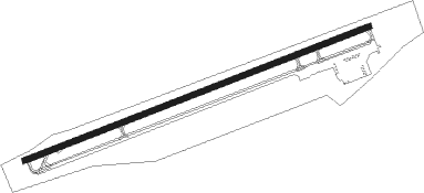
Marion/wytheville - Mountain Empire
Airport details
| Country | United States of America |
| State | Virginia |
| Region | K6 |
| Airspace | Atlanta Ctr |
| Municipality | Smyth County |
| Elevation | 2558ft (780m) |
| Timezone | GMT -5 |
| Coordinates | 36.89486, -81.34995 |
| Magnetic var | |
| Type | land |
| Available since | X-Plane v10.40 |
| ICAO code | KMKJ |
| IATA code | n/a |
| FAA code | MKJ |
Communication
| Mountain Empire AWOS 3 | 123.875 |
| Mountain Empire CTAF/UNICOM | 122.700 |
Approach frequencies
| LOC | RW26 | 110.5 | 18.00mi |
Nearby Points of Interest:
Kimberling Lutheran Cemetery
-Rural Retreat Depot
-Old Stone Tavern
-Mountain Glen
-Smyth County Community Hospital
-Norfolk & Western Railway Depot
-Henderson Building
-R. T. Greer and Company (Marion, Virginia)
-Lincoln Theatre
-Marion Historic District (Marion, Virginia)
-Marion Male Academy
-Ripshin Farm
-St. John's Lutheran Church and Cemetery
-Clynchdale
-Abijah Thomas House
-Haller-Gibboney Rock House
-Wytheville Historic District
-Reed Creek Mill
-Loretto (Wytheville, Virginia)
-Preston House (Marion, Virginia)
-George Oscar Thompson House
-James Wynn House
-Tazewell Historic District
-Stephen G. Bourne House
-Wythe County Poorhouse Farm
Nearby beacons
| code | identifier | dist | bearing | frequency |
|---|---|---|---|---|
| BLF | BLUEFIELD VOR/DME | 25.8 | 21° | 110 |
| JUH | ASHEE (JEFFERSON) NDB | 27.7 | 177° | 410 |
| PSK | PULASKI (DUBLIN) VORTAC | 32.6 | 73° | 116.80 |
| GZG | GLADE SPRING (BLACKFORD) VOR/DME | 35.2 | 265° | 110.20 |
| JJC | MOUNTAIN CITY NDB | 36.7 | 225° | 396 |
| HMV | HOLSTON MOUNTAIN VORTAC | 46.5 | 240° | 114.60 |
| TEC | TECH (BLACKSBURG) NDB | 49.1 | 72° | 368 |
| TR | MOCCA(BRISTOL-JOHNSON-KINGSPOR NDB | 50.8 | 251° | 299 |
| BAR | HEMLOCK (BANNER ELK) NDB | 51.3 | 216° | 320 |
| BKW | BECKLEY VOR/DME | 54.2 | 14° | 117.70 |
| LW | BUSHI (LEWISBURG) NDB | 67.9 | 45° | 346 |
| LWB | DME | 74 | 45° | 116.05 |
Instrument approach procedures
| runway | airway (heading) | route (dist, bearing) |
|---|---|---|
| RW26 | DORFF (113°) | DORFF WUZUR (19mi, 87°) 5700ft WUZUR (turn) 5700ft |
| RW26 | PSK (253°) | PSK WUZUR (18mi, 251°) 5700ft |
| RNAV | WUZUR 5700ft MINTS (4mi, 257°) 5100ft BAYYA (4mi, 256°) 4500ft KMKJ (7mi, 256°) 2554ft (4990mi, 114°) 2958ft CICAG (4997mi, 294°) 6200ft CICAG (turn) |
Disclaimer
The information on this website is not for real aviation. Use this data with the X-Plane flight simulator only! Data taken with kind consent from X-Plane 12 source code and data files. Content is subject to change without notice.
