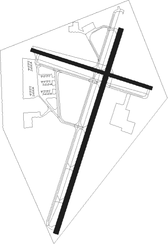
Jackson - Mc Kellar Sipes Rgnl
Airport details
| Country | United States of America |
| State | Tennessee |
| Region | K7 |
| Airspace | Memphis Ctr |
| Municipality | Madison County |
| Elevation | 434ft (132m) |
| Timezone | GMT -6 |
| Coordinates | 35.59989, -88.91561 |
| Magnetic var | |
| Type | land |
| Available since | X-Plane v10.40 |
| ICAO code | KMKL |
| IATA code | MKL |
| FAA code | MKL |
Communication
| MC KELLAR SIPES RGNL ASOS | 119.325 |
| MC KELLAR SIPES RGNL CTAF | 127.150 |
| MC KELLAR SIPES RGNL UNICOM | 122.950 |
| MC KELLAR SIPES RGNL Ground Control | 120.900 |
| MC KELLAR SIPES RGNL JACKSON Tower | 127.150 |
Approach frequencies
| ILS-cat-I | RW02 | 109.1 | 18.00mi |
| 3° GS | RW02 | 109.1 | 18.00mi |
Nearby Points of Interest:
Carnegie Center for Arts and History
-Ross-Sewell House
-William Kirby Walsh House
-Senter-Rooks House
-Chester County Courthouse
-Allen-White School
-Hamlett-Smith House
-Bolivar Court Square Historic District
-Thompsie Edwards House
-Oak Hill Farm
-Somerville Historic District
-Lauderdale County Courthouse

Nearby beacons
| code | identifier | dist | bearing | frequency |
|---|---|---|---|---|
| MKL | MC KELLAR (JACKSON) VOR/DME | 0.3 | 55° | 112 |
| MKL | MERSY (JACKSON) NDB | 5.4 | 206° | 394 |
| DYR | DYERSBURG VORTAC | 31.8 | 316° | 116.80 |
| UU | SEYER (CORINTH) NDB | 38 | 153° | 334 |
| UC | OBION (UNION CITY) NDB | 42 | 354° | 212 |
| HLI | HOLLY SPRINGS VORTAC | 57.4 | 215° | 112.40 |
Instrument approach procedures
| runway | airway (heading) | route (dist, bearing) |
|---|---|---|
| RW02 | STUKA (51°) | STUKA 3000ft ZIFFO (5mi, 108°) 3000ft |
| RW02 | TROVE (359°) | TROVE 3000ft ZIFFO (5mi, 288°) 3000ft |
| RW02 | ZIFFO (26°) | ZIFFO 3000ft |
| RNAV | ZIFFO 3000ft GLIPP (6mi, 27°) 2100ft KMKL (6mi, 26°) 493ft GARTZ (12mi, 27°) 3000ft GARTZ (turn) | |
| RW20 | GARTZ (207°) | GARTZ 3000ft |
| RW20 | SLUDD (179°) | SLUDD 3000ft GARTZ (5mi, 108°) 3000ft |
| RW20 | YUCDO (232°) | YUCDO 3000ft GARTZ (5mi, 288°) 3000ft |
| RNAV | GARTZ 3000ft ZEALS (6mi, 207°) 2000ft WITKA (3mi, 207°) 960ft KMKL (2mi, 208°) 461ft ZIFFO (12mi, 206°) 3000ft ZIFFO (turn) |
Disclaimer
The information on this website is not for real aviation. Use this data with the X-Plane flight simulator only! Data taken with kind consent from X-Plane 12 source code and data files. Content is subject to change without notice.