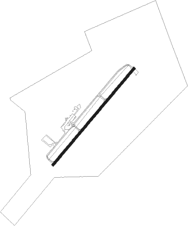
Marksville - Marksville Muni
Airport details
| Country | United States of America |
| State | Louisiana |
| Region | K4 |
| Airspace | Houston Oceanic Ctr |
| Municipality | Marksville |
| Elevation | 79ft (24m) |
| Timezone | GMT -6 |
| Coordinates | 31.09467, -92.06905 |
| Magnetic var | |
| Type | land |
| Available since | X-Plane v11.50 |
| ICAO code | KMKV |
| IATA code | n/a |
| FAA code | MKV |
Communication
| Marksville Muni CTAF | 122.900 |
| Marksville Muni POLK Approach/Departure | 132.050 |
Nearby Points of Interest:
St. Paul Lutheran Church
-Hypolite Bordelon House
-Marksville Prehistoric Indian Site
-Fort DeRussy
-Thomas A. Lemoine House
-Bayou Rouge Baptist Church
-Texas and Pacific Railroad Depot
-Bordelonville Floodgate
-Frithland
-Trinity Episcopal Church
-White Hall Plantation House
-White's Chapel United Methodist Church
-Lecompte High School
-Alexander State Forest Headquarters Building
-Alexandria Hall
-Cottingham House
-Bland House
-James Wade Bolton House
-Arna Wendell Bontemps House
-Commercial Building
-Masonic Building
-Rapides Bank and Trust Company Building
-Mt. Olivet Episcopal Church and Cemetery
-C.A. Schnack Jewelry Company Store
-United States Post Office and Courthouse–Alexandria
Nearby beacons
| code | identifier | dist | bearing | frequency |
|---|---|---|---|---|
| AEX | ALEXANDRIA VORTAC | 24.2 | 291° | 116.10 |
| ECY | DURALDE (EUNICE) NDB | 37.6 | 215° | 263 |
| LF | LAFFS (LAFARETTE) NDB | 49 | 169° | 375 |
| HEZ | NATCHEZ VOR/DME | 50.4 | 56° | 110 |
| HAH | NATCHEZ-ADAMS COUNTY NDB | 53.4 | 52° | 388 |
| BT | RUNDI (BATON ROUGE) NDB | 53.8 | 121° | 284 |
| LFT | LAFAYETTE VORTAC | 54.2 | 175° | 109.80 |
| LSU | FIGHTING TIGER (BATON ROU VORTAC | 54.2 | 128° | 116.50 |
| SWB | SAWMILL (WINNFIELD) VOR/DME | 61.2 | 325° | 113.75 |
Instrument approach procedures
| runway | airway (heading) | route (dist, bearing) |
|---|---|---|
| RW04 | MIKLE (360°) | MIKLE COKUT (8mi, 262°) 2000ft COKUT (turn) 2000ft |
| RW04 | MUSHE (124°) | MUSHE COKUT (12mi, 199°) 2000ft COKUT (turn) 2000ft |
| RNAV | COKUT 2000ft VODOY (6mi, 49°) 1700ft KMKV (5mi, 49°) 114ft (5512mi, 109°) 479ft COKUT (5520mi, 289°) 2000ft COKUT (turn) |
Disclaimer
The information on this website is not for real aviation. Use this data with the X-Plane flight simulator only! Data taken with kind consent from X-Plane 12 source code and data files. Content is subject to change without notice.