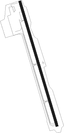
Marco Island
Airport details
| Country | United States of America |
| State | Florida |
| Region | K7 |
| Airspace | Miami Oceanic Ctr |
| Municipality | Collier County |
| Elevation | 3ft (1m) |
| Timezone | GMT -5 |
| Coordinates | 25.99503, -81.67253 |
| Magnetic var | |
| Type | land |
| Available since | X-Plane v10.40 |
| ICAO code | KMKY |
| IATA code | MRK |
| FAA code | MKY |
Communication
| Marco Island AWOS 3 | 120.075 |
| Marco Island CTAF/UNICOM | 122.800 |
| Marco Island Clearance DEL | 120.800 |
| Marco Island MIAMI ARTCC | 134.750 |
| Marco Island FORT MYERS Approach/Departure | 119.750 |
Nearby Points of Interest:
Naples Historic District
-Seaboard Coast Line Railroad Depot
-Bank of Everglades Building
-Old Collier County Courthouse
-Wilderness Waterway
-Monroe Station
Nearby beacons
| code | identifier | dist | bearing | frequency |
|---|---|---|---|---|
| CYY | CYPRESS (NAPLES) VOR/DME | 11 | 326° | 108.60 |
| RSW | LEE COUNTY (FORT MYERS) VORTAC | 32.5 | 349° | 111.80 |
| FM | CALOO (FORT MYERS) NDB | 34.6 | 332° | 341 |
| LBV | LA BELLE VORTAC | 52.2 | 19° | 110.40 |
| PGD | PUNTA GORDA VOR | 57.9 | 341° | 110.20 |
| PHK | PAHOKEE VOR/DME | 70.8 | 51° | 115.40 |
Departure and arrival routes
| Transition altitude | 18000ft |
| Transition level | 18000ft |
| SID end points | distance | outbound heading | |
|---|---|---|---|
| RW17 | |||
| CSHEL6 | 154mi | 8° | |
| RW35 | |||
| CSHEL6 | 154mi | 8° | |
| STAR starting points | distance | inbound heading | |
|---|---|---|---|
| ALL | |||
| PIKKR7 | 78.8 | 133° | |
| ZEILR5 | 97.3 | 148° | |
| SHFTY5 | 102.9 | 177° | |
Instrument approach procedures
| runway | airway (heading) | route (dist, bearing) |
|---|---|---|
| RW17 | DEEDS (272°) | DEEDS AVCOF (29mi, 292°) 2100ft AVCOF (turn) 2000ft |
| RNAV | AVCOF 2000ft EJAMO (6mi, 166°) 1500ft AYWEN (2mi, 166°) 820ft KMKY (3mi, 166°) 65ft (4956mi, 108°) 300ft ONSAW (4953mi, 288°) 2000ft ONSAW (turn) | |
| RW35 | COPGI (13°) | COPGI ONSAW (5mi, 79°) 2000ft |
| RW35 | DEEDS (272°) | DEEDS TAGJO (19mi, 245°) 2000ft ONSAW (5mi, 259°) 2000ft |
| RW35 | ONSAW (346°) | ONSAW 6000ft ONSAW (turn) 2000ft |
| RNAV | ONSAW 2000ft PARYE (6mi, 346°) 1500ft KMKY (5mi, 346°) 45ft (4956mi, 108°) 286ft AVCOF (4959mi, 288°) 3000ft AVCOF (turn) 3000ft |
Holding patterns
| STAR name | hold at | type | turn | heading* | altitude | leg | speed limit |
|---|---|---|---|---|---|---|---|
| PIKKR7 | CODGR | VHF | right | 289 (109)° | DME 11.0mi | ICAO rules | |
| PIKKR7 | OBESE | VHF | left | 5 (185)° | DME 11.0mi | ICAO rules | |
| PIKKR7 | PIKKR | VHF | right | 328 (148)° | DME 8.0mi | ICAO rules | |
| PIKKR7 | WHITL | VHF | left | 6 (186)° | DME 11.0mi | ICAO rules | |
| PIKKR7 | ZEILR | VHF | right | 320 (140)° | < 17999ft | DME 6.0mi | ICAO rules |
| SHFTY5 | HEPOX | VHF | right | 354 (174)° | DME 11.0mi | ICAO rules | |
| SHFTY5 | MAZZY | VHF | right | 341 (161)° | DME 8.0mi | ICAO rules | |
| SHFTY5 | SHFTY | VHF | left | 3 (183)° | DME 11.0mi | ICAO rules | |
| SHFTY5 | WOSAK | VHF | right | 354 (174)° | DME 11.0mi | ICAO rules | |
| *) magnetic outbound (inbound) holding course | |||||||
Disclaimer
The information on this website is not for real aviation. Use this data with the X-Plane flight simulator only! Data taken with kind consent from X-Plane 12 source code and data files. Content is subject to change without notice.
