Miles City - Frank Wiley Fld
Airport details
| Country | United States of America |
| State | Montana |
| Region | K1 |
| Airspace | Salt Lake City Ctr |
| Municipality | Custer County |
| Elevation | 2628ft (801m) |
| Timezone | GMT -7 |
| Coordinates | 46.42713, -105.87682 |
| Magnetic var | |
| Type | land |
| Available since | X-Plane v10.40 |
| ICAO code | KMLS |
| IATA code | MLS |
| FAA code | MLS |
Communication
| Frank Wiley Fld WX ASOS | 135.575 |
| Frank Wiley Fld CTAF/UNICOM | 123.000 |
Nearby Points of Interest:
Miles City Waterworks Building and Pumping Plant Park
-William Harmon House
-Main Street Historic District
-Northern Pacific Railway Depot
-Holy Rosary Hospital
-George M. Miles House
-East Main Street Residential Historic District
-Walrond and Elizabeth Snell House
-Thomas and Beulah Shore House
-St. Philip's Episcopal Church
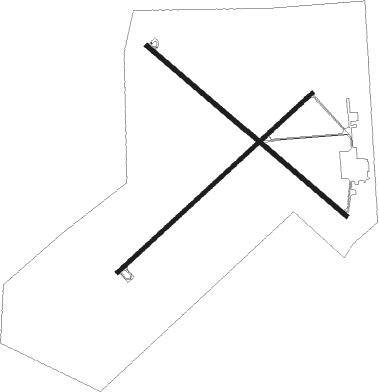
Runway info
Runway 4 / 22  | ||
| length | 1732m (5682ft) | |
| bearing | 62° / 242° | |
| width | 23m (75ft) | |
| surface | asphalt | |
| Runway 13 / 31 | ||
| length | 1713m (5620ft) | |
| bearing | 125° / 305° | |
| width | 30m (100ft) | |
| surface | asphalt | |
Nearby beacons
| code | identifier | dist | bearing | frequency |
|---|---|---|---|---|
| MLS | MILES CITY VOR/DME | 4.1 | 240° | 112.10 |
Instrument approach procedures
| runway | airway (heading) | route (dist, bearing) |
|---|---|---|
| RW04 | ONBOH (21°) | ONBOH OPEJY (10mi, 311°) 5500ft |
| RW04 | OPEJY (62°) | OPEJY 5500ft |
| RW04 | TEJIY (90°) | TEJIY OPEJY (10mi, 131°) 5500ft |
| RNAV | OPEJY 5500ft UCVIC (7mi, 61°) 4300ft YULUT (3mi, 61°) 3420ft KMLS (3mi, 65°) 2669ft (6058mi, 114°) 2879ft AXUPE (6046mi, 294°) 6000ft AXUPE (turn) | |
| RW13 | DEYEN (169°) | DEYEN EGITE (10mi, 235°) 5500ft |
| RW13 | DHAKS (95°) | DHAKS EGITE (10mi, 55°) 5500ft |
| RW13 | EGITE (124°) | EGITE 5500ft |
| RNAV | EGITE 5500ft JAXOD (7mi, 124°) 4300ft KMLS (6mi, 123°) 2673ft (6058mi, 114°) 2880ft BOKDE (6051mi, 294°) 6000ft BOKDE (turn) | |
| RW22 | AXUPE (241°) | AXUPE 5800ft |
| RW22 | JASRU (201°) | JASRU AXUPE (10mi, 131°) 5800ft |
| RW22 | WUTEK (269°) | WUTEK AXUPE (10mi, 312°) 5800ft |
| RNAV | AXUPE 5800ft ZONOG (8mi, 242°) 4300ft LOCIP (3mi, 242°) 3300ft KMLS (2mi, 235°) 2669ft (6058mi, 114°) 2878ft OPEJY (6070mi, 294°) 6000ft OPEJY (turn) | |
| RW31 | BOKDE (305°) | BOKDE 5500ft |
| RW31 | EASTE (274°) | EASTE BOKDE (10mi, 235°) 5500ft |
| RW31 | NEUMS (352°) | NEUMS BOKDE (10mi, 55°) 5500ft |
| RNAV | BOKDE 5500ft AVUNE (7mi, 305°) 4300ft CADUX (3mi, 305°) 3300ft KMLS (2mi, 308°) 2669ft (6058mi, 114°) 2877ft EGITE (6065mi, 294°) 6000ft EGITE (turn) |
Disclaimer
The information on this website is not for real aviation. Use this data with the X-Plane flight simulator only! Data taken with kind consent from X-Plane 12 source code and data files. Content is subject to change without notice.