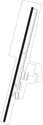
Athens - Mc Minn Co
Airport details
| Country | United States of America |
| State | Tennessee |
| Region | K7 |
| Airspace | Atlanta Ctr |
| Municipality | McMinn County |
| Elevation | 856ft (261m) |
| Timezone | GMT -5 |
| Coordinates | 35.39919, -84.56178 |
| Magnetic var | |
| Type | land |
| Available since | X-Plane v10.40 |
| ICAO code | KMMI |
| IATA code | MMI |
| FAA code | MMI |
Communication
| Mc Minn Co AWOS 3 | 125.425 |
| Mc Minn Co CTAF/UNICOM | 122.800 |
| Mc Minn Co KNOXVILLE Approach/Departure | 123.900 |
Nearby Points of Interest:
First United Presbyterian Church
-William Wiggins House
-Polk County Courthouse
-John McCroskey House
-Rattlesnake Springs
-Ocoee Dam No. 1
-Ocoee Dam No. 2
-Mialoquo
-Craigmiles Hall
-Tomotley
-W.J. Hughes Business House
-Icehouse Bottom
-Broad Street United Methodist Church
-Toqua
-Blythe Ferry
-Hair Conrad Cabin
-Broyles-Darwin House
-Dr. Walter Thomison House
-William H. Griffitts House
-Blair's Ferry Storehouse
-Burra Burra Mine
-Craigs Chapel AME Zion Church
-Citico
-John M. Rorex House
-Roane County Courthouse
Nearby beacons
| code | identifier | dist | bearing | frequency |
|---|---|---|---|---|
| DTE | MARK ANTON (DAYTON) NDB | 18.7 | 283° | 394 |
| HCH | HINCH MTN (CROSSVILLE) VOR/DME | 30.6 | 313° | 117.60 |
| CQN | DAISY (N.CHATTANOOGA) NDB | 32.3 | 249° | 341 |
| GQO | CHOO CHOO (CHATTANOOGA) VORTAC | 39.1 | 233° | 115.80 |
| HRS | HARRIS VORTAC | 41.9 | 125° | 109.80 |
| VXV | VOLUNTEER (KNOXVILLE) VORTAC | 44.5 | 53° | 116.40 |
Instrument approach procedures
| runway | airway (heading) | route (dist, bearing) |
|---|---|---|
| RW02 | KIRCH (101°) | KIRCH PIBGE (16mi, 163°) 4100ft ZAGUG (5mi, 105°) 4100ft |
| RW02 | MARBL (303°) | MARBL SOBNE (20mi, 264°) 5600ft ZAGUG (5mi, 311°) 4100ft |
| RW02 | PEEKS (140°) | PEEKS PIBGE (22mi, 188°) 4100ft ZAGUG (5mi, 105°) 4100ft |
| RW02 | ZAGUG (22°) | ZAGUG 4100ft |
| RNAV | ZAGUG 4100ft COTKI (2mi, 22°) 3700ft HETAK (4mi, 22°) 3500ft KMMI (9mi, 22°) 851ft (5139mi, 113°) 1274ft HUVEP (5136mi, 293°) 3100ft HUVEP (turn) | |
| RW20 | HUVEP (203°) | HUVEP 3100ft |
| RW20 | MARBL (303°) | MARBL GROSS (27mi, 340°) 6300ft HUVEP (7mi, 277°) 3100ft |
| RW20 | PEEKS (140°) | PEEKS IXABE (7mi, 66°) 3600ft HUVEP (5mi, 105°) 3100ft |
| RNAV | HUVEP 3100ft GIMFY (6mi, 203°) 2800ft NONOC (3mi, 203°) 1900ft KMMI (4mi, 202°) 914ft ZAGUG (15mi, 202°) 4100ft ZAGUG (turn) |
Disclaimer
The information on this website is not for real aviation. Use this data with the X-Plane flight simulator only! Data taken with kind consent from X-Plane 12 source code and data files. Content is subject to change without notice.