Marks - Selfs
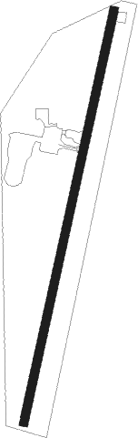
Airport details
| Country | United States of America |
| State | Mississippi |
| Region | K7 |
| Airspace | Memphis Ctr |
| Municipality | Quitman County |
| Elevation | 161ft (49m) |
| Timezone | GMT -6 |
| Coordinates | 34.23145, -90.28956 |
| Magnetic var | |
| Type | land |
| Available since | X-Plane v10.40 |
| ICAO code | KMMS |
| IATA code | MMS |
| FAA code | MMS |
Communication
| Selfs CTAF | 122.900 |
Nearby Points of Interest:
Tallahatchie County Courthouse
-Lee House
-Estevan Hall
-William A. Short House
-Keesee House
-St. Mary's Catholic Church
-Phillips County Courthouse
-Richard L. Kitchens Post No. 41
-Jacob Trieber Federal Building, United States Post Office, and United States Court House
-Helena Library and Museum
-Almer Store
-William Nicholas Straub House
-Allin House
-Sidney H. Horner House
-West House
-Jerome Bonaparte Pillow House
-Coolidge House
-Beech Street Historic District
-James C. Tappan House
-E.S. Ready House
-Maj. James Alexander Tappan House
-Altman House
-White House
-Helena Confederate Cemetery
-Taylor-Falls House
Nearby beacons
| code | identifier | dist | bearing | frequency |
|---|---|---|---|---|
| UJM | MARVELL (HELENA) VOR/DME | 28 | 312° | 109.60 |
| UV | TUNNG (OXFORD) NDB | 34.1 | 77° | 426 |
| GW | TEOCK NDB | 39.7 | 162° | 349 |
| SQS | SIDON VORTAC | 46.1 | 179° | 114.70 |
| MEM | MEMPHIS VORTAC | 49.4 | 21° | 117.50 |
| HLI | HOLLY SPRINGS VORTAC | 50.8 | 56° | 112.40 |
| GLH | GREENVILLE VOR/DME | 54.7 | 224° | 114.25 |
| MTQ | METCALF (GREENVILLE) NDB | 59.4 | 221° | 359 |
Instrument approach procedures
| runway | airway (heading) | route (dist, bearing) |
|---|---|---|
| RW02 | IVZOB (20°) | IVZOB 3000ft |
| RNAV | IVZOB 3000ft XIKRY (5mi, 20°) 1700ft GUVRE (2mi, 20°) 980ft KMMS (3mi, 20°) 201ft (5420mi, 111°) 440ft UTFIR (5417mi, 291°) 3000ft UTFIR (turn) | |
| RW20 | UTFIR (200°) | UTFIR 3000ft |
| RNAV | UTFIR 3000ft WUGEK (5mi, 200°) 1700ft UFAYY (2mi, 200°) 1080ft KMMS (3mi, 200°) 201ft (5420mi, 111°) 562ft IVZOB (5422mi, 291°) 3000ft IVZOB (turn) |
Disclaimer
The information on this website is not for real aviation. Use this data with the X-Plane flight simulator only! Data taken with kind consent from X-Plane 12 source code and data files. Content is subject to change without notice.