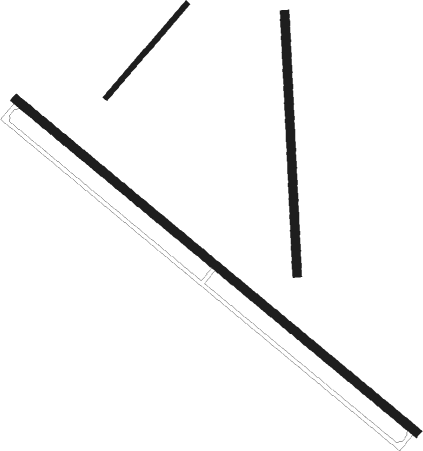
Eastover - Mc Entire Angs
Airport details
| Country | United States of America |
| State | South Carolina |
| Region | K7 |
| Airspace | Jacksonville Ctr |
| Municipality | Richland County |
| Elevation | 251ft (77m) |
| Timezone | GMT -5 |
| Coordinates | 33.92077, -80.80114 |
| Magnetic var | |
| Type | land |
| Available since | X-Plane v10.40 |
| ICAO code | KMMT |
| IATA code | MMT |
| FAA code | MMT |
Communication
| MC ENTIRE ANGS CTAF | 132.400 |
| MC ENTIRE ANGS Ground Control | 127.625 |
| MC ENTIRE ANGS Tower | 132.400 |
| MC ENTIRE ANGS SHAW Approach/Departure | 125.400 |
Approach frequencies
| ILS-cat-I | RW32 | 111.1 | 18.00mi |
| 2.5° GS | RW32 | 111.1 | 18.00mi |
Nearby Points of Interest:
John J. Kaminer House
-Claudius Scott Cottage
-J.A. Byrd Mercantile Store
-Kensington Plantation House
-William Jennings Bryan Dorn Veterans Affairs Medical Center
-Millwood
-Ensor-Keenan House
-Dovillers-Manning-Magoffin House
-Curtiss-Wright Hangar
-Melrose Heights-Oak Lawn-Fairview Historic District
-J. Davis Powell House
-Old Shandon Historic District
-Raymond Price House
-George R. Price House
-Lyles-Gudmundson House
-Wallace-McGee House
-Heslep House
-A. Fletcher Spigner House
-Building at 303 Saluda Avenue
-Olympia Armory
-University Neighborhood Historic District
-Richland Cotton Mill
-Good Samaritan-Waverly Hospital
-Union Station
-Alston House
Runway info
Nearby beacons
| code | identifier | dist | bearing | frequency |
|---|---|---|---|---|
| MMT | MC ENTIRE (COLUMBIA) VORTAC | 0.2 | 340° | 113.20 |
| CAE | COLUMBIA VORTAC | 13.1 | 256° | 114.70 |
| SSC | SHAW (SUMTER) TACAN | 17 | 80° | 110.10 |
| CA | MURRY (COLUMBIA) NDB | 22.2 | 276° | 362 |
| SMS | SUMTER NDB | 22.3 | 81° | 252 |
| VAN | VANCE VORTAC | 32 | 142° | 110.40 |
| MNI | MANNING NDB | 35.8 | 119° | 381 |
| HVS | HARTSVILLE NDB | 44.6 | 55° | 341 |
| AIK | AIKEN NDB | 46.6 | 253° | 347 |
| EOE | ENOREE (NEWBERRY) NDB | 47.6 | 295° | 278 |
| LKR | LANCASTER NDB | 48.2 | 356° | 400 |
| FL | ALCOT (FLORENCE) NDB | 49.5 | 75° | 335 |
| CTF | CHESTERFIELD VOR/DME | 51 | 36° | 108.20 |
| UDG | DARLINGTON NDB | 55.1 | 60° | 245 |
| DCM | CHESTER NDB | 55.6 | 335° | 220 |
| DYB | DORCHESTER COUNTY(SUMMERVILLE) NDB | 57.8 | 149° | 365 |
| ALD | ALLENDALE VOR | 59.8 | 208° | 116.70 |
| UZ | RALLY (ROCK HILL) NDB | 59.8 | 344° | 227 |
| UOT | UNION COUNTY NDB | 61.9 | 312° | 326 |
| CH | ASHLY (CHARLESTON) NDB | 66.7 | 143° | 329 |
Disclaimer
The information on this website is not for real aviation. Use this data with the X-Plane flight simulator only! Data taken with kind consent from X-Plane 12 source code and data files. Content is subject to change without notice.

