Morristown - Morristown Muni
Airport details
| Country | United States of America |
| State | New Jersey |
| Region | K6 |
| Airspace | New York Ctr |
| Municipality | Hanover Township |
| Elevation | 187ft (57m) |
| Timezone | GMT -5 |
| Coordinates | 40.79933, -74.41489 |
| Magnetic var | |
| Type | land |
| Available since | X-Plane v10.40 |
| ICAO code | KMMU |
| IATA code | MMU |
| FAA code | MMU |
Communication
| Morristown Muni ATIS | 124.250 |
| Morristown Muni Clearance DEL | 128.600 |
| Morristown Muni Ground Control | 134.200 |
| Morristown Muni Tower | 118.100 |
| Morristown Muni NEW YORK Approach | 127.600 |
| Morristown Muni NEW YORK Departure | 119.200 |
Approach frequencies
| ILS-cat-I | RW23 | 110.3 | 18.00mi |
| 3° GS | RW23 | 110.3 | 18.00mi |
Nearby Points of Interest:
United States Army Steam Locomotive No. 4039
-Morristown and Erie Railroad Whippany Water Tank
-Alnwick Hall
-First Church of Hanover
-Oak Dell
-Sayre House
-Boisaubin Manor
-Madison Civic Commercial District
-Madison Masonic Lodge
-Thomas Nast Home
-Morris County Courthouse
-Troy Meadows
-Dusenberry House
-Bowers-Livingston-Osborn House
-Fosterfields
-Stephen Condit House
-Bowlsby-Degelleke House
-Craftsman Farms
-Ward-Force House and Condit Family Cook House
-Grimes Homestead
-John Smith House
-New Vernon Historic District
-Washington Valley Historic District
-Washington Valley Schoolhouse
-Samuel Orton Harrison House
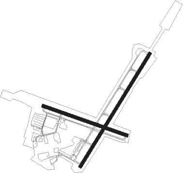
Runway info
Runway 5 / 23  | ||
| length | 1830m (6004ft) | |
| bearing | 44° / 224° | |
| width | 46m (151ft) | |
| surface | asphalt | |
| Runway 13 / 31 | ||
| length | 1219m (3999ft) | |
| bearing | 109° / 289° | |
| width | 46m (151ft) | |
| surface | asphalt | |
Nearby beacons
| code | identifier | dist | bearing | frequency |
|---|---|---|---|---|
| CAT | CHATHAM NDB | 3.5 | 194° | 254 |
| MM | MOREE (MORRISTOWN) NDB | 6 | 45° | 392 |
| TE | TORBY (TETERBORO) NDB | 12.8 | 89° | 214 |
| TEB | TETERBORO VOR/DME | 16.2 | 82° | 108.40 |
| SAX | SPARTA VORTAC | 17 | 335° | 115.70 |
| BWZ | BROADWAY (SCHOOLEY'S MT) VOR/DME | 18.5 | 270° | 114.20 |
| SBJ | SOLBERG VOR/DME | 19.7 | 237° | 112.90 |
| STW | STILLWATER VOR/DME | 23.7 | 293° | 109.60 |
| LGA | LA GUARDIA (NEW YORK) VOR/DME | 24.8 | 92° | 113.10 |
| CRI | CANARSIE VOR/DME | 26.2 | 110° | 112.30 |
| JFK | KENNEDY (NEW YORK) VOR/DME | 30.9 | 105° | 115.90 |
| COL | COLTS NECK VOR/DME | 31.5 | 152° | 115.40 |
| RBV | ROBBINSVILLE VORTAC | 36 | 188° | 113.80 |
| HUO | HUGUENOT VOR/DME | 37.5 | 344° | 116.10 |
| ARD | YARDLEY VOR/DME | 39.7 | 222° | 108.20 |
| SW | NEELY (NEWBURGH) NDB | 42 | 15° | 335 |
| FR | FRIKK (FARMINGDALE) NDB | 42.4 | 91° | 407 |
| NEL | LAKEHURST NDB | 45.4 | 174° | 396 |
| NEL | LAKEHURST TACAN | 45.8 | 175° | 111.80 |
| SKU | STANWYCK (NEWBURGH) NDB | 46.8 | 27° | 261 |
| CMK | CARMEL VOR/DME | 47.5 | 60° | 116.60 |
| GXU | MC GUIRE (WRIGHTSTOWN) VORTAC | 48.1 | 193° | 110.60 |
| ING | AMBLER NDB | 56.7 | 232° | 275 |
| IGN | KINGSTON VOR/DME | 58.4 | 34° | 117.60 |
| CYN | COYLE VORTAC | 58.9 | 181° | 113.40 |
| PWL | PAWLING (POUGHKEEPSIE) VOR/DME | 68.9 | 40° | 114.30 |
Departure and arrival routes
| Transition altitude | 18000ft |
| Transition level | 18000ft |
| SID end points | distance | outbound heading | |
|---|---|---|---|
| RW05 | |||
| MMU7 | 15mi | 159° | |
| RW13 | |||
| MMU7 | 15mi | 159° | |
| RW23 | |||
| MMU7 | 15mi | 159° | |
| RW31 | |||
| MMU7 | 15mi | 159° | |
| STAR starting points | distance | inbound heading | |
|---|---|---|---|
| ALL | |||
| JAIKE3 | 81.7 | 50° | |
| MAZIE3 | 42.7 | 56° | |
| LVZ4 | 64.3 | 110° | |
Instrument approach procedures
| runway | airway (heading) | route (dist, bearing) |
|---|---|---|
| RW05 | SBJ (57°) | SBJ KWITE (9mi, 71°) 2000ft |
| RW05 | STW (113°) | STW ZELEN (21mi, 154°) 3000ft KWITE (7mi, 100°) 2000ft |
| RNAV | KWITE 2000ft HOSBE (7mi, 44°) 1800ft KMMU (5mi, 43°) 241ft (4700mi, 119°) 587ft MIKEF (4697mi, 299°) 2500ft MIKEF (turn) 2500ft | |
| RW23-Y | RONOW (224°) | RONOW BINGG (6mi, 224°) 2000ft |
| RW23-Y | SBJ (57°) | SBJ SHOTT (20mi, 39°) 3000ft FIGON (6mi, 52°) 2000ft BINGG (5mi, 123°) 2000ft |
| RW23-Y | STW (113°) | STW ELIZE (10mi, 113°) 3000ft SHOTT (8mi, 106°) 3000ft FIGON (6mi, 52°) 2000ft BINGG (5mi, 123°) 2000ft |
| RNAV | BINGG 2000ft KMMU (6mi, 224°) 238ft CODOL (5mi, 223°) 2000ft CODOL (turn) | |
| RW23-Z | EMRSN (146°) | EMRSN FALTY (5mi, 80°) 3000ft GODLY (5mi, 80°) 3000ft BADDA (6mi, 139°) 3000ft |
| RW23-Z | FALTY (175°) | FALTY GODLY (5mi, 80°) 3000ft BADDA (6mi, 139°) 3000ft |
| RW23-Z | GODLY (202°) | GODLY BADDA (6mi, 139°) 3000ft |
| RNAV | BADDA 3000ft BINGG (6mi, 224°) 2000ft KMMU (6mi, 224°) 238ft (4700mi, 119°) 384ft SUCSO (4704mi, 299°) SBJ (13mi, 244°) 2000ft SBJ (turn) |
Holding patterns
| STAR name | hold at | type | turn | heading* | altitude | leg | speed limit |
|---|---|---|---|---|---|---|---|
| JAIKE3 | MAZIE | VHF | left | 237 (57)° | < 17999ft | 1.0min timed | 210 |
| JAIKE3 | PALEO | VHF | left | 232 (52)° | < 45000ft | 1.5min timed | ICAO rules |
| JAIKE3 | SPNCR | VHF | right | 227 (47)° | 6001ft - 14000ft | DME 4.0mi | 210 |
| LVZ4 | HARTY | VHF | left | 305 (125)° | 18000ft - 45000ft | 1.5min timed | ICAO rules |
| LVZ4 | HOXIE | VHF | left | 295 (115)° | 18000ft - 45000ft | DME 6.0mi | ICAO rules |
| LVZ4 | MUGZY | VHF | left | 305 (125)° | 6001ft - 14000ft | 1.0min timed | 210 |
| MAZIE3 | BACKY | VHF | right | 216 (36)° | DME 7.0mi | ICAO rules | |
| MAZIE3 | MAZIE | VHF | left | 237 (57)° | < 17999ft | 1.0min timed | 210 |
| MAZIE3 | RAZER | VHF | right | 229 (49)° | < 60000ft | DME 6.0mi | 210 |
| *) magnetic outbound (inbound) holding course | |||||||
Disclaimer
The information on this website is not for real aviation. Use this data with the X-Plane flight simulator only! Data taken with kind consent from X-Plane 12 source code and data files. Content is subject to change without notice.