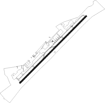
Morristown - Moore-murrell
Airport details
| Country | United States of America |
| State | Tennessee |
| Region | K7 |
| Airspace | Atlanta Ctr |
| Municipality | Morristown |
| Elevation | 1312ft (400m) |
| Timezone | GMT -5 |
| Coordinates | 36.17535, -83.38417 |
| Magnetic var | |
| Type | land |
| Available since | X-Plane v10.40 |
| ICAO code | KMOR |
| IATA code | n/a |
| FAA code | MOR |
Communication
| Moore-Murrell AWOS 3 | 126.725 |
| Moore-Murrell CTAF/UNICOM | 122.800 |
| Moore-Murrell KNOXVILLE Approach/Departure | 132.800 |
Approach frequencies
| SDF | RW05 | 109.5 | 18.00mi |
Nearby Points of Interest:
Fairvue (Jefferson City, Tennessee)
-Hamblen County Courthouse
-Rose Center
-Morristown College
-Lawson D. Franklin House
-William Cocke House
-Henderson Chapel African Methodist Episcopal Zion Church
-Fairfax
-Poplar Hill
-Lea Springs
-Bulls Gap Historic District
-Shields' Station
-Swaggerty Blockhouse
-Hamilton-Lay Store
-Chesterfield House, Knoxville, Tennessee
-Claiborne County Jail
-Graham-Kivett House
-Brabson's Ferry Plantation
-Buckingham House
-Riley H. Andes House
-Rose Glen
-Sevier County Courthouse
-Wheatlands
-Leroy Keener House
-Price Public Elementary School
Nearby beacons
| code | identifier | dist | bearing | frequency |
|---|---|---|---|---|
| JXT | JEFFERSON (MORRISTOWN) NDB | 5.9 | 235° | 346 |
| SOT | SNOWBIRD VORTAC | 28.2 | 139° | 108.80 |
| RVN | ROGERSVILLE NDB | 29.4 | 61° | 329 |
| VXV | VOLUNTEER (KNOXVILLE) VORTAC | 29.6 | 242° | 116.40 |
| BO | BOOIE (BRISTOL) NDB | 45 | 76° | 221 |
| IM | KEANS (ASHEVILLE) NDB | 54.7 | 129° | 357 |
| LOZ | LONDON VOR/DME | 62.2 | 320° | 116.55 |
| BRA | BROAD RIVER (ASHEVILLE) NDB | 70.1 | 135° | 379 |
Instrument approach procedures
| runway | airway (heading) | route (dist, bearing) |
|---|---|---|
| RW05 | AUBRY (34°) | AUBRY YURSU (11mi, 6°) 4200ft |
| RW05 | TAMPI (174°) | TAMPI YURSU (15mi, 222°) 4200ft YURSU (turn) 4200ft |
| RNAV | YURSU 4200ft SIQCU (6mi, 55°) 3200ft KMOR (6mi, 54°) 1352ft (5085mi, 113°) 2000ft YURSU (5093mi, 293°) 4200ft YURSU (turn) | |
| RW23 | FARLI (228°) | FARLI NIBGE (11mi, 218°) 4300ft |
| RW23 | OTWAY (265°) | OTWAY NIBGE (16mi, 288°) 4300ft |
| RW23 | TAMPI (174°) | TAMPI NIBGE (11mi, 72°) 4300ft NIBGE (turn) 4300ft |
| RW23 | WHINS (307°) | WHINS NIBGE (14mi, 24°) 4300ft NIBGE (turn) 4300ft |
| RNAV | NIBGE 4300ft WINRI (6mi, 235°) 3200ft KMOR (7mi, 236°) 1315ft (5085mi, 113°) 1571ft SIQCU (5089mi, 293°) MALIN (15mi, 291°) 5000ft MALIN (turn) |
Disclaimer
The information on this website is not for real aviation. Use this data with the X-Plane flight simulator only! Data taken with kind consent from X-Plane 12 source code and data files. Content is subject to change without notice.