Mount Pocono - Pocono Mountains Muni
Airport details
| Country | United States of America |
| State | Pennsylvania |
| Region | K6 |
| Airspace | New York Ctr |
| Municipality | Coolbaugh Township |
| Elevation | 1916ft (584m) |
| Timezone | GMT -5 |
| Coordinates | 41.13770, -75.38006 |
| Magnetic var | |
| Type | land |
| Available since | X-Plane v10.40 |
| ICAO code | KMPO |
| IATA code | n/a |
| FAA code | MPO |
Communication
| Pocono Mountains Muni ASOS | 120.275 |
| Pocono Mountains Muni CTAF/UNICOM | 122.700 |
| Pocono Mountains Muni WILKES BARRE Approach/Departure | 126.300 |
Nearby Points of Interest:
Pocono Manor Historic District
-Patriotic Order Sons of America Washington Camp 422
-Bridge in Dreher Township
-Quiet Valley Farm
-Monroe County Courthouse
-Fenner–Snyder Mill
-Christ Hamilton United Lutheran Church and Cemetery
-Promised Land State Park Whittaker Lodge District
-Shawnee-Minisink Site
-Worthington Hall
-Lacawac
-John Michael Farm
-Sunfish Pond
-Capt. Jacob Shoemaker House
-Ross Common Manor
-John Turn Farm
-Cold Spring Farm Springhouse
-Schoonover Mountain House
-Bear Creek Village Historic District
-Turn Store and the Tinsmith's Shop
-Peters House
-Minisink Archaeological Site
-Real Estate Building
-Warrington Stone Bridge
-Old Mine Road Historic District
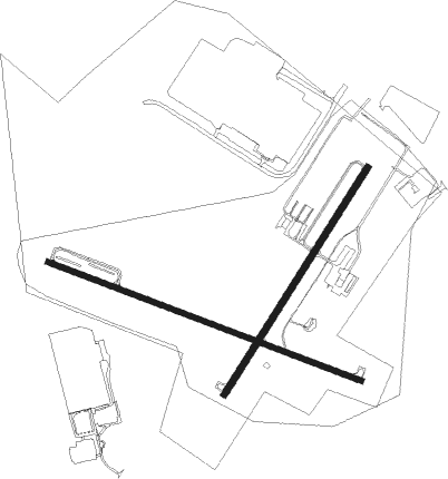
Runway info
Runway 5 / 23  | ||
| length | 1219m (3999ft) | |
| bearing | 45° / 225° | |
| width | 30m (98ft) | |
| surface | asphalt | |
| Runway 13 / 31 | ||
| length | 1522m (4993ft) | |
| bearing | 110° / 290° | |
| width | 25m (82ft) | |
| surface | asphalt | |
| displ threshold | 152m (499ft) / 64m (210ft) | |
Nearby beacons
| code | identifier | dist | bearing | frequency |
|---|---|---|---|---|
| LVZ | WILKES-BARRE VORTAC | 16.1 | 294° | 111.60 |
| STW | STILLWATER VOR/DME | 24.6 | 106° | 109.60 |
| FJC | ALLENTOWN VORTAC | 24.9 | 190° | 117.50 |
| BWZ | BROADWAY (SCHOOLEY'S MT) VOR/DME | 32.4 | 121° | 114.20 |
| ETX | EAST TEXAS VOR/DME | 36.1 | 209° | 110.20 |
| SAX | SPARTA VORTAC | 38.3 | 95° | 115.70 |
| HUO | HUGUENOT VOR/DME | 39.1 | 71° | 116.10 |
| SBJ | SOLBERG VOR/DME | 44.1 | 131° | 112.90 |
| CAT | CHATHAM NDB | 49.2 | 113° | 254 |
| PTW | POTTSTOWN VORTAC | 55.5 | 191° | 116.50 |
| HNK | HANCOCK VOR/DME | 55.6 | 4° | 116.80 |
| ARD | YARDLEY VOR/DME | 57.3 | 152° | 108.20 |
| RBV | ROBBINSVILLE VORTAC | 69.1 | 137° | 113.80 |
Instrument approach procedures
| runway | airway (heading) | route (dist, bearing) |
|---|---|---|
| RW05 | BEERS (17°) | BEERS WIBUM (7mi, 332°) 4000ft |
| RW05 | WHITT (71°) | WHITT WIBUM (8mi, 103°) 4000ft |
| RNAV | WIBUM 4000ft WOSIT (6mi, 44°) 3400ft YONUP (2mi, 45°) 2600ft KMPO (2mi, 43°) 1935ft ZEGAS (7mi, 45°) LVZ (18mi, 276°) 4000ft LVZ (turn) | |
| RW13 | LVZ (114°) | LVZ DEGDE (5mi, 123°) 4200ft |
| RW13 | VOKYO (82°) | VOKYO DEGDE (13mi, 57°) 4200ft |
| RNAV | DEGDE 4200ft CUTKO (6mi, 109°) 3400ft KMPO (5mi, 109°) 1924ft (4747mi, 119°) 3000ft WHITT (4760mi, 298°) 4200ft WHITT (turn) | |
| RW31 | BEERS (17°) | BEERS ZUCRY (10mi, 93°) 4200ft WONNU (12mi, 32°) 4000ft |
| RW31 | SCOUP (284°) | SCOUP WONNU (4mi, 264°) 4000ft |
| RNAV | WONNU 4000ft YUKPU (8mi, 290°) 3400ft KMPO (5mi, 290°) 1933ft (4747mi, 119°) 2224ft RYANF (4755mi, 299°) WHITT (12mi, 222°) 4200ft WHITT (turn) |
Disclaimer
The information on this website is not for real aviation. Use this data with the X-Plane flight simulator only! Data taken with kind consent from X-Plane 12 source code and data files. Content is subject to change without notice.