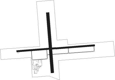
Macomb - Macomb Muni
Airport details
| Country | United States of America |
| State | Illinois |
| Region | K5 |
| Airspace | Chicago Ctr |
| Municipality | McDonough County |
| Elevation | 707ft (215m) |
| Timezone | GMT -6 |
| Coordinates | 40.52008, -90.65239 |
| Magnetic var | |
| Type | land |
| Available since | X-Plane v10.40 |
| ICAO code | KMQB |
| IATA code | MQB |
| FAA code | MQB |
Communication
| MACOMB MUNI AWOS 3 | 119.025 |
| MACOMB MUNI CTAF/UNICOM | 122.800 |
Approach frequencies
| LOC | RW27 | 110.3 | 18.00mi |
Nearby Points of Interest:
Sherman Hall
-McDonough County Courthouse
-William S. Bailey House
-Clarence Kleinkopf Round Barn
-Carithers Store Building
-Tartar's Ferry Bridge
-La Harpe City Hall
-La Harpe Historic District
-Metal Highway Bridges of Fulton County TR
-Buckeye Bridge
-Charles Emmor McCormick House
-Elsworth Snowden House
-Edward Hamer House
-Stapleford-Hoover-Whitney House
-William Hoopes House
-Joab Mershon House
-William Franklin and Rebecca Durell House
-Edith Chipman House
-Patterson Hamer House
-Henry H. Page House
-Vermont Masonic Hall
-Daniel O'Connell House
-Odd Fellows Opera Block
-Lucinda Hunter House
-Robert Dilworth House

Nearby beacons
| code | identifier | dist | bearing | frequency |
|---|---|---|---|---|
| JZY | MACOMB NDB | 4.1 | 91° | 251 |
| BRL | BURLINGTON VOR/DME | 17.4 | 307° | 111.40 |
| BR | BURNS (BURLINGTON) NDB | 22.9 | 286° | 390 |
| GBG | DME | 26.9 | 28° | 109.80 |
| EOK | KEOKUK NDB | 35.8 | 266° | 366 |
| PIA | PEORIA VORTAC | 40.3 | 79° | 115.20 |
| UI | QUINCY NDB | 46.9 | 224° | 293 |
| MZV | MOLINE VOR/DME | 48.1 | 1° | 114.40 |
| IJX | DME | 48.5 | 151° | 108.60 |
| UIN | QUINCY VORTAC | 49.5 | 223° | 113.60 |
| DDD | CITY DME | 55.5 | 330° | 116.50 |
| SPI | SPINNER (SPRINGFIELD) VORTAC | 60.5 | 125° | 112.70 |
| SP | HUSKK (SPRINGFIELD) NDB | 60.7 | 130° | 382 |
| IOW | IOWA CITY VOR/DME | 74.1 | 316° | 116.20 |
Instrument approach procedures
| runway | airway (heading) | route (dist, bearing) |
|---|---|---|
| RW09 | BRL (127°) | BRL HUKPO (6mi, 176°) 2300ft TUYOB (6mi, 176°) 2300ft |
| RW09 | TUYOB (90°) | TUYOB 2300ft |
| RW09 | UIN (43°) | UIN ZUVBO (38mi, 29°) 2300ft TUYOB (6mi, 29°) 2300ft |
| RNAV | TUYOB 2300ft WEKEM (7mi, 90°) 2300ft GICSE (3mi, 90°) 1280ft KMQB (2mi, 90°) 746ft (5435mi, 114°) 906ft WULIN (5424mi, 294°) 2300ft WULIN (turn) | |
| RW27 | BADER (303°) | BADER JUTSI (6mi, 33°) 2300ft WULIN (6mi, 323°) 2300ft |
| RW27 | LOGOS (250°) | LOGOS WULIN (15mi, 232°) 2300ft |
| RW27 | WULIN (270°) | WULIN 2300ft |
| RNAV | WULIN 2300ft ODOYO (6mi, 270°) 2300ft IWNUM (3mi, 270°) 1220ft KMQB (2mi, 271°) 719ft (5435mi, 114°) 886ft TUYOB (5447mi, 294°) 2300ft TUYOB (turn) |
Disclaimer
The information on this website is not for real aviation. Use this data with the X-Plane flight simulator only! Data taken with kind consent from X-Plane 12 source code and data files. Content is subject to change without notice.