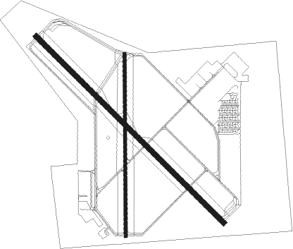
Smyrna
Airport details
| Country | United States of America |
| State | Tennessee |
| Region | K7 |
| Airspace | Memphis Ctr |
| Municipality | Smyrna |
| Elevation | 541ft (165m) |
| Timezone | GMT -6 |
| Coordinates | 36.00990, -86.51086 |
| Magnetic var | |
| Type | land |
| Available since | X-Plane v10.40 |
| ICAO code | KMQY |
| IATA code | MQY |
| FAA code | MQY |
Communication
| Smyrna ASOS | 119.125 |
| Smyrna CTAF | 118.500 |
| Smyrna UNICOM | 122.950 |
| Smyrna Clearance DEL | 121.400 |
| Smyrna Tower | 118.500 |
| Smyrna NASHVILLE Approach/Departure | 128.450 |
Approach frequencies
| ILS-cat-I | RW32 | 111.1 | 18.00mi |
| 2.8° GS | RW32 | 111.1 | 18.00mi |
Nearby Points of Interest:
Idler's Retreat
-Sam Davis House
-Benajah Gray Log House
-Jordan-Williams House
-Sherwood Green House
-Bank of Nolensville
-Hays-Kiser House
-Ellis Service Station Garage
-Beesley Primitive Baptist Church
-John C. Spence House
-Oaklands Historic House Museum
-John M. Winstead Houses
-Rutherford County Courthouse
-Marymont
-Gen. Joseph B. Palmer House
-Allen Chapel A.M.E. Church
-Hall-Harding-McCampbell House
-Bradley Academy Museum
-Collier-Crichlow House
-John Frost House
-Boxwood
-Newton Jordan House
-Arnold-Harrell House
-Jarman Farm
-John Herbert House
Nearby beacons
| code | identifier | dist | bearing | frequency |
|---|---|---|---|---|
| FQW | WALTER HILL (MURFREESBORO) NDB | 7.3 | 109° | 371 |
| BNA | NASHVILLE VORTAC | 11.3 | 306° | 114.10 |
| SYI | SHELBYVILLE VOR/DME | 27.1 | 171° | 113.55 |
| HEM | HUCHN NDB | 44.9 | 91° | 233 |
| GHM | (CENTERVILLE) DME | 46.9 | 259° | 111.60 |
| BW | NOORA (BOWLING GREEN) NDB | 52.2 | 2° | 236 |
| CK | SNUFF(FT CAMPBELL (CLARKSVILLE NDB | 52.5 | 301° | 335 |
| BWG | GREEN DME | 55.2 | 4° | 117.90 |
| CKV | CLARKSVILLE VOR/DME | 57 | 304° | 110.60 |
| FK | AIRBE(FT CAMPBELL/HOPKINSVILLE NDB | 61.7 | 309° | 273 |
Instrument approach procedures
| runway | airway (heading) | route (dist, bearing) |
|---|---|---|
| RW01 | LENON (229°) | LENON EYXUR (30mi, 198°) 3000ft ZOPUK (9mi, 273°) 3000ft |
| RW01 | SYI (351°) | SYI UMETE (8mi, 338°) 3000ft ZOPUK (8mi, 338°) 3000ft |
| RNAV | ZOPUK 3000ft ODOSE (5mi, 5°) 2600ft WAXUV (4mi, 5°) 1420ft KMQY (3mi, 15°) 564ft (5236mi, 113°) 943ft VADOW (5223mi, 293°) 3000ft VADOW (turn) | |
| RW14 | HUDNU (132°) | HUDNU 3100ft |
| RNAV | HUDNU 3100ft FAZIM (7mi, 133°) 2000ft KMQY (5mi, 130°) 593ft (5236mi, 113°) 943ft JOPIV (5227mi, 293°) 3000ft JOPIV (turn) | |
| RW19 | LENON (229°) | LENON YOJIM (7mi, 217°) 3000ft WULIG (8mi, 270°) 3000ft |
| RW19 | SYI (351°) | SYI VADOW (24mi, 26°) 3000ft YOJIM (14mi, 355°) 3000ft WULIG (8mi, 270°) 3000ft |
| RNAV | WULIG 3000ft ZIGRI (6mi, 223°) 2200ft OGECU (3mi, 190°) 1140ft KMQY (2mi, 174°) 566ft (5236mi, 113°) 1000ft VADOW (5223mi, 293°) 3000ft VADOW (turn) | |
| RW32 | JOPIV (315°) | JOPIV 3000ft |
| RNAV | JOPIV 3000ft SHEHL (7mi, 313°) 2100ft UJIVA (3mi, 313°) 1140ft KMQY (2mi, 323°) 568ft (5236mi, 113°) 1500ft JOPIV (5227mi, 293°) 3000ft JOPIV (turn) |
Disclaimer
The information on this website is not for real aviation. Use this data with the X-Plane flight simulator only! Data taken with kind consent from X-Plane 12 source code and data files. Content is subject to change without notice.

