Beaufort - Michael J Smith Fld
Airport details
| Country | United States of America |
| State | North Carolina |
| Region | K7 |
| Airspace | Washington Ctr |
| Municipality | Beaufort |
| Elevation | 11ft (3m) |
| Timezone | GMT -5 |
| Coordinates | 34.73375, -76.66036 |
| Magnetic var | |
| Type | land |
| Available since | X-Plane v10.40 |
| ICAO code | KMRH |
| IATA code | n/a |
| FAA code | MRH |
Communication
| MICHAEL J SMITH FLD ASOS | 135.375 |
| MICHAEL J SMITH FLD CTAF/UNICOM | 122.800 |
| MICHAEL J SMITH FLD CHERRY POINT Clearance | 125.650 |
| MICHAEL J SMITH FLD CHERRY POINT Approach/Departure | 124.100 |
| MICHAEL J SMITH FLD CHERRY POINT Approach/Departure | 132.575 |
Approach frequencies
| LOC | RW26 | 108.5 | 18.00mi |
Nearby Points of Interest:
Carteret County Home
-Beaufort Historic District
-Jacob Henry House
-Gibbs House
-Morehead City Municipal Building
-Morehead City Historic District
-Cape Lookout Village Historic District
-China Grove (Oriental, North Carolina)
-New Bern Battlefield Site
-Palo Alto Plantation
-Ocracoke Historic District
-Mount Shiloh Missionary Baptist Church
-Isaac Taylor House
-New Bern City Hall
-York-Gordon House
-Coor-Bishop House
-Benjamin Smith House
-Christ Episcopal Church and Parish House
-Gull Harbor
-First Baptist Church
-Coor-Gaston House
-Eli Smallwood House
-Hawks House
-Smith-Whitford House
-Jones-Jarvis House
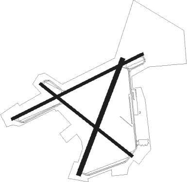
Runway info
Runway 8 / 26  | ||
| length | 1527m (5010ft) | |
| bearing | 72° / 252° | |
| width | 30m (100ft) | |
| surface | asphalt | |
| displ threshold | 0m (0ft) / 88m (289ft) | |
| Runway 3 / 21 | ||
| length | 1280m (4199ft) | |
| bearing | 30° / 210° | |
| width | 46m (150ft) | |
| surface | asphalt | |
| displ threshold | 263m (863ft) / 157m (515ft) | |
| Runway 14 / 32 | ||
| length | 1220m (4003ft) | |
| bearing | 127° / 307° | |
| width | 30m (100ft) | |
| surface | asphalt | |
| displ threshold | 0m (0ft) / 152m (499ft) | |
Nearby beacons
| code | identifier | dist | bearing | frequency |
|---|---|---|---|---|
| NKT | CHERRY POINT TACAN | 14.6 | 308° | 112.80 |
| EW | KAFTI (NEW BERN) NDB | 26.9 | 304° | 362 |
| EWN | NEW BERN VOR/DME | 27.8 | 311° | 113.60 |
| NCA | NEW RIVER TACAN | 38.5 | 268° | 115.40 |
| DIW | DIXON NDB | 40.3 | 258° | 198 |
| RNW | CHOCOWINITY NDB | 51.4 | 330° | 388 |
| ISO | KINSTON VORTAC | 58.4 | 305° | 109.60 |
| AQE | ALWOOD (GREENVILLE) NDB | 68 | 324° | 230 |
Instrument approach procedures
| runway | airway (heading) | route (dist, bearing) |
|---|---|---|
| RW03 | EWN (131°) | EWN JIDON (33mi, 148°) 3000ft JIDON (turn) 1800ft |
| RNAV | JIDON 1800ft WOVIP (6mi, 30°) 1000ft KMRH (3mi, 28°) 48ft (4749mi, 114°) 600ft EWN (4770mi, 294°) 3000ft EWN (turn) | |
| RW08 | EWN (131°) | EWN WAPDI (17mi, 154°) 3000ft ITOLE (9mi, 154°) 1800ft |
| RNAV | ITOLE 1800ft CIBAG (7mi, 72°) 1000ft KMRH (3mi, 73°) 51ft (4749mi, 114°) 600ft EWN (4770mi, 294°) 3000ft EWN (turn) | |
| RW14 | EWN (131°) | EWN ULVAQ (17mi, 135°) 3100ft |
| RNAV | ULVAQ 3100ft ISUJU (6mi, 127°) 1600ft CUMTO (3mi, 127°) 520ft KMRH (2mi, 125°) 46ft (4749mi, 114°) 360ft LAVTE (4741mi, 294°) 2300ft LAVTE (turn) | |
| RW21 | EWN (131°) | EWN RIXOE (20mi, 114°) 3000ft PEPKE (6mi, 111°) 1800ft |
| RNAV | PEPKE 1800ft HOPEM (6mi, 210°) 1000ft KMRH (3mi, 212°) 47ft (4749mi, 114°) 500ft EWN (4770mi, 294°) 3000ft EWN (turn) | |
| RW26 | EWN (131°) | EWN CIGOR (32mi, 117°) 3000ft CIGOR (turn) 1900ft |
| RNAV | CIGOR 1900ft MOKEY (6mi, 252°) 1000ft KMRH (3mi, 250°) 51ft (4749mi, 114°) 500ft EWN (4770mi, 294°) 3000ft EWN (turn) | |
| RW32 | EWN (131°) | EWN LAVTE (37mi, 130°) 3000ft LAVTE (turn) 2300ft |
| RNAV | LAVTE 2300ft EXAVE (6mi, 307°) 1000ft KMRH (3mi, 308°) 50ft (4749mi, 114°) 380ft ISUJU (4753mi, 294°) EWN (23mi, 313°) 3000ft EWN (turn) |
Disclaimer
The information on this website is not for real aviation. Use this data with the X-Plane flight simulator only! Data taken with kind consent from X-Plane 12 source code and data files. Content is subject to change without notice.