Mineral Point - Iowa Co
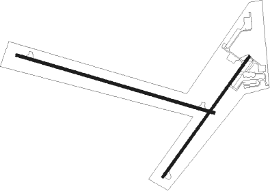
Airport details
| Country | United States of America |
| State | Wisconsin |
| Region | K5 |
| Airspace | Chicago Ctr |
| Municipality | Town of Linden |
| Elevation | 1169ft (356m) |
| Timezone | GMT -6 |
| Coordinates | 42.88689, -90.23666 |
| Magnetic var | |
| Type | land |
| Available since | X-Plane v10.40 |
| ICAO code | KMRJ |
| IATA code | n/a |
| FAA code | MRJ |
Communication
| Iowa Co AWOS 3 | 118.525 |
| Iowa Co CTAF/UNICOM | 122.800 |
Nearby Points of Interest:
Spensley Farm
-Pendarvis
-Mottley Family Farmstead
-Iowa Street Historic District
-Iowa County Courthouse
-Old Rock School
-David J. and Maggie Jones House
-Plum Grove Primitive Methodist Church
-Lafayette County Courthouse
-Mitchell-Rountree House
-Beebe House
-Bayley Avenue Historic District
-Ullrich Hall
-Hyde Chapel
-Grove Street Historic District
-Kittleson House
-Roberts House
-Cassidy Farmhouse
-Tower Hill State Park
-Gulbrand and Bertha Jensvold House
-Onon B. and Betsy Dahle House
-Water Street Commercial Historic District
-Avoca River-Bottom Prairie
-Dwight T. Parker Public Library
-Fort Blue Mounds

Nearby beacons
| code | identifier | dist | bearing | frequency |
|---|---|---|---|---|
| LNR | ROCK DME | 24.8 | 14° | 116.05 |
| DBQ | DUBUQUE VORTAC | 35.8 | 224° | 115.80 |
| DB | ZILOM (DUBUQUE) NDB | 37.4 | 213° | 341 |
| MSN | MADISON VORTAC | 42.3 | 74° | 108.60 |
| DLL | DELLS (BARABOO) VORTAC | 44.9 | 35° | 117 |
| PLL | POLO VOR/DME | 63.7 | 142° | 111.20 |
Instrument approach procedures
| runway | airway (heading) | route (dist, bearing) |
|---|---|---|
| RW04 | ZUPOV (48°) | ZUPOV 3500ft |
| RNAV | ZUPOV 3500ft JANUN (7mi, 49°) 2900ft KMRJ (6mi, 47°) 1204ft (5416mi, 115°) 1364ft ZOBIK (5407mi, 296°) 3600ft ZOBIK (turn) | |
| RW11 | YIDUC (106°) | YIDUC 3500ft |
| RNAV | YIDUC 3500ft JAROS (7mi, 105°) 2900ft HIKUW (4mi, 106°) 1700ft KMRJ (2mi, 106°) 1169ft (5416mi, 115°) 1329ft YECNU (5404mi, 295°) 3600ft YECNU (turn) | |
| RW22 | ZOBIK (230°) | ZOBIK 3600ft |
| RNAV | ZOBIK 3600ft JADUX (7mi, 229°) 2900ft EYDUF (4mi, 229°) 1780ft KMRJ (2mi, 235°) 1211ft (5416mi, 115°) 1371ft ZUPOV (5423mi, 295°) 3500ft ZUPOV (turn) | |
| RW29 | YECNU (286°) | YECNU 3600ft |
| RNAV | YECNU 3600ft JALAN (7mi, 286°) 2900ft GIVGE (3mi, 286°) 1800ft KMRJ (2mi, 285°) 1204ft (5416mi, 115°) 1414ft YIDUC (5428mi, 295°) 3500ft YIDUC (turn) |
Disclaimer
The information on this website is not for real aviation. Use this data with the X-Plane flight simulator only! Data taken with kind consent from X-Plane 12 source code and data files. Content is subject to change without notice.