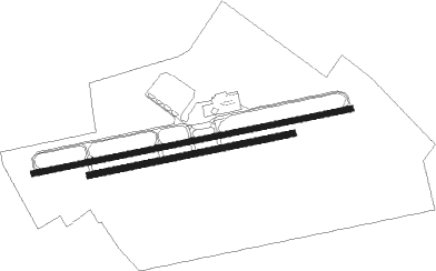
Marysville - Union Co
Airport details
| Country | United States of America |
| State | Ohio |
| Region | K5 |
| Airspace | Indianapolis Ctr |
| Municipality | Marysville |
| Elevation | 1020ft (311m) |
| Timezone | GMT -5 |
| Coordinates | 40.22469, -83.35161 |
| Magnetic var | |
| Type | land |
| Available since | X-Plane v10.40 |
| ICAO code | KMRT |
| IATA code | n/a |
| FAA code | MRT |
Communication
| Union Co AWOS 3 | 119.275 |
| Union Co CTAF/UNICOM | 122.800 |
| Union Co COLUMBUS Approach/Departure | 125.950 |
Nearby Points of Interest:
Ellis Mounds
-Reed Covered Bridge
-Farmers National Bank
-Elmwood Place
-The Fort
-Cary Village Site
-Carl H. Shier Farm
-Asher Brand Residence
-Myer House
-William Culbertson House
-Masonic Temple
-Oram Nincehelser House
-John H. Clark House
-Jeff Kimball House
-Village Hobby Shop
-Demand-Gest House
-Artz House
-Norvall Hunter Farm
-Stratford Methodist Episcopal Church
-Brelsford-Seese House
-Austin Hall
-Edwards Gymnasium/Pfieffer Natatorium
-Delaware Public Library
-Odd Fellows Hall
-Hilliard Methodist Episcopal Church
Nearby beacons
| code | identifier | dist | bearing | frequency |
|---|---|---|---|---|
| OS | FULER (COLUMBUS) NDB | 11.4 | 135° | 515 |
| BU | BOUTN (COLUMBUS) NDB | 25.2 | 160° | 230 |
| BUD | BUCKEYE (MARION) VOR | 26.9 | 36° | 109.80 |
| LC | PICKL (COLUMBUS) NDB | 31.4 | 124° | 376 |
| LCK | RICKENBACKER (COLUMBUS) TACAN | 31.6 | 135° | 134.20 |
| ROD | ROSEWOOD VORTAC | 31.9 | 275° | 117.50 |
| XSF | SPRINGFIELD TACAN | 32.3 | 232° | 133.80 |
| SGH | DME | 32.5 | 232° | 113.20 |
| DD | COBBS (COLUMBUS) NDB | 32.7 | 145° | 253 |
| APE | APPLETON VORTAC | 35.2 | 96° | 116.70 |
| CSS | COURT HOUSE (WASHINGTON) NDB | 37.5 | 184° | 414 |
| FFO | PATTERSON (DAYTON) TACAN | 40.5 | 240° | 115.20 |
| XUB | YELLOW BUD (CIRCLEVILLE) VOR | 45.3 | 152° | 112.50 |
| IL | AIRBO (WILMINGTON) NDB | 47.4 | 208° | 407 |
| FBC | FLAG CITY VORTAC | 47.5 | 331° | 108.20 |
| AT | BRUNY (DAYTON) NDB | 50.5 | 249° | 315 |
| MFD | MANSFIELD VORTAC | 51.9 | 50° | 108.80 |
| MXQ | MIDWEST (WILMINGTON) VOR/DME | 52 | 209° | 112.90 |
| MF | MANNS (MANSFIELD) NDB | 52.6 | 59° | 372 |
| TII | TIFFIN NDB | 52.6 | 9° | 269 |
| HW | CUBLA (WILMINGTON) NDB | 57.6 | 211° | 299 |
| MW | ONIDA (MIDDLETOWN) NDB | 59.2 | 236° | 223 |
Instrument approach procedures
| runway | airway (heading) | route (dist, bearing) |
|---|---|---|
| RW09 | KUTAW (85°) | KUTAW 3000ft |
| RNAV | KUTAW 3000ft YODTU (6mi, 85°) 2200ft KMRT (4mi, 85°) 1061ft (5101mi, 116°) 1421ft NESWU (5090mi, 296°) 3000ft NESWU (turn) | |
| RW27 | NESWU (265°) | NESWU 3000ft |
| RNAV | NESWU 3000ft ZEVAB (6mi, 265°) 2200ft KMRT (4mi, 265°) 1037ft (5101mi, 116°) 1360ft KUTAW (5111mi, 296°) 3000ft KUTAW (turn) |
Disclaimer
The information on this website is not for real aviation. Use this data with the X-Plane flight simulator only! Data taken with kind consent from X-Plane 12 source code and data files. Content is subject to change without notice.

