Monterey - Monterey Regl
Airport details
| Country | United States of America |
| State | California |
| Region | K2 |
| Airspace | Oakland Ctr |
| Municipality | Monterey County |
| Elevation | 253ft (77m) |
| Timezone | GMT -8 |
| Coordinates | 36.58695, -121.84278 |
| Magnetic var | |
| Type | land |
| Available since | X-Plane v10.40 |
| ICAO code | KMRY |
| IATA code | MRY |
| FAA code | MRY |
Communication
| Monterey Regl ATIS | 119.250 |
| Monterey Regl Clearance Delivery | 135.450 |
| Monterey Regl Ground | 120.875 |
| Monterey Regl Tower | 118.400 |
| Monterey Regl NORCAL Approach | 133.500 |
| Monterey Regl NORCAL Departure | 127.150 |
Approach frequencies
| LOC | RW28L | 110.7 | 18.00mi |
| ILS-cat-I | RW10R | 110.7 | 18.00mi |
| 3° GS | RW10R | 110.7 | 18.00mi |
Nearby Points of Interest:
G. T. Marsh and Sons
-Cathedral of San Carlos Borromeo
-Mary C. W. Black Studio House
-Monterey State Historic Park
-Larkin House
-James W. Finch House
-Lou Ellen Parmelee House
-Trimmer Hill
-Frank LaVerne Buck House
-Asilomar Conference Grounds
-Fort Ord Station Veterinary Hospital
-Tor House and Hawk Tower
-Whalers Cabin
-Peter J. Bontadelli House
-Monterey County Jail
-B. V. Sargent House
-Monterey County Court House
-Samuel M. Black House
-Elkhorn Slough
-Redman Hirahara Farmstead
-USS Macon
-Porter-Vallejo Mansion
-Odd Fellows Hall
-Godfrey M. Bockius House
-Rozas House
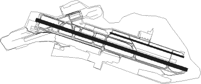
Runway info
Runway 10L / 28R  | ||
| length | 1068m (3504ft) | |
| bearing | 109° / 289° | |
| width | 18m (60ft) | |
| surface | asphalt | |
| blast zone | 76m (249ft) / 0m (0ft) | |
| Runway 10R / 28L | ||
| length | 2189m (7182ft) | |
| bearing | 109° / 289° | |
| width | 46m (150ft) | |
| surface | asphalt | |
| displ threshold | 53m (174ft) / 53m (174ft) | |
| blast zone | 116m (381ft) / 122m (400ft) | |
Nearby beacons
| code | identifier | dist | bearing | frequency |
|---|---|---|---|---|
| MR | MUNSO (MONTEREY) NDB | 5 | 289° | 385 |
| SNS | SALINAS VORTAC | 12.4 | 72° | 117.30 |
| UAD | CHUALAR (SALINAS) NDB | 18.6 | 105° | 263 |
| BSR | BIG SUR VORTAC | 26.2 | 154° | 114 |
| SJC | SAN JOSE VOR/DME | 47.5 | 353° | 114.10 |
| HGT | HUNTER LIGGETT NDB | 49.1 | 134° | 209 |
| NUQ | MOFFETT (MOUNTAIN VIEW) TACAN | 51.8 | 346° | 117.60 |
| OSI | WOODSIDE VOR/DME | 52.7 | 331° | 113.90 |
Departure and arrival routes
| Transition altitude | 18000ft |
| Transition level | 18000ft |
| SID end points | distance | outbound heading | |
|---|---|---|---|
| RW10 (ALL) | |||
| TORO7 | 12mi | 68° | |
| MRY5 | 17mi | 298° | |
| RW28 (ALL) | |||
| MRY5 | 17mi | 298° | |
Instrument approach procedures
| runway | airway (heading) | route (dist, bearing) |
|---|---|---|
| RW10R | SNS (252°) | SNS ZEBED (20mi, 267°) 3600ft ZEBED (turn) 2600ft |
| RNAV | ZEBED 2600ft MINCK (4mi, 109°) 1700ft KMRY (5mi, 108°) 205ft (6910mi, 107°) 1000ft SNS (6898mi, 287°) 5000ft SNS (turn) 5000ft | |
| RW28LY | SNS (252°) | SNS HIXAR (5mi, 157°) 5100ft HIXAR (turn) 5100ft |
| RW28LY | WIGGL (289°) | WIGGL HIXAR (14mi, 308°) 5100ft |
| RNAV | HIXAR 5100ft IGEYO (3mi, 254°) 4100ft HUGON (2mi, 275°) 3200ft INICU (4mi, 275°) 1740ft UTUYA (3mi, 275°) 482ft (6910mi, 107°) 657ft SNS (6898mi, 287°) 6000ft SNS (turn) | |
| RW28LZ | BASEC (259°) | BASEC SNS (11mi, 266°) 4900ft |
| RW28LZ | JEJMA (238°) | JEJMA SNS (8mi, 213°) 4900ft |
| RW28LZ | SNS (252°) | SNS 4900ft |
| RNAV | SNS 4900ft CONIV (4mi, 235°) 4000ft OKUPE (5mi, 235°) HUTAD (2mi, 263°) KMRY (4mi, 289°) 302ft URUYU (7mi, 288°) CUGVU (10mi, 29°) SNS (15mi, 111°) 5500ft SNS (turn) |
Disclaimer
The information on this website is not for real aviation. Use this data with the X-Plane flight simulator only! Data taken with kind consent from X-Plane 12 source code and data files. Content is subject to change without notice.