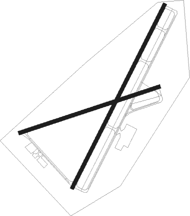
Massena - Massena Intl Richards Fld
Airport details
| Country | United States of America |
| State | New York |
| Region | K6 |
| Airspace | Boston Ctr |
| Municipality | Town of Massena |
| Elevation | 213ft (65m) |
| Timezone | GMT -5 |
| Coordinates | 44.93624, -74.84512 |
| Magnetic var | |
| Type | land |
| Available since | X-Plane v10.40 |
| ICAO code | KMSS |
| IATA code | MSS |
| FAA code | MSS |
Communication
| MASSENA INTL RICHARDS FLD ASOS | 128.075 |
| MASSENA INTL RICHARDS FLD CTAF/UNICOM | 123.000 |
| MASSENA INTL RICHARDS FLD BOSTON Approach/Departure | 135.250 |
Approach frequencies
| ILS-cat-I | RW05 | 108.7 | 18.00mi |
| 3° GS | RW05 | 108.7 | 18.00mi |
Nearby Points of Interest:
Dr. Buck–Stevens House
-Hepburn Library
-Lac Saint-François National Wildlife Area
-Waddington Historic District
-Hopkinton Green Historic District
-Jonathan Wallace House
-Market Street Historic District
-United States Post Office
-Clarkson-Knowles Cottage
-Clarkson Office Building
-Buck's Bridge Community Church
-Malone Armory
-Lake Saint Francis
-Village Park Historic District
-Richardson Hall, St. Lawrence University
-Herring-Cole Hall, St. Lawrence University
-St. Lawrence University-Old Campus Historic District
-Sunday Rock

Nearby beacons
| code | identifier | dist | bearing | frequency |
|---|---|---|---|---|
| MSS | MASSENA TACAN | 5.3 | 100° | 114.10 |
| MS | MISSE (MASSENA) NDB | 5.7 | 221° | 278 |
| PTD | POTSDAM NDB | 12.8 | 190° | 400 |
| OG | OGIVE (OGDENSBURG) NDB | 25.8 | 245° | 358 |
| OW | OTTAWA NDB | 39.5 | 301° | 236 |
| SLK | LAKE DME | 42.9 | 131° | 109.20 |
| ZMR | HERMAS (MONTREAL) NDB | 52.2 | 48° | 272 |
| ZMM | JOLY (MONTREAL) NDB | 52.7 | 42° | 266 |
| YUL | MONTREAL VOR/DME | 55 | 52° | 116.30 |
| ZMX | JANVIER (MONTREAL) NDB | 62.1 | 49° | 317 |
Instrument approach procedures
| runway | airway (heading) | route (dist, bearing) |
|---|---|---|
| RW05 | APKAF (62°) | APKAF DORIE (5mi, 113°) 2800ft |
| RW05 | DORIE (40°) | DORIE 6000ft DORIE (turn) 2800ft |
| RW05 | SETBE (12°) | SETBE DORIE (5mi, 293°) 2800ft |
| RNAV | DORIE 2800ft KOGEY (6mi, 40°) 2100ft KMSS (6mi, 40°) 257ft (4765mi, 121°) 455ft HODSA (4763mi, 301°) HINED (12mi, 113°) 3000ft HINED (turn) | |
| RW09 | AWIPI (38°) | AWIPI WERKI (7mi, 322°) 2000ft |
| RW09 | NIPHI (93°) | NIPHI WERKI (7mi, 142°) 2000ft |
| RW09 | WERKI (69°) | WERKI 2000ft |
| RNAV | WERKI 2000ft KFOXX (5mi, 68°) 1900ft WOPRA (3mi, 68°) 1020ft ZIGMA (2mi, 69°) 406ft (4765mi, 121°) 621ft WERKI (4773mi, 301°) 2000ft WERKI (turn) | |
| RW23 | SSENA (280°) | SSENA SALAS (11mi, 6°) 2500ft SALAS (turn) 2500ft |
| RNAV | SALAS 2500ft NEKIC (6mi, 221°) 1900ft ZATSI (3mi, 221°) 900ft KMSS (3mi, 221°) 271ft (4765mi, 121°) 620ft DORIE (4769mi, 301°) 2800ft DORIE (turn) | |
| RW27 | JURGO (233°) | JURGO YUDUK (7mi, 161°) 2900ft |
| RW27 | YUDUK (260°) | YUDUK 2900ft |
| RW27 | ZAKOD (284°) | ZAKOD YUDUK (7mi, 341°) 2900ft |
| RNAV | YUDUK 2900ft UVENE (5mi, 260°) 1900ft KMSS (5mi, 260°) 255ft (4765mi, 121°) 1000ft YUDUK (4755mi, 301°) 2900ft YUDUK (turn) |
Disclaimer
The information on this website is not for real aviation. Use this data with the X-Plane flight simulator only! Data taken with kind consent from X-Plane 12 source code and data files. Content is subject to change without notice.