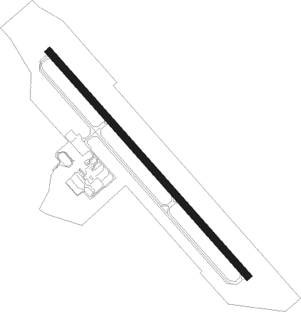
Monticello - Sullivan Co Intl
Airport details
| Country | United States of America |
| State | New York |
| Region | K6 |
| Airspace | Boston Ctr |
| Municipality | Town of Bethel |
| Elevation | 1399ft (426m) |
| Timezone | GMT -5 |
| Coordinates | 41.70164, -74.79503 |
| Magnetic var | |
| Type | land |
| Available since | X-Plane v10.40 |
| ICAO code | KMSV |
| IATA code | n/a |
| FAA code | MSV |
Communication
| Sullivan Co Intl AWOS | 124.725 |
| Sullivan Co Intl Unicom | 122.800 |
Approach frequencies
| ILS-cat-I | RW15 | 109.1 | 18.00mi |
| 3° GS | RW15 | 109.1 | 18.00mi |
Nearby Points of Interest:
Bikur Cholim B'nai Israel Synagogue
-Manion's General Store
-Ferndale School
-Bennett Family House
-Jewish Community Center of White Sulphur Springs
-Munson Diner
-Town and Country Building
-Liberty Downtown Historic District
-Rivoli Theatre, South Fallsburg
-South Fallsburg Hebrew Association Synagogue
-Loch Sheldrake Synagogue
-Stone Arch Bridge
-Jewish Center of Lake Huntington
-Cochecton Center Methodist Episcopal Church
-B'nai Israel Synagogue
-Center Theatre
-First Methodist Episcopal Church of Parksville
-Woodbourne Reformed Church Complex
-Tefereth Israel Anshei Parksville Synagogue
-Glen Wild Methodist Church
-Anshei Glen Wild Synagogue
-Ohave Shalom Synagogue
-Forestburgh Town Hall
-German Presbyterian Church and Hortonville Cemetery
-Cochecton
Nearby beacons
| code | identifier | dist | bearing | frequency |
|---|---|---|---|---|
| HUO | HUGUENOT VOR/DME | 19.7 | 145° | 116.10 |
| SW | NEELY (NEWBURGH) NDB | 28.5 | 111° | 335 |
| DNY | DE LANCEY VOR/DME | 29.5 | 341° | 112.10 |
| HNK | HANCOCK VOR/DME | 31.8 | 305° | 116.80 |
| SKU | STANWYCK (NEWBURGH) NDB | 35.2 | 103° | 261 |
| SAX | SPARTA VORTAC | 39.8 | 158° | 115.70 |
| STW | STILLWATER VOR/DME | 42.5 | 186° | 109.60 |
| IGN | KINGSTON VOR/DME | 43.6 | 92° | 117.60 |
| LVZ | WILKES-BARRE VORTAC | 47.7 | 244° | 111.60 |
| RKA | ROCKDALE VOR/DME | 50 | 330° | 112.60 |
| MM | MOREE (MORRISTOWN) NDB | 53.5 | 151° | 392 |
| BWZ | BROADWAY (SCHOOLEY'S MT) VOR/DME | 54.2 | 182° | 114.20 |
| CAT | CHATHAM NDB | 60 | 159° | 254 |
| TEB | TETERBORO VOR/DME | 60.9 | 139° | 108.40 |
| TE | TORBY (TETERBORO) NDB | 61.6 | 144° | 214 |
| FJC | ALLENTOWN VORTAC | 65.7 | 214° | 117.50 |
| LGA | LA GUARDIA (NEW YORK) VOR/DME | 69.2 | 135° | 113.10 |
Instrument approach procedures
| runway | airway (heading) | route (dist, bearing) |
|---|---|---|
| RW15 | FITRE (150°) | FITRE JIBOT (4mi, 217°) 4000ft |
| RW15 | WECOL (106°) | WECOL JIBOT (7mi, 60°) 4000ft |
| RNAV | JIBOT 4000ft TOLMY (6mi, 135°) 3200ft KMSV (6mi, 135°) 1444ft MUMVE (12mi, 135°) 3300ft MUMVE (turn) | |
| RW33 | HAWLY (61°) | HAWLY ICIPA (17mi, 97°) 4000ft MUMVE (5mi, 60°) 3300ft |
| RW33 | HELON (274°) | HELON JEYPY (13mi, 255°) 4000ft MUMVE (5mi, 241°) 3300ft |
| RW33 | HUO (325°) | HUO MUMVE (8mi, 341°) 3300ft |
| RW33 | MUMVE (315°) | MUMVE 3300ft |
| RNAV | MUMVE 3300ft BRGNR (6mi, 315°) 3200ft AVJUB (2mi, 315°) 2400ft KMSV (3mi, 315°) 1419ft (4727mi, 119°) 1810ft MUMVE (4718mi, 299°) 3300ft MUMVE (turn) |
Disclaimer
The information on this website is not for real aviation. Use this data with the X-Plane flight simulator only! Data taken with kind consent from X-Plane 12 source code and data files. Content is subject to change without notice.