Mattoon/charleston - Coles County Memorial
Airport details
| Country | United States of America |
| State | Illinois |
| Region | K5 |
| Airspace | Kansas City Ctr |
| Municipality | Coles County |
| Elevation | 722ft (220m) |
| Timezone | GMT -6 |
| Coordinates | 39.47789, -88.27998 |
| Magnetic var | |
| Type | land |
| Available since | X-Plane v10.40 |
| ICAO code | KMTO |
| IATA code | n/a |
| FAA code | MTO |
Communication
| Coles County Memorial AWOS 3 | 118.375 |
| Coles County Memorial CTAF/UNICOM | 122.700 |
| Coles County Memorial CHAMPAIGN Approach/Departure | 132.850 |
Approach frequencies
| ILS-cat-I | RW29 | 111.1 | 18.00mi |
| 3° GS | RW29 | 111.1 | 18.00mi |
Nearby Points of Interest:
Fifteenth Street and Oklahoma Avenue Brick Street
-Railway Express Agency Building
-Unity Church (Mattoon, Illinois)
-Alexander Briggs House
-Health Education Building
-Pemberton Hall
-Old Main
-Sixth, Seventh, and Tenth Street Stone Arch Bridges
-McFarland House (Charleston, Illinois)
-Coles County Courthouse
-Will Rogers Theatre
-Richard Roytek House
-Blakeman Bridge
-Harrison Street Bridge
-Cumberland County Courthouse
-Arcola Carnegie Public Library
-Greenup Commercial Historic District
-Thornton Ward Estate
-Dr. Hiram Rutherford House and Office
-Moultrie County Courthouse
-Philip D. Armour III House
-Clarksburg Schoolhouse
-Streibich Blacksmith Shop
-Chautauqua Auditorium
-Horace M. Tallman House
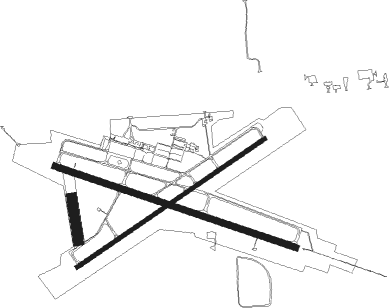
Runway info
Runway 11 / 29  | ||
| length | 1978m (6490ft) | |
| bearing | 108° / 288° | |
| width | 46m (150ft) | |
| surface | concrete | |
| Runway 6 / 24 | ||
| length | 1766m (5794ft) | |
| bearing | 66° / 246° | |
| width | 30m (100ft) | |
| surface | asphalt | |
| Runway 18 / 36 | ||
| length | 335m (1099ft) | |
| bearing | 174° / 354° | |
| width | 76m (250ft) | |
| surface | grass | |
Nearby beacons
| code | identifier | dist | bearing | frequency |
|---|---|---|---|---|
| MTO | DME | 0.2 | 270° | 109.40 |
| SYZ | SHELBYVILLE NDB | 26.4 | 263° | 365 |
| CM | VEALS (CHAMPAIGN/URBANA) NDB | 29.6 | 11° | 407 |
| AXC | ADDERS VORTAC | 30.8 | 294° | 117.20 |
| CMI | CHAMPAIGN VORTAC | 33.4 | 0° | 110 |
| BIB | BIBLE GROVE VORTAC | 34.7 | 200° | 109 |
| DE | ELWIN (DECATUR) NDB | 36.3 | 295° | 275 |
| PLX | PALESTINE (ROBINSON) NDB | 40.7 | 126° | 391 |
| HU | YINNO (TERRE HAUTE) NDB | 41.2 | 96° | 245 |
| OLY | OLNEY NDB | 45.8 | 172° | 272 |
| VLA | VANDALIA VOR/DME | 47 | 246° | 114.30 |
| LWV | DME | 52.9 | 136° | 108.80 |
| DNV | DANVILLE VORTAC | 59.2 | 42° | 111 |
| DN | JULIP (DANVILLE) NDB | 59.7 | 43° | 332 |
| SAM | SAMSVILLE VOR/DME | 60.3 | 169° | 116.60 |
Instrument approach procedures
| runway | airway (heading) | route (dist, bearing) |
|---|---|---|
| RW06 | HOMAX (66°) | HOMAX 3000ft |
| RNAV | HOMAX 3000ft ZAGUK (6mi, 66°) 2300ft WAXEK (3mi, 66°) 1320ft KMTO (2mi, 66°) 760ft (5325mi, 114°) 972ft NIBIE (5316mi, 294°) 3000ft NIBIE (turn) | |
| RW11 | WUBTA (108°) | WUBTA 3000ft |
| RNAV | WUBTA 3000ft YAYSU (6mi, 108°) 2400ft ZOSIB (2mi, 108°) 1680ft KMTO (3mi, 108°) 759ft (5325mi, 114°) 1200ft NIBIE (5316mi, 294°) 3000ft NIBIE (turn) | |
| RW24 | NIBIE (246°) | NIBIE 3000ft |
| RNAV | NIBIE 3000ft RIFJO (6mi, 246°) 2300ft KMTO (5mi, 246°) 758ft (5325mi, 114°) 1200ft WUBTA (5336mi, 294°) 3000ft WUBTA (turn) | |
| RW29 | OSEKE (288°) | OSEKE 3000ft |
| RNAV | OSEKE 3000ft IDOCE (8mi, 288°) 2400ft YITCU (4mi, 288°) 1240ft KMTO (2mi, 288°) 765ft (5325mi, 114°) 2000ft ZARIR (5332mi, 294°) 3000ft ZARIR (turn) |
Disclaimer
The information on this website is not for real aviation. Use this data with the X-Plane flight simulator only! Data taken with kind consent from X-Plane 12 source code and data files. Content is subject to change without notice.