Fort Indiantown Gap(annville) - Muir Aaf
Airport details
| Country | United States of America |
| State | Pennsylvania |
| Region | K6 |
| Airspace | New York Ctr |
| Municipality | Union Township |
| Elevation | 487ft (148m) |
| Timezone | GMT -5 |
| Coordinates | 40.43399, -76.56686 |
| Magnetic var | |
| Type | land |
| Available since | X-Plane v10.40 |
| ICAO code | KMUI |
| IATA code | MUI |
| FAA code | MUI |
Communication
| Muir AAF ASOS | 124.175 |
| Muir AAF CTAF | 126.200 |
| Muir AAF Ground Control | 121.625 |
| Muir AAF Tower | 126.200 |
| Muir AAF HARRISBURG Approach/Departure | 118.250 |
Nearby Points of Interest:
Waterville Bridge
-Bindnagles Evangelical Lutheran Church
-Annville Historic District
-Biever House
-Union Canal
-John Todd House
-Swatara Furnace
-Landis Shoe Company Building
-Gloninger Estate
-Reading Railroad Station
-Cornwall & Lebanon Railroad Station
-Salem Evangelical Lutheran Church
-Tabor Reformed Church
-Josiah Funck Mansion
-Derry Session House and Enclosure
-Milton S. Hershey Mansion
-Dr. B. Stauffer House
-Spannuth Mill
-GAR Building
-Pine Grove Historic District
-Nutting Hall
-Tulpehocken Manor Plantation
-Enoch Matlack House
-Colebrook Iron Master's House
-Dr. William Henderson House
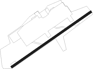
Runway info
| Runway 7 / 25 | ||
| length | 1214m (3983ft) | |
| bearing | 66° / 246° | |
| width | 30m (98ft) | |
| surface | asphalt | |
| displ threshold | 106m (348ft) / 37m (121ft) | |
Nearby beacons
| code | identifier | dist | bearing | frequency |
|---|---|---|---|---|
| BZJ | BELLGROVE (INDIANTOWN GAP) NDB | 0.6 | 83° | 328 |
| RAV | RAVINE VORTAC | 7.3 | 345° | 114.60 |
| MD | ENOLA (HARRISBURG) NDB | 18.9 | 241° | 204 |
| LRP | LANCASTER VOR/DME | 22.6 | 139° | 117.30 |
| HAR | HARRISBURG VORTAC | 24.3 | 255° | 112.50 |
| CX | LATLE (HARRISBURG) NDB | 25.2 | 240° | 219 |
| SEG | SELINSGROVE VOR/DME | 25.8 | 318° | 110.40 |
| MIP | MILTON VORTAC | 35.6 | 351° | 109.20 |
| ETX | EAST TEXAS VOR/DME | 41.2 | 81° | 110.20 |
| MXE | MODENA VORTAC | 51.4 | 120° | 113.20 |
| FQM | WILLIAMSPORT VOR/DME | 55.1 | 347° | 114.40 |
| EMI | WESTMINSTER VORTAC | 59.4 | 204° | 117.90 |
| DQO | DUPONT (WILMINGTON) VORTAC | 63.3 | 128° | 114 |
| LVZ | WILKES-BARRE VORTAC | 64.2 | 46° | 111.60 |
| IL | HADIN (WILMINGTON) NDB | 67.4 | 132° | 248 |
Instrument approach procedures
| runway | airway (heading) | route (dist, bearing) |
|---|---|---|
| RWNVB | BOBSS (53°) | BOBSS 3000ft |
| RNAV | BOBSS 3000ft FALAS (7mi, 52°) 2100ft CAMRU (4mi, 52°) 1420ft (4794mi, 118°) 1420ft BAARN (4794mi, 298°) 3100ft BAARN (turn) |
Disclaimer
The information on this website is not for real aviation. Use this data with the X-Plane flight simulator only! Data taken with kind consent from X-Plane 12 source code and data files. Content is subject to change without notice.