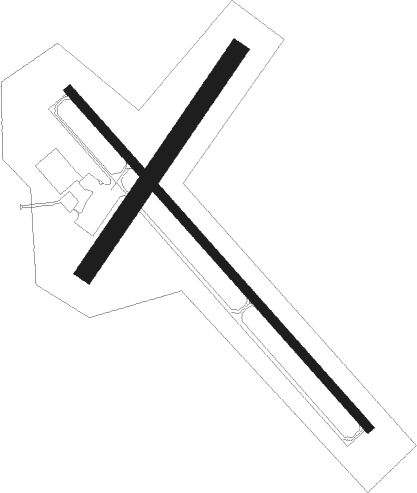
Montevideo - Montevideo Chippewa Co
Airport details
| Country | United States of America |
| State | Minnesota |
| Region | K3 |
| Airspace | Minneapolis Ctr |
| Municipality | Montevideo |
| Elevation | 1034ft (315m) |
| Timezone | GMT -6 |
| Coordinates | 44.96920, -95.71039 |
| Magnetic var | |
| Type | land |
| Available since | X-Plane v10.40 |
| ICAO code | KMVE |
| IATA code | n/a |
| FAA code | MVE |
Communication
| Montevideo Chippewa Co CTAF/UNICOM | 122.800 |
Nearby Points of Interest:
Chicago, Milwaukee and St. Paul Depot
-Camp Release State Monument
-Lac qui Parle Mission
-Upper Sioux Agency State Park
-Sacred Heart Public School
-Gethsemane Episcopal Church
-Appleton City Hall
-Church of St. Bridget-Catholic
-Sabin S. Murdock House
-Madison Carnegie Library
-Lac Qui Parle County Courthouse
-Christ Episcopal Church
-Church of St. Francis Xavier
-Joseph Brown House Ruins
-St. Paul's Evangelical Lutheran Church & Parsonage
-Monson Lake State Park CCC/WPA/Rustic Style Historic Resources

Nearby beacons
| code | identifier | dist | bearing | frequency |
|---|---|---|---|---|
| MVE | MONTEVIDEO VOR/DME | 0.2 | 333° | 111.60 |
| BDH | WILLMAR VOR/DME | 26.3 | 76° | 113.70 |
| GB | GARNO (MARSHALL) NDB | 29.3 | 203° | 253 |
| MML | MARSHALL VOR/DME | 31.6 | 192° | 111 |
| MOX | MORRIS VOR/DME | 37.4 | 337° | 109.60 |
| RWF | REDWOOD FALLS VOR/DME | 39 | 131° | 113.30 |
| AXN | ALEXANDRIA VOR/DME | 62.7 | 26° | 112.80 |
Instrument approach procedures
| runway | airway (heading) | route (dist, bearing) |
|---|---|---|
| RW14 | CLAPS (257°) | CLAPS ZARTU (23mi, 276°) 3400ft ZARTU (turn) 3400ft |
| RW14 | DAWSO (96°) | DAWSO ZARTU (16mi, 75°) 3400ft |
| RW14 | MOX (157°) | MOX ZARTU (27mi, 168°) 3400ft |
| RNAV | ZARTU 3400ft WUMIR (6mi, 133°) 2600ft KMVE (5mi, 133°) 1079ft (5648mi, 115°) 1284ft YIBUG (5641mi, 295°) 3300ft YIBUG (turn) | |
| RW32 | FITAS (260°) | FITAS YIBUG (22mi, 237°) 3300ft YIBUG (turn) 3300ft |
| RW32 | RISLE (37°) | RISLE YIBUG (18mi, 69°) 3300ft YIBUG (turn) 3300ft |
| RW32 | RWF (311°) | RWF YIBUG (28mi, 310°) 3300ft |
| RNAV | YIBUG 3300ft ZATVU (6mi, 313°) 2600ft WUMPI (2mi, 313°) 1860ft KMVE (3mi, 313°) 1065ft (5648mi, 115°) 1226ft ZARTU (5654mi, 295°) 3400ft ZARTU (turn) |
Disclaimer
The information on this website is not for real aviation. Use this data with the X-Plane flight simulator only! Data taken with kind consent from X-Plane 12 source code and data files. Content is subject to change without notice.