Mineral Wells - Mineral Wells Rgnl
Airport details
| Country | United States of America |
| State | Texas |
| Region | K4 |
| Airspace | Ft Worth Ctr |
| Municipality | Mineral Wells |
| Elevation | 974ft (297m) |
| Timezone | GMT -6 |
| Coordinates | 32.78676, -98.06119 |
| Magnetic var | |
| Type | land |
| Available since | X-Plane v10.40 |
| ICAO code | KMWL |
| IATA code | MWL |
| FAA code | MWL |
Communication
| Mineral Wells Rgnl ASOS | 135.075 |
| Mineral Wells Rgnl Mineral Wells UNICOM | 122.725 |
| Mineral Wells Rgnl FT Worth Center Approach | 127.000 |
| Mineral Wells Rgnl FT Worth Center Departure | 127.000 |
Approach frequencies
| ILS-cat-I | RW31 | 109.55 | 18.00mi |
| 3° GS | RW31 | 109.55 | 18.00mi |
Nearby Points of Interest:
US 281 Bridge at the Brazos River
-Parker County Courthouse
-Weatherford Downtown Historic District
-Hood County Courthouse Historic District
-Fort Richardson
-Jack County Courthouse
-Westover Manor
-Marshall R. Sanguinet House
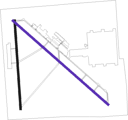
Runway info
Runway 17 / 35  | ||
| length | 1278m (4193ft) | |
| bearing | 181° / 1° | |
| width | 30m (100ft) | |
| surface | asphalt | |
| displ threshold | 0m (0ft) / 87m (285ft) | |
| Runway 13 / 31 | ||
| length | 1829m (6001ft) | |
| bearing | 131° / 311° | |
| width | 30m (100ft) | |
| surface | asphalt | |
| displ threshold | 92m (302ft) / 122m (400ft) | |
Nearby beacons
| code | identifier | dist | bearing | frequency |
|---|---|---|---|---|
| MQP | MILLSAP (MINERAL WELLS) VORTAC | 4.8 | 134° | 117.70 |
| NFW | NAS JRB FORT WORTH (FT WO TACAN | 31.4 | 91° | 108.70 |
| GHX | GRAHAM NDB | 31.6 | 311° | 371 |
| FT | MUFIN (FORT WORTH) NDB | 35.2 | 81° | 365 |
| JEN | GLEN ROSE TACAN | 38.7 | 164° | 115 |
| FUZ | RANGER (DALLAS-FORT WORTH VORTAC | 44.9 | 83° | 115.70 |
| UKW | BOWIE VORTAC | 46.5 | 18° | 117.15 |
| DT | PINCK (DENTON) NDB | 52.7 | 60° | 257 |
| SKB | SCOTLAND (WICHITA FALLS) NDB | 63.5 | 337° | 344 |
| BWD | BROWNWOOD VOR/DME | 70.3 | 225° | 108.60 |
Instrument approach procedures
| runway | airway (heading) | route (dist, bearing) |
|---|---|---|
| RW31 | CEOLA (256°) | CEOLA NABIE (12mi, 185°) 4000ft HEAST (7mi, 256°) 3000ft |
| RW31 | GUNFE (332°) | GUNFE HEAST (7mi, 16°) 3000ft |
| RW31 | MQP (314°) | MQP HEAST (8mi, 130°) 3000ft HEAST (turn) 3000ft |
| RNAV | HEAST 3000ft CUTIS (7mi, 311°) 2500ft KMWL (5mi, 312°) 1026ft (5812mi, 108°) 1600ft HEAST (5804mi, 288°) 4000ft HEAST (turn) |
Disclaimer
The information on this website is not for real aviation. Use this data with the X-Plane flight simulator only! Data taken with kind consent from X-Plane 12 source code and data files. Content is subject to change without notice.