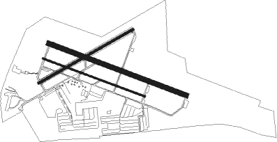
San Diego - Montgomery Fld
Airport details
| Country | United States of America |
| State | California |
| Region | K2 |
| Airspace | Los Angeles Ctr |
| Municipality | San Diego |
| Elevation | 423ft (129m) |
| Timezone | GMT -8 |
| Coordinates | 32.81578, -117.14726 |
| Magnetic var | |
| Type | land |
| Available since | X-Plane v10.40 |
| ICAO code | KMYF |
| IATA code | MYF |
| FAA code | MYF |
Communication
| Montgomery Fld ATIS | 126.900 |
| Montgomery Fld UNICOM | 122.950 |
| Montgomery Fld Clearance DEL | 123.725 |
| Montgomery Fld Ground Control | 118.225 |
| Montgomery Fld Tower | 119.200 |
| Montgomery Fld SOCAL Departure | 119.600 |
Approach frequencies
| ILS-cat-I | RW28R | 111.95 | 18.00mi |
| 3° GS | RW28R | 111.95 | 18.00mi |
Runway info
Nearby beacons
| code | identifier | dist | bearing | frequency |
|---|---|---|---|---|
| NKX | MIRAMAR (SAN DIEGO) TACAN | 3.2 | 352° | 109.60 |
| MZB | MISSION BAY (SAN DIEGO) VORTAC | 4.4 | 247° | 117.80 |
| NZY | NORTH ISLAND (SAN DIEGO) TACAN | 7.6 | 211° | 117 |
| PGY | POGGI (SAN DIEGO) VORTAC | 14.9 | 141° | 116.45 |
| NRS | IMPERIAL BEACH TACAN | 15.2 | 172° | 109.20 |
| TIJ | TIJUANA VOR/DME | 19.2 | 145° | 116.50 |
| OCN | OCEANSIDE VORTAC | 28.9 | 328° | 115.30 |
| NFG | CAMP PENDLETON (OCEANSIDE TACAN | 30 | 332° | 111.80 |
| JLI | JULIAN VORTAC | 34.3 | 60° | 114 |
| HDF | HOMELAND (RIVERSIDE) VOR | 57.7 | 358° | 113.40 |
| ELB | EL TORO (SANTA ANA) VOR/DME | 59.4 | 326° | 117.20 |
| TRM | THERMAL VORTAC | 69.5 | 51° | 116.20 |
| SLI | SEAL BEACH (LOS ALAMITOS) VORTAC | 73.8 | 317° | 115.70 |
Departure and arrival routes
| Transition altitude | 18000ft |
| Transition level | 18000ft |
| SID end points | distance | outbound heading | |
|---|---|---|---|
| RW10 (ALL) | |||
| CWARD2 | 74mi | 317° | |
| RW10L | |||
| PADRZ2 | 123mi | 317° | |
| RW10R | |||
| PADRZ2 | 123mi | 317° | |
| RW23 | |||
| CWARD2 | 74mi | 317° | |
| PADRZ2 | 123mi | 317° | |
| RW28 (ALL) | |||
| CWARD2 | 74mi | 317° | |
| RW28L | |||
| PADRZ2 | 123mi | 317° | |
| RW28R | |||
| PADRZ2 | 123mi | 317° | |
Instrument approach procedures
| runway | airway (heading) | route (dist, bearing) |
|---|---|---|
| RW28R | BARET (275°) | BARET OGOTE (4mi, 271°) 6100ft BAKEL (4mi, 271°) 5900ft MIBBY (4mi, 215°) 4200ft |
| RNAV | MIBBY 4200ft NESTY (3mi, 292°) 3600ft PENYY (4mi, 292°) 2500ft PALOS (3mi, 292°) 1380ft KMYF (4mi, 289°) 463ft (6759mi, 106°) 673ft JOPDO (6764mi, 286°) CARIF (11mi, 337°) 3000ft CARIF (turn) |
Disclaimer
The information on this website is not for real aviation. Use this data with the X-Plane flight simulator only! Data taken with kind consent from X-Plane 12 source code and data files. Content is subject to change without notice.

