Mexico - Mexico Meml
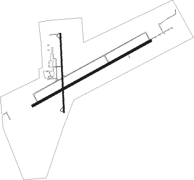
Airport details
| Country | United States of America |
| State | Missouri |
| Region | K3 |
| Airspace | Kansas City Ctr |
| Municipality | Mexico |
| Elevation | 823ft (251m) |
| Timezone | GMT -6 |
| Coordinates | 39.15750, -91.81828 |
| Magnetic var | |
| Type | land |
| Available since | X-Plane v10.40 |
| ICAO code | KMYJ |
| IATA code | n/a |
| FAA code | MYJ |
Communication
| Mexico Meml AWOS 3 | 120.575 |
| Mexico Meml CTAF | 122.900 |
| Mexico Meml MIZZU Approach/Departure | 124.375 |
Approach frequencies
| LOC | RW24 | 109.5 | 18.00mi |
Nearby Points of Interest:
Audrain County Courthouse
-Ross House
-Chatol
-Albert Bishop Chance House and Gardens
-Lincoln School
-Mark Twain State Park Picnic Shelter at Buzzard's Roost
-Brandon-Bell-Collier House
-Robnett-Payne House
-M. Fred Bell Speculative Cottage
-M. Fred Bell Rental Cottage
-Dr. George M. Willing House
-John Augustus Hockaday House
-Merritt Violette House
-Sylvester Marion and Frances Anne Stephens Baker House
-Paris Male Academy
-Greenwood
-David Guitar House
-Pitcher Store
-David Gordon House and Collins Log Cabin
-Farmers Mercantile Co. Building
-High Hill School
-Wright Brothers Mule Barn
-Stephens College South Campus Historic District
-East Campus Neighborhood
-Central Dairy Building

Nearby beacons
| code | identifier | dist | bearing | frequency |
|---|---|---|---|---|
| HLV | HALLSVILLE VORTAC | 14.6 | 262° | 114.20 |
| COU | COLUMBIA VOR/DME | 27.9 | 229° | 110.20 |
| JE | ALGOA (JEFFERSON CITY) NDB | 38.4 | 203° | 397 |
| MCM | DME | 42.8 | 307° | 112.90 |
| FTZ | FORISTELL VORTAC | 48.3 | 119° | 110.80 |
| UIN | QUINCY VORTAC | 48.4 | 38° | 113.60 |
| UI | QUINCY NDB | 51 | 38° | 293 |
| IRK | KIRKSVILLE VORTAC | 68.7 | 322° | 114.60 |
Instrument approach procedures
| runway | airway (heading) | route (dist, bearing) |
|---|---|---|
| RW06 | HLV (82°) | HLV TABCO (5mi, 113°) 3000ft |
| RW06 | OGULE (63°) | OGULE TABCO (4mi, 36°) 3000ft |
| RW06 | TABCO (70°) | TABCO 3000ft |
| RNAV | TABCO 3000ft WOPES (6mi, 71°) 2500ft SERRO (3mi, 71°) 1640ft KMYJ (3mi, 70°) 863ft (5490mi, 113°) 1073ft HAPTO (5479mi, 293°) 3000ft HAPTO (turn) | |
| RW24 | FOVUR (230°) | FOVUR 3000ft HAPTO (5mi, 150°) 3000ft |
| RW24 | HAPTO (251°) | HAPTO 3000ft |
| RW24 | JEROB (269°) | JEROB 3000ft HAPTO (5mi, 330°) 3000ft |
| RNAV | HAPTO 3000ft MIRIE (6mi, 251°) 2500ft KMYJ (6mi, 251°) 850ft (5490mi, 113°) 1126ft TABCO (5500mi, 293°) 3000ft TABCO (turn) |
Disclaimer
The information on this website is not for real aviation. Use this data with the X-Plane flight simulator only! Data taken with kind consent from X-Plane 12 source code and data files. Content is subject to change without notice.