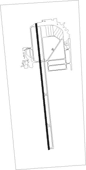
Mccall - Mc Call Muni
Airport details
| Country | United States of America |
| State | Idaho |
| Region | K1 |
| Airspace | Salt Lake City Ctr |
| Municipality | McCall |
| Elevation | 5020ft (1530m) |
| Timezone | GMT -7 |
| Coordinates | 44.89365, -116.09932 |
| Magnetic var | |
| Type | land |
| Available since | X-Plane v10.40 |
| ICAO code | KMYL |
| IATA code | MYL |
| FAA code | MYL |
Communication
| Mc Call Muni ASOS | 119.925 |
| Mc Call Muni CTAF/UNICOM | 122.800 |
Nearby Points of Interest:
Elo School
-Matt Ruatsale Homestead
-Col. E. M. Heigho House
-Pacific and Idaho Northern Railroad Depot
-John Korvola Homestead
-Council Ranger Station
-Adams County Courthouse
Nearby beacons
| code | identifier | dist | bearing | frequency |
|---|---|---|---|---|
| DNJ | DONNELLY (MC CALL) VOR/DME | 8.8 | 220° | 116.20 |
Departure and arrival routes
| Transition altitude | 18000ft |
| Transition level | 18000ft |
| SID end points | distance | outbound heading | |
|---|---|---|---|
| RW16 | |||
| PEPUC2 | 18mi | 174° | |
Instrument approach procedures
| runway | airway (heading) | route (dist, bearing) |
|---|---|---|
| RW16 | DNJ (40°) | DNJ JALUL (28mi, 26°) 10800ft JALUL (turn) 10800ft |
| RW16 | KOVRY (139°) | KOVRY JALUL (17mi, 93°) 10800ft JALUL (turn) 10800ft |
| RNAV | JALUL 10800ft HETSO (6mi, 199°) 9500ft LUHPY (3mi, 199°) 9000ft FIKVO (5mi, 200°) 6940ft EGNAJ (3mi, 200°) 5940ft XOYTY (2mi, 200°) 5267ft (6496mi, 111°) 5424ft UDABE (6498mi, 291°) PEPUC (16mi, 168°) 11700ft PEPUC (turn) | |
| RW34 | DNJ (40°) | DNJ PEPUC (12mi, 142°) 10200ft PEPUC (turn) 10000ft |
| RW34 | SIDZY (346°) | SIDZY PEPUC (6mi, 322°) 10000ft |
| RNAV | PEPUC 10000ft VACUA (11mi, 351°) 7500ft KMYL (7mi, 359°) 5047ft (6496mi, 111°) 5600ft WADPO (6501mi, 291°) SUMOQ (17mi, 260°) 12000ft SUMOQ (turn) 12000ft |
Disclaimer
The information on this website is not for real aviation. Use this data with the X-Plane flight simulator only! Data taken with kind consent from X-Plane 12 source code and data files. Content is subject to change without notice.
