Myrtle Beach - Myrtle Beach Intl
Airport details
| Country | United States of America |
| State | South Carolina |
| Region | K7 |
| Airspace | Jacksonville Ctr |
| Municipality | Myrtle Beach |
| Elevation | 23ft (7m) |
| Timezone | GMT -5 |
| Coordinates | 33.67975, -78.92834 |
| Magnetic var | |
| Type | land |
| Available since | X-Plane v10.40 |
| ICAO code | KMYR |
| IATA code | MYR |
| FAA code | MYR |
Communication
| Myrtle Beach Intl ATIS | 123.925 |
| Myrtle Beach Intl MYRTLE BEACH Ground Control | 120.300 |
| Myrtle Beach Intl MYRTLE BEACH Tower | 128.450 |
| Myrtle Beach Intl MYRTLE BEACH Approach | 119.200 |
| Myrtle Beach Intl MYRTLE BEACH Departure | 119.200 |
Approach frequencies
| ILS-cat-II | RW18 | 109.5 | 18.00mi |
| ILS-cat-I | RW36 | 111.9 | 18.00mi |
| 3° GS | RW36 | 111.9 | 18.00mi |
| 3° GS | RW18 | 109.5 | 18.00mi |
Nearby Points of Interest:
Myrtle Beach Atlantic Coast Line Railroad Station
-Buck's Upper Mill Farm
-Waccamaw River Memorial Bridge
-Waccamaw River Warehouse Historic District
-C.P. Quattlebaum House
-Paul Quattlebaum House
-Old Horry County Courthouse
-C.P. Quattlebaum Office
-Atlantic Coast Line Railroad Depot
-Conway Downtown Historic District
-Beaty-Spivey House
-United States Post Office
-W. H. Winborne House
-Beaty-Little House
-Arthur M. Burroughs House
-J.W. Holliday Jr. House
-Conway Residential Historic District
-Burroughs School
-H.W. Ambrose House
-Brookgreen Gardens
-Atalaya and Brookgreen Gardens
-Atalaya Castle
-Chicora Wood Plantation
-Summer Chapel, Prince Frederick's Episcopal Church
-Cedar Grove Plantation Chapel
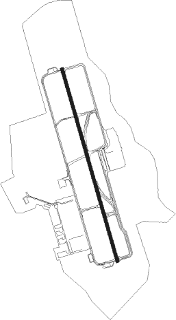
Runway info
| Runway 18 / 36 | ||
| length | 2908m (9541ft) | |
| bearing | 166° / 346° | |
| width | 46m (150ft) | |
| surface | asphalt | |
| blast zone | 255m (837ft) / 255m (837ft) | |
Nearby beacons
| code | identifier | dist | bearing | frequency |
|---|---|---|---|---|
| CRE | GRAND STRAND VORTAC | 12.9 | 57° | 114.40 |
| HYW | HORRY (CONWAY) NDB | 13.1 | 306° | 370 |
| PHH | ANDREWS NDB | 32.9 | 249° | 255 |
| CPC | CAMP (WHITEVILLE) NDB | 37.2 | 20° | 227 |
| CFY | EVANS (LAKE CITY) NDB | 43.1 | 282° | 420 |
| FLO | FLORENCE VORTAC | 49.2 | 307° | 115.20 |
| DLC | DILLON NDB | 51.1 | 330° | 274 |
| JB | JIGEL (LUMBERTON) NDB | 53 | 346° | 384 |
| FL | ALCOT (FLORENCE) NDB | 54.8 | 298° | 335 |
| UDG | DARLINGTON NDB | 66.1 | 309° | 245 |
| BES | BENNETTSVILLE NDB | 69.2 | 319° | 230 |
Instrument approach procedures
| runway | airway (heading) | route (dist, bearing) |
|---|---|---|
| RW18 | UXDEP (166°) | UXDEP 2000ft |
| RW18 | WOPSU (140°) | WOPSU UXDEP (8mi, 105°) 2000ft |
| RW18 | ZEVIM (194°) | ZEVIM UXDEP (8mi, 233°) 2000ft |
| RNAV | UXDEP 2000ft BEVET (6mi, 166°) 1600ft JOKIX (2mi, 166°) 860ft KMYR (3mi, 166°) 74ft (4853mi, 113°) 500ft PLANN (4860mi, 293°) 3000ft PLANN (turn) 3000ft | |
| RWNVA | CRE (237°) | CRE 2000ft |
| RNAV | CRE 2000ft LAMPP (7mi, 236°) 1600ft JATBU (4mi, 236°) 740ft MAKCP (1mi, 236°) 740ft (4853mi, 113°) 740ft PLANN (4860mi, 293°) 3000ft PLANN (turn) |
Disclaimer
The information on this website is not for real aviation. Use this data with the X-Plane flight simulator only! Data taken with kind consent from X-Plane 12 source code and data files. Content is subject to change without notice.