Beaufort - Beaufort Mcas
Airport details
| Country | United States of America |
| State | South Carolina |
| Region | K7 |
| Airspace | Jacksonville Ctr |
| Municipality | Beaufort |
| Elevation | 37ft (11m) |
| Timezone | GMT -5 |
| Coordinates | 32.48057, -80.71925 |
| Magnetic var | |
| Type | land |
| Available since | X-Plane v10.40 |
| ICAO code | KNBC |
| IATA code | BFT |
| FAA code | NBC |
Communication
| Beaufort MCAS Ground Control/Clearance DEL | 128.150 |
| Beaufort MCAS Tower | 119.050 |
| Beaufort MCAS Approach/Departure | 123.700 |
| Beaufort MCAS Approach/Departure | 118.450 |
Nearby Points of Interest:
Beaufort National Cemetery
-Barnwell-Gough House
-Tabby Manse
-William Barnwell House
-John A. Cuthbert House
-McLeod Farmstead
-The Anchorage
-Robert Smalls House
-Beaufort Historic District
-Marshlands
-Union Church of Port Royal
-F.W. Scheper Store
-Sams Plantation Complex Tabby Ruins
-Mary Jenkins Community Praise House
-The Corner Store and Office
-The Corner Packing Shed
-The Green
-Dr. York Bailey House
-Old House Plantation
-Eddings Point Community Praise House
-Knights of Wise Men Lodge
-Emanuel Alston House
-White Hall Plantation House Ruins and Oak Avenue
-Charlesfort-Santa Elena Site
-Frogmore Plantation Complex (St. Helena Island, South Carolina)
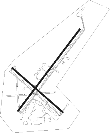
Runway info
Runway 5 / 23  | ||
| length | 3723m (12215ft) | |
| bearing | 47° / 227° | |
| width | 61m (200ft) | |
| surface | asphalt | |
| blast zone | 255m (837ft) / 255m (837ft) | |
| Runway 14 / 32 | ||
| length | 2441m (8009ft) | |
| bearing | 131° / 311° | |
| width | 61m (200ft) | |
| surface | asphalt | |
| blast zone | 65m (213ft) / 59m (194ft) | |
Nearby beacons
| code | identifier | dist | bearing | frequency |
|---|---|---|---|---|
| NBC | BEAUFORT TACAN | 0.1 | 129° | 110.50 |
| SAV | SAVANNAH VORTAC | 31.5 | 235° | 115.95 |
| SV | WASSA (SAVANNAH) NDB | 31.6 | 209° | 335 |
| SVN | HUNTER (SAVANNAH) VOR/DME | 35.3 | 222° | 111.60 |
| DYB | DORCHESTER COUNTY(SUMMERVILLE) NDB | 41.4 | 37° | 365 |
| CHS | CHARLESTON VORTAC | 42.4 | 59° | 113.50 |
| ALD | ALLENDALE VOR | 43.1 | 313° | 116.70 |
| CH | ASHLY (CHARLESTON) NDB | 43.2 | 51° | 329 |
| JYL | SYLVANIA NDB | 45.4 | 281° | 245 |
| BZ | BULLO (STATESBORO) NDB | 48 | 266° | 407 |
| MOQ | MC INTOSH (HINESVILLE) NDB | 56 | 231° | 263 |
| VAN | VANCE VORTAC | 61.2 | 15° | 110.40 |
Instrument approach procedures
| runway | airway (heading) | route (dist, bearing) |
|---|---|---|
| RW05 | FULON (99°) | FULON 5000ft FOSSS (15mi, 127°) 2800ft |
| RNAV | FOSSS 2800ft GAYLR (5mi, 61°) 1300ft KNBC (5mi, 47°) 75ft (4936mi, 112°) 437ft HOWEL (4930mi, 292°) 3000ft HOWEL (turn) | |
| RW14 | FARRL (129°) | FARRL 2800ft |
| RW14 | KASKE (177°) | KASKE 4000ft FARRL (10mi, 224°) 2800ft |
| RW14 | SAV (55°) | SAV 4000ft FULON (24mi, 17°) 4000ft FARRL (12mi, 77°) 2800ft |
| RNAV | FARRL 2800ft DBLNC (6mi, 131°) 1000ft KNBC (4mi, 126°) 72ft (4936mi, 112°) 700ft MEECH (4920mi, 292°) 3000ft MEECH (turn) 6000ft | |
| RW23 | HOWEL (227°) | HOWEL 2800ft |
| RW23 | KASKE (177°) | KASKE 4000ft HOWEL (10mi, 127°) 2800ft |
| RW23 | MEECH (271°) | MEECH 4000ft HOWEL (12mi, 307°) 2800ft |
| RNAV | HOWEL 2800ft PAAPY (6mi, 227°) 1000ft KNBC (4mi, 226°) 56ft (4936mi, 112°) 380ft ATBUY (4940mi, 292°) 3000ft ATBUY (turn) 6000ft | |
| RW32 | MEECH (271°) | MEECH 4000ft BAURR (11mi, 230°) 3000ft |
| RW32 | SAV (55°) | SAV 4000ft MUZAK (25mi, 80°) 4000ft BAURR (10mi, 49°) 3000ft |
| RNAV | BAURR 3000ft DNAHU (7mi, 311°) 1100ft KNBC (4mi, 315°) 64ft (4936mi, 112°) 437ft FARRL (4943mi, 292°) 3000ft FARRL (turn) 4200ft |
Disclaimer
The information on this website is not for real aviation. Use this data with the X-Plane flight simulator only! Data taken with kind consent from X-Plane 12 source code and data files. Content is subject to change without notice.