Lakehurst - Lakehurst Maxfield Fld
Airport details
| Country | United States of America |
| State | New Jersey |
| Region | K6 |
| Airspace | New York Ctr |
| Municipality | Jackson Township |
| Elevation | 103ft (31m) |
| Timezone | GMT -5 |
| Coordinates | 40.03578, -74.35137 |
| Magnetic var | |
| Type | land |
| Available since | X-Plane v10.40 |
| ICAO code | KNEL |
| IATA code | NEL |
| FAA code | NEL |
Communication
| Lakehurst Maxfield Fld Ground Control | 118.375 |
| Lakehurst Maxfield Fld Tower | 127.775 |
| Lakehurst Maxfield Fld MC GUIRE Approach/Departure | 124.150 |
Nearby Points of Interest:
Hangar No. 1, Lakehurst Naval Air Station
-Ocean County Courthouse
-Upper Freehold Baptist Meeting
-Clarksburg School
-Clarksburg Methodist Episcopal Church
-Orient Baptist Church
-Salter's Mill
-Roosevelt
-Zurbrugg Mansion
-Hankinson-Moreau-Covenhoven House
-Old Upper Springfield Friends Burying Ground
-Court Street School
-Church Street School
-Bay Head Historic District
-U.S. Life Saving Station No. 14
-Manasquan Friends Meetinghouse and Burying Ground
-Glimmer Glass Bridge
-Cedar Bridge Tavern
-Morris Mansion and Mill
-Arney's Mount Friends Meetinghouse and Burial Ground
-Frederic A. Duggan First Aid and Emergency Squad Building
-Probasco-Dittner Farmstead
-Martin Maloney Cottage
-Audenried Cottage
-Point Breeze
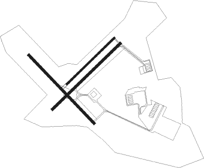
Runway info
Runway 15 / 33  | ||
| length | 1524m (5000ft) | |
| bearing | 133° / 313° | |
| width | 46m (150ft) | |
| surface | asphalt | |
| blast zone | 61m (200ft) / 61m (200ft) | |
| Runway 6L / 24R | ||
| length | 1068m (3504ft) | |
| bearing | 58° / 238° | |
| width | 27m (90ft) | |
| surface | concrete | |
| blast zone | 0m (0ft) / 35m (115ft) | |
| Runway 6 / 24 | ||
| length | 1526m (5007ft) | |
| bearing | 58° / 238° | |
| width | 46m (150ft) | |
| surface | asphalt | |
| blast zone | 76m (249ft) / 61m (200ft) | |
Nearby beacons
| code | identifier | dist | bearing | frequency |
|---|---|---|---|---|
| NEL | LAKEHURST TACAN | 0.1 | 304° | 111.80 |
| NEL | LAKEHURST NDB | 0.9 | 60° | 396 |
| GXU | MC GUIRE (WRIGHTSTOWN) VORTAC | 11.3 | 264° | 110.60 |
| RBV | ROBBINSVILLE VORTAC | 11.9 | 319° | 113.80 |
| CYN | COYLE VORTAC | 13.6 | 200° | 113.40 |
| COL | COLTS NECK VOR/DME | 18.7 | 35° | 115.40 |
| ARD | YARDLEY VOR/DME | 28.6 | 291° | 108.20 |
| ACY | ATLANTIC CITY VORTAC | 36.3 | 201° | 108.60 |
| SBJ | SOLBERG VOR/DME | 37.4 | 324° | 112.90 |
| CRI | CANARSIE VOR/DME | 40.4 | 38° | 112.30 |
| VCN | CEDAR LAKE (MILLVILLE) VOR/DME | 41.2 | 231° | 115.20 |
| CAT | CHATHAM NDB | 42.4 | 354° | 254 |
| ING | AMBLER NDB | 43.2 | 276° | 275 |
| JFK | KENNEDY (NEW YORK) VOR/DME | 44.6 | 44° | 115.90 |
| TE | TORBY (TETERBORO) NDB | 47.2 | 16° | 214 |
| LGA | LA GUARDIA (NEW YORK) VOR/DME | 50 | 33° | 113.10 |
| OOD | WOODSTOWN VORTAC | 50 | 247° | 112.80 |
| TEB | TETERBORO VOR/DME | 50.5 | 20° | 108.40 |
| BWZ | BROADWAY (SCHOOLEY'S MT) VOR/DME | 50.6 | 328° | 114.20 |
| MM | MOREE (MORRISTOWN) NDB | 50.7 | 1° | 392 |
| RNB | RAINBOW (MILLVILLE) NDB | 51.8 | 232° | 363 |
| FR | FRIKK (FARMINGDALE) NDB | 59.6 | 50° | 407 |
| SIE | SEA ISLE VORTAC | 60.1 | 206° | 114.80 |
| STW | STILLWATER VOR/DME | 62.3 | 332° | 109.60 |
Departure and arrival routes
| Transition altitude | 18000ft |
| Transition level | 18000ft |
| STAR starting points | distance | inbound heading | |
|---|---|---|---|
| ALL | |||
| WAALK2 | 54.5 | 13° | |
Instrument approach procedures
| runway | airway (heading) | route (dist, bearing) |
|---|---|---|
| RW24 | AGENE (265°) | AGENE 2000ft JAPDU (8mi, 313°) 2000ft |
| RW24 | CYN (20°) | CYN 2000ft JAPDU (25mi, 40°) 2000ft JAPDU (turn) 2000ft |
| RW24 | ECCOR (203°) | ECCOR 2000ft JAPDU (8mi, 133°) 2000ft |
| RW24 | RBV (139°) | RBV 2000ft JAPDU (16mi, 96°) 2000ft JAPDU (turn) 2000ft |
| RNAV | JAPDU 2000ft HORBO (6mi, 238°) 2000ft RAMEE (3mi, 238°) 1100ft KNEL (3mi, 238°) 152ft (4689mi, 118°) 700ft JAPDU (4681mi, 298°) 2000ft JAPDU (turn) 4100ft | |
| RW33 | CAGON (352°) | CAGON 2000ft IMULE (8mi, 58°) 2000ft |
| RW33 | CYN (20°) | CYN 2000ft IMULE (12mi, 76°) 2000ft IMULE (turn) 2000ft |
| RW33 | GEMGE (285°) | GEMGE 2000ft IMULE (8mi, 238°) 2000ft |
| RW33 | RBV (139°) | RBV 2000ft IMULE (24mi, 137°) 2000ft IMULE (turn) 2000ft |
| RNAV | IMULE 2000ft HIMDA (6mi, 313°) 2000ft KNEL (6mi, 315°) 139ft (4689mi, 118°) 700ft IMULE (4680mi, 298°) 2000ft IMULE (turn) 4100ft |
Holding patterns
| STAR name | hold at | type | turn | heading* | altitude | leg | speed limit |
|---|---|---|---|---|---|---|---|
| WAALK2 | BUKYY | VHF | right | 248 (68)° | DME 10.0mi | ICAO rules | |
| WAALK2 | JAYBO | VHF | right | 267 (87)° | DME 8.0mi | ICAO rules | |
| WAALK2 | WAALK | VHF | right | 219 (39)° | DME 7.0mi | ICAO rules | |
| *) magnetic outbound (inbound) holding course | |||||||
Disclaimer
The information on this website is not for real aviation. Use this data with the X-Plane flight simulator only! Data taken with kind consent from X-Plane 12 source code and data files. Content is subject to change without notice.