Summerdale - Summerdale Nolf
Airport details
| Country | United States of America |
| State | Alabama |
| Region | |
| Airspace | Jacksonville Ctr |
| Municipality | Baldwin County |
| Elevation | 147ft (45m) |
| Timezone | GMT -6 |
| Coordinates | 30.50587, -87.65134 |
| Magnetic var | |
| Type | land |
| Available since | X-Plane v10.40 |
| ICAO code | KNFD |
| IATA code | n/a |
| FAA code | NFD |
Communication
Nearby Points of Interest:
Foley Downtown Historic District
-St. Patrick's Catholic Church
-St. Paul's Episcopal Church
-Sunnyside Hotel
-Governor's Club
-Lebanon Chapel AME Church
-Tolstoy Park
-Street House
-United States Post Office
-Twin Beach AME Church
-Montrose Historic District
-Methodist Episcopal Church, South (Daphne, Alabama)
-Pensacola Naval Air Station Historic District
-Mobile-Tensaw River Delta
-Martin Lindsey House
-North Hill Preservation District
-Brisk & Jacobson Store
-Charles William Jones House
-Pincus Building
-Miller-O'Donnell House
-Coley Building
-First National Bank
-Emanuel Building
-James House
-Crystal Ice Company Building
Runway info
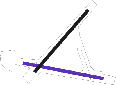
Runway 5 / 23  | ||
| length | 1217m (3993ft) | |
| bearing | 50° / 230° | |
| width | 50m (164ft) | |
| surface | asphalt | |
| blast zone | 153m (502ft) / 156m (512ft) | |
| Runway 11 / 29 | ||
| length | 1216m (3990ft) | |
| bearing | 103° / 283° | |
| width | 50m (164ft) | |
| surface | asphalt | |
| blast zone | 152m (499ft) / 157m (515ft) | |
Nearby beacons
| code | identifier | dist | bearing | frequency |
|---|---|---|---|---|
| NUN | SAUFLEY (PENSACOLA) VOR | 16.4 | 96° | 108.80 |
| NPA | PENSACOLA TACAN | 19.4 | 114° | 117.20 |
| BFM | BROOKLEY (MOBILE) VORTAC | 21.8 | 285° | 112.80 |
| PKZ | PICKENS (PENSACOLA) NDB | 24.8 | 98° | 326 |
| NSE | WHITING (MILTON) TACAN | 35.2 | 71° | 112.30 |
| MOB | WISLE (MOBILE) NDB | 36.9 | 291° | 248 |
| NGS | SANTA ROSA (MILTON) TACAN | 37.5 | 81° | 133.60 |
| SJI | SEMMES (MOBILE) VORTAC | 38.9 | 287° | 115.30 |
| HRT | HURLBURT (MARY ESTHER) TACAN | 49.9 | 95° | 110.80 |
| CEW | CRESTVIEW VORTAC | 53.7 | 72° | 115.90 |
| GCV | GREENE CO. (LEAKESVILLE) VORTAC | 55.8 | 305° | 115.70 |
| MVC | MONROEVILLE VORTAC | 59.2 | 17° | 116.80 |
Disclaimer
The information on this website is not for real aviation. Use this data with the X-Plane flight simulator only! Data taken with kind consent from X-Plane 12 source code and data files. Content is subject to change without notice.