Fallon - Fallon Nas
Airport details
| Country | United States of America |
| State | Nevada |
| Region | K2 |
| Airspace | Oakland Ctr |
| Municipality | Churchill County |
| Elevation | 3934ft (1199m) |
| Timezone | GMT -8 |
| Coordinates | 39.41783, -118.69859 |
| Magnetic var | |
| Type | land |
| Available since | X-Plane v10.40 |
| ICAO code | KNFL |
| IATA code | NFL |
| FAA code | NFL |
Communication
| Fallon NAS AWOS | 118.250 |
| Fallon NAS NAVY FALLON Tower | 119.250 |
| Fallon NAS NAVY FALLON Approach/Departure | 120.850 |
Nearby Points of Interest:
Harmon School
-Oats Park Grammar School
-Holy Trinity Episcopal Church (Fallon, Nevada)
-Maine Street Historic District
-Robert L. Douglass House
-Fallon City Hall
-Churchill County Jail
-Federal Building and Post Office
-Churchill County Courthouse
-Hazen Store
-Wadsworth Union Church
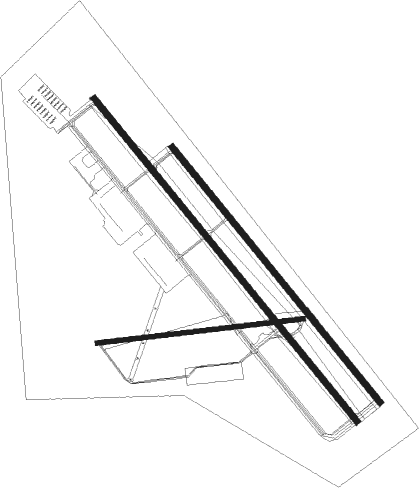
Runway info
Runway 13R / 31L  | ||
| length | 4272m (14016ft) | |
| bearing | 138° / 318° | |
| width | 61m (201ft) | |
| surface | asphalt | |
| blast zone | 255m (837ft) / 255m (837ft) | |
| Runway 13L / 31R | ||
| length | 3380m (11089ft) | |
| bearing | 138° / 318° | |
| width | 61m (200ft) | |
| surface | concrete | |
| blast zone | 255m (837ft) / 255m (837ft) | |
| Runway 7 / 25 | ||
| length | 2130m (6988ft) | |
| bearing | 88° / 268° | |
| width | 47m (154ft) | |
| surface | asphalt | |
| blast zone | 244m (801ft) / 152m (499ft) | |
Nearby beacons
| code | identifier | dist | bearing | frequency |
|---|---|---|---|---|
| NFL | FALLON TACAN | 0.3 | 262° | 113.50 |
| HZN | HAZEN VORTAC | 15 | 288° | 114.10 |
| LLC | LOVELOCK VORTAC | 42.8 | 10° | 116.50 |
| FMG | MUSTANG (RENO) VORTAC | 44.9 | 277° | 117.90 |
| MVA | MINA VORTAC | 59.8 | 142° | 115.10 |
Departure and arrival routes
| Transition altitude | 18000ft |
| Transition level | 18000ft |
| SID end points | distance | outbound heading | |
|---|---|---|---|
| RW07 | |||
| WATER7 | 43mi | 10° | |
| YERIN7 | 29mi | 211° | |
| RW13 (ALL) | |||
| WATER7 | 43mi | 10° | |
| YERIN7 | 29mi | 211° | |
| RW25 | |||
| WATER7 | 43mi | 10° | |
| YERIN7 | 29mi | 211° | |
| RW31 (ALL) | |||
| WATER7 | 43mi | 10° | |
| YERIN7 | 29mi | 211° | |
Instrument approach procedures
| runway | airway (heading) | route (dist, bearing) |
|---|---|---|
| RW13R | BIKZE (138°) | BIKZE 9800ft BIKZE (turn) 6600ft |
| RW13R | HZN (108°) | HZN 7200ft BIKZE (8mi, 67°) 6600ft |
| RNAV | BIKZE 6600ft JENGU (6mi, 138°) 5400ft FEGAB (2mi, 138°) 4620ft KNFL (3mi, 138°) 3985ft (6713mi, 108°) 4300ft HOROD (6707mi, 288°) 9800ft HOROD (turn) 12800ft | |
| RW31L | MVA (322°) | MVA 9800ft HOROD (38mi, 324°) 9800ft OCERI (5mi, 318°) 8100ft JUMLA (4mi, 318°) 7300ft |
| RW31L | PRIMI (349°) | PRIMI 9800ft HOROD (29mi, 13°) 9800ft OCERI (5mi, 318°) 8100ft JUMLA (4mi, 318°) 7300ft |
| RNAV | JUMLA 7300ft WINED (5mi, 318°) 6100ft ZIPUG (3mi, 318°) 4980ft KNFL (4mi, 318°) 3982ft (6713mi, 108°) 4206ft BIKZE (6716mi, 288°) 6600ft BIKZE (turn) 9000ft |
Disclaimer
The information on this website is not for real aviation. Use this data with the X-Plane flight simulator only! Data taken with kind consent from X-Plane 12 source code and data files. Content is subject to change without notice.