Berclair - Goliad Naval Outlying Field
Airport details
| Country | United States of America |
| State | Texas |
| Region | K4 |
| Airspace | Houston Oceanic Ctr |
| Municipality | Goliad County |
| Elevation | 320ft (98m) |
| Timezone | GMT -6 |
| Coordinates | 28.61783, -97.61781 |
| Magnetic var | |
| Type | land |
| Available since | X-Plane v10.40 |
| ICAO code | KNGT |
| IATA code | n/a |
| FAA code | KNGT |
Communication
| Goliad Naval Outlying Field CTAF | 132.875 |
Nearby Points of Interest:
Dr. L.W. and Martha E.S. Chilton House
-Mission Nuestra Señora del Espíritu Santo de Zúñiga
-J. T. Jecker House
-Breeden-Runge Wholesale Grocery Company Building
-Cuero Commercial Historic District
-Terrell-Reuss Streets Historic District
-Mrs. J. V. Murphy House
-Barden-O'Connor House
-Old Nazareth Academy
-Thomas M. O'Connor House
-J. V. Vandenberge House
-D. H. Regan House
-Fossati's Delicatessen
-Randall Building
-Keef-Filley Building
-Little House (Victoria, Texas)
-Jules Leffland House
-DeLeon Plaza and Bandstand
-Proctor House
-Pickering House (Victoria, Texas)
-Burrough-Daniel House
-George H. Hauschild Building
-Victoria Colored School
-Trinity Lutheran Church
-William Wheeler House
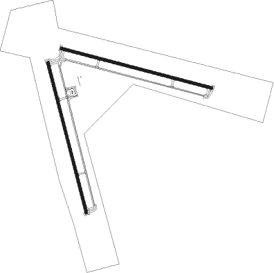
Runway info
Runway 11 / 29  | ||
| length | 2447m (8028ft) | |
| bearing | 107° / 287° | |
| width | 46m (150ft) | |
| surface | concrete | |
| blast zone | 39m (128ft) / 35m (115ft) | |
| Runway 17 / 35 | ||
| length | 2449m (8035ft) | |
| bearing | 169° / 349° | |
| width | 46m (150ft) | |
| surface | asphalt | |
| displ threshold | 0m (0ft) / 2m (7ft) | |
| blast zone | 44m (144ft) / 41m (135ft) | |
Nearby beacons
| code | identifier | dist | bearing | frequency |
|---|---|---|---|---|
| THX | THREE RIVERS VORTAC | 28.9 | 258° | 111.40 |
| VCT | VICTORIA VOR/DME | 37.6 | 66° | 109 |
| CRP | CORPUS CHRISTI VORTAC | 43.8 | 166° | 115.50 |
| NOG | ORANGE GROVE TACAN | 48.8 | 210° | 133.60 |
| ALI | ALICE VOR | 56.8 | 205° | 114.50 |
| SSF | STINSON (SAN ANTONIO) VOR | 57.9 | 308° | 108.40 |
| NGP | TRUAX (CORPUS CHRISTI) TACAN | 58.5 | 161° | 114 |
| RND | RANDOLPH VORTAC | 64.4 | 323° | 112.30 |
| DHK | RANDOLPH TACAN | 64.8 | 325° | 109.90 |
| KSY | KELLY (SAN ANTONIO) TACAN | 68.6 | 309° | 112 |
Instrument approach procedures
| runway | airway (heading) | route (dist, bearing) |
|---|---|---|
| RW11 | RFNEK (107°) | RFNEK 4000ft |
| RW11 | THX (78°) | THX 4000ft WZOWL (15mi, 79°) 4000ft RFNEK (8mi, 21°) 4000ft |
| RW11 | VCT (246°) | VCT 4000ft JONSR (42mi, 264°) 4000ft RFNEK (8mi, 201°) 4000ft |
| RNAV | RFNEK 4000ft MCBRD (6mi, 107°) 2200ft KNGT (6mi, 108°) 372ft (5807mi, 106°) 720ft SWEEN (5794mi, 286°) 4000ft SWEEN (turn) 8000ft | |
| RW17 | AHUGE (168°) | AHUGE 4000ft |
| RW17 | THX (78°) | THX 4000ft MALEA (25mi, 51°) 4000ft AHUGE (8mi, 81°) 4000ft |
| RW17 | VCT (246°) | VCT 4000ft MAAAX (28mi, 263°) 4000ft AHUGE (8mi, 261°) 4000ft |
| RNAV | AHUGE 4000ft SIIZE (6mi, 169°) 2200ft KNGT (6mi, 167°) 376ft (5807mi, 106°) 900ft SWEEN (5794mi, 286°) 4000ft SWEEN (turn) 8000ft | |
| RW29 | SWEEN (287°) | SWEEN 4000ft |
| RW29 | THX (78°) | THX 4000ft TEMKN (38mi, 98°) 4000ft SWEEN (9mi, 22°) 4000ft |
| RW29 | VCT (246°) | VCT 4000ft SOWLS (23mi, 237°) 4000ft SWEEN (8mi, 202°) 4000ft |
| RNAV | SWEEN 4000ft BOMRS (6mi, 287°) 2200ft KNGT (7mi, 286°) 318ft (5807mi, 106°) 900ft SWEEN (5794mi, 286°) 4000ft SWEEN (turn) 8000ft | |
| RW35 | THX (78°) | THX 4000ft JAYNO (31mi, 100°) 4000ft JAYNO (turn) 4000ft |
| RW35 | VCT (246°) | VCT 4000ft OLSKI (37mi, 224°) 4000ft JAYNO (8mi, 261°) 4000ft |
| RNAV | JAYNO 4000ft COMNS (6mi, 349°) 2200ft STGRY (3mi, 349°) 1300ft KNGT (4mi, 351°) 351ft (5807mi, 106°) 900ft SWEEN (5794mi, 286°) 4000ft SWEEN (turn) 8000ft |
Disclaimer
The information on this website is not for real aviation. Use this data with the X-Plane flight simulator only! Data taken with kind consent from X-Plane 12 source code and data files. Content is subject to change without notice.