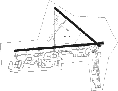
Jacksonville - Jacksonville Nas
Airport details
| Country | United States of America |
| State | Florida |
| Region | K7 |
| Airspace | Jacksonville Ctr |
| Municipality | Jacksonville |
| Elevation | 20ft (6m) |
| Timezone | GMT -5 |
| Coordinates | 30.22822, -81.66546 |
| Magnetic var | |
| Type | land |
| Available since | X-Plane v10.40 |
| ICAO code | KNIP |
| IATA code | NIP |
| FAA code | NIP |
Communication
| Jacksonville NAS Clearence Delivery | 134.775 |
| Jacksonville NAS Navy Jacksonville Ground | 128.600 |
| Jacksonville NAS Navy Jacksonville Tower | 125.150 |
| Jacksonville NAS Jacksonville Approach/Departure | 127.775 |
Nearby Points of Interest:
Red Bank Plantation
-River Road Historic District
-William Helffrich House
-Mandarin Store and Post Office
-Winterbourne
-Orange Park Negro Elementary School
-Joseph Green House
-Lane-Towers House
-Maple Leaf
-William Clarke Estate
-William Westcott House
-South Jacksonville Grammar School
-Jacksonville Fire Museum
-Dyal-Upchurch Building
-Hutchinson-Suddath Building
-Title & Trust Company of Florida Building
-11 East Forsyth
-El Modelo Block
-Jacksonville Public Library
-Schultz Building
-Prime F. Osborn III Convention Center
-Morocco Temple
-Elks Club Building
-W. A. Knight Building
-The Carling
Runway info
Nearby beacons
| code | identifier | dist | bearing | frequency |
|---|---|---|---|---|
| NIP | JACKSONVILLE TACAN | 0.6 | 305° | 108.20 |
| CRG | CRAIG (JACKSONVILLE) VORTAC | 10.4 | 55° | 114.50 |
| NZC | CECIL TACAN | 10.6 | 268° | 114.10 |
| RYD | REYNOLDS (GREEN COVE SPRINGS) NDB | 15.6 | 178° | 338 |
| JA | DINNS (JACKSONVILLE) NDB | 15.8 | 330° | 344 |
| NRB | MAYPORT TACAN | 15.8 | 57° | 111.40 |
| SGJ | SAINT AUGUSTINE VOR/DME | 23.8 | 129° | 109.40 |
| GN | WYNDS (GAINESVILLE) NDB | 42.6 | 222° | 269 |
| GNV | GATORS VORTAC | 45.1 | 229° | 116.20 |
| LCQ | LAKE CITY NDB | 47.4 | 267° | 204 |
| TAY | TAYLOR VORTAC | 48.8 | 287° | 112.90 |
| SSI | BRUNSWICK (ST SIMONS I) VORTAC | 50.6 | 15° | 109.80 |
| OMN | ORMOND BEACH VORTAC | 62.5 | 149° | 112.60 |
Departure and arrival routes
| Transition altitude | 18000ft |
| Transition level | 18000ft |
| STAR starting points | distance | inbound heading | |
|---|---|---|---|
| ALL | |||
| AMG2 | 89.7 | 147° | |
| HOTAR1 | 45.9 | 224° | |
| POGIE2 | 102.6 | 349° | |
Instrument approach procedures
| runway | airway (heading) | route (dist, bearing) |
|---|---|---|
| RW10-Y | MADEN (9°) | MADEN 1600ft ITEGE (6mi, 327°) 1600ft |
| RNAV | ITEGE 1600ft CIROT (3mi, 329°) 1600ft BUMPH (4mi, 6°) 1500ft APUPE (1mi, 67°) 1027ft KNIP (4mi, 92°) 72ft (4973mi, 110°) 600ft MADEN (4974mi, 290°) 2000ft MADEN (turn) 6000ft | |
| RW10-Z | GNV (49°) | GNV 3000ft FRESH (29mi, 26°) 3000ft HOWLR (8mi, 45°) 3000ft |
| RW10-Z | MONIA (123°) | MONIA 3000ft REDIE (10mi, 181°) 3000ft HOWLR (7mi, 135°) 3000ft |
| RNAV | HOWLR 3000ft HUTNO (5mi, 90°) 3000ft IVANZ (5mi, 90°) 1400ft KNIP (5mi, 92°) 72ft (4973mi, 110°) 600ft MADEN (4974mi, 290°) 2000ft MADEN (turn) 6000ft | |
| RW28-Y | DUWOT (269°) | DUWOT 1600ft |
| RW28-Y | JETSO (300°) | JETSO DUWOT (27mi, 312°) 1600ft |
| RW28-Y | SUBER (248°) | SUBER DUWOT (23mi, 238°) 1600ft |
| RNAV | DUWOT 1600ft DONNO (5mi, 270°) 1600ft KNIP (5mi, 268°) 68ft (4973mi, 110°) 600ft ITEGE (4977mi, 290°) MADEN (6mi, 147°) 2000ft MADEN (turn) 6000ft | |
| RW28-Z | DUWOT (269°) | DUWOT 1600ft |
| RW28-Z | JETSO (300°) | JETSO DUWOT (27mi, 312°) 1600ft |
| RW28-Z | SUBER (248°) | SUBER DUWOT (23mi, 238°) 1600ft |
| RNAV | DUWOT 1600ft DONNO (5mi, 270°) 1600ft DUBTE (3mi, 270°) 800ft KNIP (2mi, 265°) 68ft (4973mi, 110°) 600ft ITEGE (4977mi, 290°) MADEN (6mi, 147°) 2000ft MADEN (turn) 6000ft |
Holding patterns
| STAR name | hold at | type | turn | heading* | altitude | leg | speed limit |
|---|---|---|---|---|---|---|---|
| POGIE2 | SHINR | VHF | right | 175 (355)° | DME 8.0mi | ICAO rules | |
| *) magnetic outbound (inbound) holding course | |||||||
Disclaimer
The information on this website is not for real aviation. Use this data with the X-Plane flight simulator only! Data taken with kind consent from X-Plane 12 source code and data files. Content is subject to change without notice.

