Meridian - Joe Williams Nolf
Airport details
| Country | United States of America |
| State | Mississippi |
| Region | K7 |
| Airspace | Memphis Ctr |
| Municipality | Kemper County |
| Elevation | 540ft (165m) |
| Timezone | GMT -6 |
| Coordinates | 32.79893, -88.83453 |
| Magnetic var | |
| Type | land |
| Available since | X-Plane v10.40 |
| ICAO code | KNJW |
| IATA code | n/a |
| FAA code | NJW |
Communication
| Joe Williams Nolf BRAVO Tower | 118.475 |
Nearby Points of Interest:
Old US Post Office
-Downtown Philadelphia Historic District
-Porterville General Store
-Yates-Flora House
-Goodwin-Harrison House
-Merrehope
-Masonic Temple
-Elson-Dudley House
-Porter-Crawford House
-Cahn-Crawford House
-United States Post Office and Courthouse
-Temple Theatre
-Dement Printing Company
-Threefoot Building
-Meridian City Hall
-Standard Drug Company
-Meridian Regional Airport
-Oakhurst (Emelle, Alabama)
-Dr. James Alvis Beavers House
-Stuckey's Bridge
-Newton station
-Gibbs House
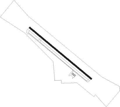
Runway info
| Runway 13 / 31 | ||
| length | 2441m (8009ft) | |
| bearing | 129° / 309° | |
| width | 46m (150ft) | |
| surface | concrete | |
| displ threshold | 86m (282ft) / 94m (308ft) | |
| blast zone | 255m (837ft) / 59m (194ft) | |
Nearby beacons
| code | identifier | dist | bearing | frequency |
|---|---|---|---|---|
| NMM | MERIDIAN TACAN | 19.7 | 127° | 111.90 |
| MEI | MERIDIAN VORTAC | 25.2 | 176° | 117 |
| EWA | DME | 32.1 | 139° | 113.80 |
| IGB | BIGBEE (COLUMBUS) VORTAC | 44.2 | 25° | 116.20 |
| CBM | CALEDONIA (COLUMBUS) VORTAC | 54.3 | 25° | 115.20 |
Disclaimer
The information on this website is not for real aviation. Use this data with the X-Plane flight simulator only! Data taken with kind consent from X-Plane 12 source code and data files. Content is subject to change without notice.