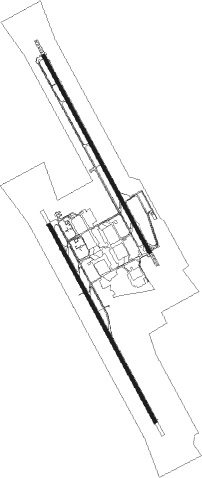
Lemoore - Lemoore Nas
Airport details
| Country | United States of America |
| State | California |
| Region | K2 |
| Airspace | Oakland Ctr |
| Municipality | Kings County |
| Elevation | 232ft (71m) |
| Timezone | GMT -8 |
| Coordinates | 36.33313, -119.95216 |
| Magnetic var | |
| Type | land |
| Available since | X-Plane v10.40 |
| ICAO code | KNLC |
| IATA code | NLC |
| FAA code | NLC |
Communication
| Lemoore NAS ATIS | 121.575 |
| Lemoore NAS Clearance Delivery | 124.100 |
| Lemoore NAS Ground Control | 121.650 |
| Lemoore NAS Tower | 128.300 |
Nearby Points of Interest:
Kings County Courthouse
-Taoist Temple (Hanford, California)
-Fowler
-Fresno Municipal Sanitary Landfill
-Southern Pacific Depot
-San Joaquin Light and Power Corporation Building
-Bank of Italy
-Fresno Bee Building
-Einstein House
-The Pioneer
-US Post Office-Visalia Town Center Station
-Hyde House (Visalia, California)
Nearby beacons
| code | identifier | dist | bearing | frequency |
|---|---|---|---|---|
| NLC | NAVY LEMOORE TACAN | 0.9 | 308° | 113.30 |
| VIS | VISALIA VOR/DME | 22.8 | 86° | 109.40 |
| CZQ | CLOVIS (FRESNO) VORTAC | 33.7 | 14° | 112.90 |
| AVE | AVENAL VOR/DME | 41.2 | 182° | 117.10 |
| PXN | PANOCHE VORTAC | 46 | 295° | 112.60 |
| FRA | FRIANT VORTAC | 49.4 | 25° | 115.60 |
| PRB | PASO ROBLES VORTAC | 51.4 | 226° | 114.30 |
| TTE | TULE VOR/DME | 51.7 | 114° | 109.20 |
| HYP | EL NIDO (MERCED) VOR/DME | 57.4 | 333° | 114.20 |
| EHF | SHAFTER (BAKERSFIELD) VORTAC | 65.7 | 135° | 115.40 |
Instrument approach procedures
| runway | airway (heading) | route (dist, bearing) |
|---|---|---|
| RW14L | CIVUN (153°) | CIVUN 1800ft |
| RW14L | NAVRE (130°) | NAVRE 1800ft CIVUN (8mi, 93°) 1800ft |
| RNAV | CIVUN 1800ft NAKLE (7mi, 151°) 1800ft KNLC (7mi, 155°) 271ft (6830mi, 107°) 1200ft STRAT (6822mi, 287°) 2000ft STRAT (turn) 4000ft | |
| RW14R | HELMM (149°) | HELMM 2800ft |
| RW14R | NAVRE (130°) | NAVRE 2800ft HELMM (7mi, 96°) 2800ft |
| RNAV | HELMM 2800ft MIKSE (6mi, 151°) 2800ft KNLC (8mi, 148°) 279ft (6830mi, 107°) 1200ft PHROG (6829mi, 287°) 2000ft PHROG (turn) 4000ft | |
| RW32L | LEGDE (313°) | LEGDE 1800ft PHROG (8mi, 279°) 1800ft |
| RW32L | PHROG (333°) | PHROG 1800ft |
| RNAV | PHROG 1800ft LERNE (8mi, 332°) 1800ft KNLC (7mi, 335°) 275ft (6830mi, 107°) 1000ft CREEZ (6839mi, 287°) 3100ft CREEZ (turn) 4000ft | |
| RW32R | LEGDE (313°) | LEGDE 2800ft SILUE (6mi, 273°) 2800ft |
| RW32R | SILUE (330°) | SILUE 2800ft |
| RNAV | SILUE 2800ft CILUN (8mi, 331°) 2800ft OYISU (3mi, 331°) 800ft KNLC (5mi, 327°) 266ft (6830mi, 107°) 1200ft HAYEN (6826mi, 287°) 2000ft HAYEN (turn) 4000ft |
Disclaimer
The information on this website is not for real aviation. Use this data with the X-Plane flight simulator only! Data taken with kind consent from X-Plane 12 source code and data files. Content is subject to change without notice.

