New York - Brooklyn Cgas - Floyd Bennett Field
Airport details
| Country | United States of America |
| State | New York |
| Region | |
| Airspace | New York Ctr |
| Elevation | 16ft (5m) |
| Timezone | GMT -5 |
| Coordinates | 40.59340, -73.89893 |
| Magnetic var | |
| Type | land |
| Available since | X-Plane v10.40 |
| ICAO code | KNOP |
| IATA code | ONP |
| FAA code | n/a |
Communication
Nearby Points of Interest:
Hendrick I. Lott House
-Stoothoff-Baxter-Kouwenhaven House
-Beth El Jewish Center of Flatbush
-Joost Van Nuyse House
-Jackie Robinson House
-Hubbard House
-Ocean Parkway
-Congregation Beth Israel
-Ocean Parkway Jewish Center
-United States Post Office
-Flatbush Town Hall
-Coney Island Fire Station Pumping Station
-New York Congregational Home for the Aged
-Lefferts Manor Historic District
-Parkway Theatre
-Grecian Shelter
-Eastern Parkway
-75th Police Precinct Station House
-Weeksville Heritage Center
-Boathouse on the Lullwater of the Lake in Prospect Park
-Crown Heights North Historic District
-Kol Israel Synagogue
-Saitta House
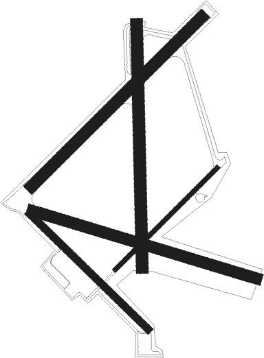
Runway info
Runway 12 / 30  | ||
| length | 1532m (5026ft) | |
| bearing | 106° / 286° | |
| width | 74m (242ft) | |
| surface | asphalt | |
| Runway 15 / 33 | ||
| length | 1084m (3556ft) | |
| bearing | 131° / 311° | |
| width | 50m (164ft) | |
| surface | asphalt | |
| Runway 1 / 19 | ||
| length | 1599m (5246ft) | |
| bearing | 4° / 184° | |
| width | 78m (256ft) | |
| surface | asphalt | |
| Runway 6R / 24L | ||
| length | 945m (3100ft) | |
| bearing | 57° / 237° | |
| width | 29m (94ft) | |
| surface | concrete | |
| Runway 6L / 24R | ||
| length | 1573m (5161ft) | |
| bearing | 57° / 237° | |
| width | 78m (256ft) | |
| surface | asphalt | |
Nearby beacons
| code | identifier | dist | bearing | frequency |
|---|---|---|---|---|
| CRI | CANARSIE VOR/DME | 1.1 | 13° | 112.30 |
| JFK | KENNEDY (NEW YORK) VOR/DME | 6.2 | 73° | 115.90 |
| LGA | LA GUARDIA (NEW YORK) VOR/DME | 11.5 | 9° | 113.10 |
| TE | TORBY (TETERBORO) NDB | 16.5 | 312° | 214 |
| TEB | TETERBORO VOR/DME | 17 | 327° | 108.40 |
| COL | COLTS NECK VOR/DME | 20.6 | 223° | 115.40 |
| FR | FRIKK (FARMINGDALE) NDB | 21.9 | 66° | 407 |
| CAT | CHATHAM NDB | 25.7 | 286° | 254 |
| MM | MOREE (MORRISTOWN) NDB | 26.2 | 303° | 392 |
| DPK | DEER PARK VOR/DME | 29.6 | 72° | 117.70 |
| RBV | ROBBINSVILLE VORTAC | 35.9 | 237° | 113.80 |
| SBJ | SOLBERG VOR/DME | 38.4 | 269° | 112.90 |
| NEL | LAKEHURST NDB | 38.5 | 219° | 396 |
| NEL | LAKEHURST TACAN | 39.3 | 219° | 111.80 |
| SAX | SPARTA VORTAC | 40.6 | 307° | 115.70 |
| CMK | CARMEL VOR/DME | 43.6 | 25° | 116.60 |
| BWZ | BROADWAY (SCHOOLEY'S MT) VOR/DME | 43.7 | 283° | 114.20 |
| GXU | MC GUIRE (WRIGHTSTOWN) VORTAC | 47.4 | 230° | 110.60 |
| BDR | BRIDGEPORT VOR/DME | 48.9 | 54° | 108.80 |
| STW | STILLWATER VOR/DME | 50.2 | 293° | 109.60 |
| CYN | COYLE VORTAC | 52.6 | 214° | 113.40 |
| SW | NEELY (NEWBURGH) NDB | 55.6 | 340° | 335 |
| SKU | STANWYCK (NEWBURGH) NDB | 56.5 | 351° | 261 |
| HUO | HUGUENOT VOR/DME | 58.2 | 320° | 116.10 |
Disclaimer
The information on this website is not for real aviation. Use this data with the X-Plane flight simulator only! Data taken with kind consent from X-Plane 12 source code and data files. Content is subject to change without notice.