Pensacola - Pensacola Nas
Airport details
| Country | United States of America |
| State | Florida |
| Region | K7 |
| Airspace | Jacksonville Ctr |
| Municipality | Escambia County |
| Elevation | 24ft (7m) |
| Timezone | GMT -6 |
| Coordinates | 30.35327, -87.31797 |
| Magnetic var | |
| Type | land |
| Available since | X-Plane v10.40 |
| ICAO code | KNPA |
| IATA code | NPA |
| FAA code | NPA |
Communication
| Pensacola NAS ATIS | 124.350 |
| Pensacola NAS SHERMAN Clearance DEL | 134.100 |
| Pensacola NAS SHERMAN Ground Control | 121.700 |
| Pensacola NAS SHERMAN Tower | 120.700 |
| Pensacola NAS Approach | 120.050 |
| Pensacola NAS Approach | 120.650 |
| Pensacola NAS Departure | 120.650 |
Approach frequencies
| ILS-cat-I | RW07L | 109.3 | 18.00mi |
| 3° GS | RW07L | 109.3 | 18.00mi |
Nearby Points of Interest:
Pensacola Naval Air Station Historic District
-United States Customs House and Post Office
-Charles William Jones House
-American National Bank Building
-Palafox Historic District
-Lavalle House
-L & N Marine Terminal Building
-Winston E. Arnow Federal Building
-North Hill Preservation District
-Thiesen Building
-Clara Barkley Dorr House
-Pensacola Historic District
-Louisville and Nashville Passenger Station and Express Building
-King-Hooton House
-First Christian Church
-Sacred Heart Catholic Church
-James House
-Crystal Ice Company Building
-Pensacola Hospital
-Archeological Properties of the Naval Live Oaks Reservation MPS
-John Edmunds Apartment House
-First American Road in Florida
-Naval Live Oaks Reservation
-Foley Downtown Historic District
-Arcadia Sawmill and Arcadia Cotton Mill
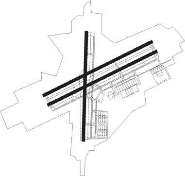
Runway info
Runway 7L / 25R  | ||
| length | 2436m (7992ft) | |
| bearing | 71° / 251° | |
| width | 61m (200ft) | |
| surface | asphalt | |
| blast zone | 255m (837ft) / 255m (837ft) | |
| Runway 7R / 25L | ||
| length | 2436m (7992ft) | |
| bearing | 71° / 251° | |
| width | 61m (200ft) | |
| surface | asphalt | |
| blast zone | 255m (837ft) / 255m (837ft) | |
| Runway 1 / 19 | ||
| length | 2182m (7159ft) | |
| bearing | 7° / 187° | |
| width | 61m (200ft) | |
| surface | asphalt | |
| blast zone | 255m (837ft) / 255m (837ft) | |
Nearby beacons
| code | identifier | dist | bearing | frequency |
|---|---|---|---|---|
| NPA | PENSACOLA TACAN | 0.2 | 17° | 117.20 |
| NUN | SAUFLEY (PENSACOLA) VOR | 7.1 | 351° | 108.80 |
| PKZ | PICKENS (PENSACOLA) NDB | 8.8 | 59° | 326 |
| NGS | SANTA ROSA (MILTON) TACAN | 25.2 | 55° | 133.60 |
| NSE | WHITING (MILTON) TACAN | 27.1 | 39° | 112.30 |
| HRT | HURLBURT (MARY ESTHER) TACAN | 32.8 | 83° | 110.80 |
| BFM | BROOKLEY (MOBILE) VORTAC | 41.2 | 289° | 112.80 |
| DWG | WARRINGTON (VALPARAISO) TACAN | 41.9 | 81° | 134.50 |
| CEW | CRESTVIEW VORTAC | 43.5 | 53° | 115.90 |
| CE | KOBRA (CRESTVIEW) NDB | 50.3 | 57° | 201 |
| MOB | WISLE (MOBILE) NDB | 56.5 | 292° | 248 |
| JUY | JUDD (ANDALUSIA) NDB | 74.5 | 44° | 264 |
Instrument approach procedures
| runway | airway (heading) | route (dist, bearing) |
|---|---|---|
| RW01 | GRANI (14°) | GRANI 1500ft GYRAL (4mi, 28°) 1500ft |
| RNAV | GYRAL 1500ft GEDAF (6mi, 7°) 1500ft KNPA (5mi, 9°) 83ft (5266mi, 109°) 800ft CUPER (5257mi, 289°) 1500ft CUPER (turn) 11000ft | |
| RW07L | FCTRY (30°) | FCTRY OBEMY (10mi, 337°) 1500ft |
| RNAV | OBEMY 1500ft ONOYA (4mi, 71°) 1500ft ODACA (2mi, 71°) 1500ft KNPA (5mi, 72°) 79ft (5266mi, 109°) 600ft CUPER (5257mi, 289°) 1500ft CUPER (turn) 11000ft | |
| RW07R | FCTRY (30°) | FCTRY FELTS (10mi, 341°) 1500ft |
| RNAV | FELTS 1500ft FATMA (5mi, 71°) 1500ft HUNET (3mi, 71°) 620ft KNPA (2mi, 70°) 79ft (5266mi, 109°) 800ft CUPER (5257mi, 289°) 1500ft CUPER (turn) 11000ft | |
| RW19 | HEMDI (179°) | HEMDI 1800ft |
| RNAV | HEMDI 1800ft WASIT (3mi, 173°) 1600ft HIKIB (2mi, 173°) 1500ft KNPA (5mi, 186°) 71ft (5266mi, 109°) 800ft FCTRY (5272mi, 289°) 1500ft FCTRY (turn) 11000ft | |
| RW25L | TEEZY (65°) | TEEZY 1500ft CUPER (28mi, 91°) POOVE (10mi, 29°) APUCE (7mi, 326°) 1500ft |
| RNAV | APUCE 1500ft ALOME (5mi, 251°) 1500ft KNPA (5mi, 251°) 68ft (5266mi, 109°) 800ft FCTRY (5272mi, 289°) 1500ft FCTRY (turn) 11000ft | |
| RW25R | TEEZY (65°) | TEEZY 1500ft CUPER (28mi, 91°) POOVE (10mi, 29°) CABMA (7mi, 325°) 1500ft |
| RNAV | CABMA 1500ft CASIK (5mi, 251°) 1500ft KNPA (5mi, 250°) 72ft (5266mi, 109°) 800ft FCTRY (5272mi, 289°) 1500ft FCTRY (turn) 11000ft |
Disclaimer
The information on this website is not for real aviation. Use this data with the X-Plane flight simulator only! Data taken with kind consent from X-Plane 12 source code and data files. Content is subject to change without notice.