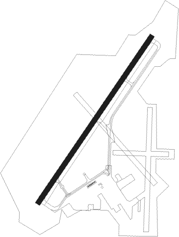
Millington - Millington Muni
Airport details
| Country | United States of America |
| State | Tennessee |
| Region | K7 |
| Airspace | Memphis Ctr |
| Municipality | Millington |
| Elevation | 318ft (97m) |
| Timezone | GMT -6 |
| Coordinates | 35.35664, -89.87041 |
| Magnetic var | |
| Type | land |
| Available since | X-Plane v10.40 |
| ICAO code | KNQA |
| IATA code | NQA |
| FAA code | NQA |
Communication
| Millington Muni AWOS 3 | 118.925 |
| Millington Muni CTAF | 120.250 |
| Millington Muni UNICOM | 122.950 |
| Millington Muni Ground Control | 121.375 |
| Millington Muni Tower | 120.250 |
| Millington Muni MEMPHIS Approach | 125.800 |
| Millington Muni MEMPHIS Approach | 126.700 |
| Millington Muni MEMPHIS Approach | 119.100 |
| Millington Muni MEMPHIS Approach | 120.075 |
| Millington Muni MEMPHIS Departure | 124.150 |
| Millington Muni MEMPHIS Departure | 124.650 |
Approach frequencies
| ILS-cat-I | RW22 | 109.75 | 18.00mi |
| 3° GS | RW22 | 109.75 | 18.00mi |
Nearby Points of Interest:
Nicholas Gotten House
-Davies Manor
-High Point Terrace
-Porter-Leath House
-Paisley Hall
-Crosstown Concourse
-Evergreen
-George Collins Love House
-Joseph Newburger House
-Delmar-Lema Historic District
-Memorial Park Funeral Home & Cemetery
-Central Gardens
-Rowland J. Darnell House
-Bradford–Maydwell House
-Maxwelton
-Victorian Village
-St. Mary's Catholic Church (Memphis, Tennessee)
-Wilks Brooks House
-Wilson Commercial Historic District
-Adams Avenue Historic District
-Robert M. Carrier House
-James Lee House
-Wilson High School Gymnasium
-Wilson Community House
-Mosby-Bennett House
Nearby beacons
| code | identifier | dist | bearing | frequency |
|---|---|---|---|---|
| MEM | MEMPHIS VORTAC | 21.2 | 198° | 117.50 |
| GQE | GILMORE VOR/DME | 29.7 | 269° | 113 |
| HLI | HOLLY SPRINGS VORTAC | 39.7 | 147° | 112.40 |
| MKL | MERSY (JACKSON) NDB | 45.7 | 80° | 394 |
| JBR | JONESBORO VOR/DME | 46.8 | 306° | 108.60 |
| DYR | DYERSBURG VORTAC | 48 | 40° | 116.80 |
| MKL | MC KELLAR (JACKSON) VOR/DME | 49.2 | 76° | 112 |
| UV | TUNNG (OXFORD) NDB | 59.5 | 166° | 426 |
| UJM | MARVELL (HELENA) VOR/DME | 61.3 | 226° | 109.60 |
| UC | OBION (UNION CITY) NDB | 70.7 | 43° | 212 |
Instrument approach procedures
| runway | airway (heading) | route (dist, bearing) |
|---|---|---|
| RW04 | GQE (89°) | GQE YEGUG (16mi, 106°) 3000ft CUXUP (8mi, 123°) 3000ft |
| RW04 | RYBRN (225°) | RYBRN FAXIP (20mi, 253°) 3000ft YEGUG (9mi, 206°) 3000ft CUXUP (8mi, 123°) 3000ft |
| RW04 | ZEDTU (41°) | ZEDTU CUXUP (4mi, 30°) 3000ft |
| RNAV | CUXUP 3000ft URANY (8mi, 44°) 2000ft WETOB (4mi, 45°) 840ft KNQA (2mi, 45°) 332ft (5399mi, 111°) 492ft RYBRN (5391mi, 292°) 3000ft RYBRN (turn) | |
| RW22 | BOROW (162°) | BOROW RYBRN (15mi, 119°) 2500ft RYBRN (turn) 2500ft |
| RW22 | DYR (220°) | DYR RYBRN (36mi, 218°) 2500ft |
| RW22 | MIOLA (255°) | MIOLA RYBRN (16mi, 275°) 2500ft |
| RW22 | ZIVNY (96°) | ZIVNY RYBRN (23mi, 75°) 2500ft RYBRN (turn) 2500ft |
| RNAV | RYBRN 2500ft PIRGE (6mi, 225°) 2000ft KNQA (6mi, 225°) 377ft (5399mi, 111°) 840ft ZIVNY (5413mi, 291°) 2500ft ZIVNY (turn) |
Disclaimer
The information on this website is not for real aviation. Use this data with the X-Plane flight simulator only! Data taken with kind consent from X-Plane 12 source code and data files. Content is subject to change without notice.