Key West - Key West Nas
Airport details
| Country | United States of America |
| State | Florida |
| Region | K7 |
| Airspace | Miami Oceanic Ctr |
| Municipality | Monroe County |
| Elevation | 3ft (1m) |
| Timezone | GMT -5 |
| Coordinates | 24.57464, -81.68665 |
| Magnetic var | |
| Type | land |
| Available since | X-Plane v10.40 |
| ICAO code | KNQX |
| IATA code | NQX |
| FAA code | NQX |
Communication
| Key West NAS Approach | 124.025 |
| Key West NAS Clearance DEL | 121.200 |
| Key West NAS Ground Control | 121.700 |
| Key West NAS Tower | 126.100 |
| Key West NAS Departure | 124.025 |
Nearby Points of Interest:
Martello Gallery-Key West Art and Historical Museum
-African Cemetery at Higgs Beach
-West Martello Tower
-Eduardo H. Gato House
-Key West Historic District
-Dr. Joseph Y. Porter House
-Western Union
-Pigeon Key Historic District
-George Adderley House
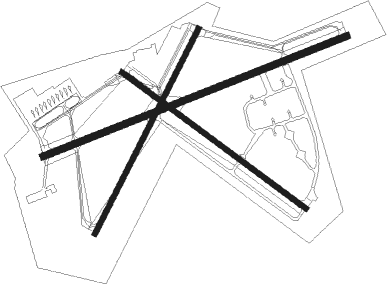
Runway info
Runway 8 / 26  | ||
| length | 3045m (9990ft) | |
| bearing | 74° / 254° | |
| width | 61m (200ft) | |
| surface | asphalt | |
| blast zone | 255m (837ft) / 255m (837ft) | |
| Runway 4 / 22 | ||
| length | 2140m (7021ft) | |
| bearing | 34° / 214° | |
| width | 46m (150ft) | |
| surface | asphalt | |
| blast zone | 255m (837ft) / 217m (712ft) | |
| Runway 14 / 32 | ||
| length | 2136m (7008ft) | |
| bearing | 128° / 308° | |
| width | 46m (150ft) | |
| surface | asphalt | |
| blast zone | 219m (719ft) / 217m (712ft) | |
Nearby beacons
| code | identifier | dist | bearing | frequency |
|---|---|---|---|---|
| NQX | NAVY KEY WEST TACAN | 0.4 | 37° | 113.10 |
| FIS | FISH HOOK (KEY WEST) NDB | 5.6 | 255° | 332 |
| EYW | KEY WEST VORTAC | 6.2 | 276° | 113.50 |
| MTH | MARATHON NDB | 33.3 | 77° | 260 |
Departure and arrival routes
| Transition altitude | 18000ft |
| Transition level | 18000ft |
| SID end points | distance | outbound heading | |
|---|---|---|---|
| DVALL | |||
| TIGAR3 | 68mi | 36° | |
| RW04 | |||
| TIGAR3 | 68mi | 36° | |
| VRGAS3 | 33mi | 77° | |
| RW08 | |||
| TIGAR3 | 68mi | 36° | |
| VRGAS3 | 33mi | 77° | |
| RW14 | |||
| TIGAR3 | 68mi | 36° | |
| VRGAS3 | 33mi | 77° | |
| RW22 | |||
| TIGAR3 | 68mi | 36° | |
| VRGAS3 | 33mi | 77° | |
| RW26 | |||
| TIGAR3 | 68mi | 36° | |
| VRGAS3 | 33mi | 77° | |
| RW32 | |||
| TIGAR3 | 68mi | 36° | |
| VRGAS3 | 33mi | 77° | |
Instrument approach procedures
| runway | airway (heading) | route (dist, bearing) |
|---|---|---|
| RW04 | BIPIN (260°) | BIPIN 1600ft TAVDE (26mi, 244°) 1600ft TAVDE (turn) 1600ft |
| RW04 | EYW (96°) | EYW 1600ft TAVDE (10mi, 176°) 1600ft TAVDE (turn) 1600ft |
| RW04 | TAVDE (35°) | TAVDE 1600ft |
| RNAV | TAVDE 1600ft MEDAC (5mi, 34°) 1600ft KNQX (6mi, 35°) 48ft (4951mi, 107°) 406ft CEGEX (4950mi, 287°) FISLI (9mi, 305°) SKIPP (10mi, 225°) 1600ft SKIPP (turn) 4000ft | |
| RW08 | BIPIN (260°) | BIPIN 1600ft DEMTE (29mi, 258°) 1600ft DEMTE (turn) 1600ft |
| RW08 | EYW (96°) | EYW 1600ft DEMTE (6mi, 232°) 1600ft DEMTE (turn) 1600ft |
| RW08 | STING (160°) | STING 1600ft DEMTE (22mi, 193°) 1600ft DEMTE (turn) 1600ft |
| RNAV | DEMTE 1600ft WEBUN (6mi, 74°) 1600ft KNQX (6mi, 75°) 49ft (4951mi, 107°) 406ft IBUSE (4948mi, 287°) SAGLE (10mi, 145°) 1600ft SAGLE (turn) 4000ft | |
| RW14 | STING (160°) | STING 1600ft LOWDN (12mi, 190°) 1600ft |
| RW14 | STRAP (201°) | STRAP 1600ft LOWDN (16mi, 239°) 1600ft LOWDN (turn) 1600ft |
| RNAV | LOWDN 1600ft OCETA (5mi, 128°) 1600ft KNQX (5mi, 128°) 48ft (4951mi, 107°) 406ft SAGLE (4943mi, 287°) 1600ft SAGLE (turn) 4000ft | |
| RW26 | BIPIN (260°) | BIPIN 1600ft CEXIG (6mi, 267°) 1600ft |
| RNAV | CEXIG 1600ft HEKEM (6mi, 258°) 1600ft KNQX (6mi, 254°) 49ft (4951mi, 107°) 406ft HIGIB (4954mi, 287°) SKIPP (9mi, 284°) 1600ft SKIPP (turn) 4000ft | |
| RW32 | BIPIN (260°) | BIPIN 1600ft SAGLE (14mi, 224°) 1600ft |
| RNAV | SAGLE 1600ft OBADE (5mi, 308°) 1600ft KNQX (6mi, 308°) 48ft (4951mi, 107°) 406ft PIBDE (4953mi, 287°) SKIPP (10mi, 271°) 1600ft SKIPP (turn) 4000ft |
Disclaimer
The information on this website is not for real aviation. Use this data with the X-Plane flight simulator only! Data taken with kind consent from X-Plane 12 source code and data files. Content is subject to change without notice.