Crows Landing - Nasa Crows Landing
Airport details
| Country | United States of America |
| State | California |
| Region | |
| Airspace | Oakland Ctr |
| Municipality | Stanislaus County |
| Elevation | 166ft (51m) |
| Timezone | GMT -8 |
| Coordinates | 37.42267, -121.10619 |
| Magnetic var | |
| Type | land |
| Available since | X-Plane v10.40 |
| ICAO code | KNRC |
| IATA code | NRC |
| FAA code | NRC |
Communication
Nearby Points of Interest:
El Viejo Post Office
-McHenry Mansion
-John Ohm House
-Pacheco Pass
-Bank of Italy
-Tracy City Hall and Jail
-Bank of Tracy
-Bloss Mansion
-Bank of Los Banos Building
-Church of St. Joseph
-Grant Ranch County Park
-Merced County High School
-United States Post Office (Merced, California)
-Kaehler-Rector House
-Maj. George Beecher Cook House
-Leggett House
-Thomas H. Leggett House
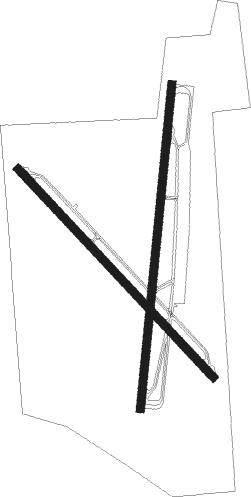
Runway info
Runway 17 / 35  | ||
| length | 2447m (8028ft) | |
| bearing | 193° / 13° | |
| width | 61m (200ft) | |
| surface | concrete | |
| Runway 12 / 30 | ||
| length | 2143m (7031ft) | |
| bearing | 135° / 315° | |
| width | 61m (200ft) | |
| surface | concrete | |
Nearby beacons
| code | identifier | dist | bearing | frequency |
|---|---|---|---|---|
| MOD | MODESTO VOR/DME | 14.1 | 36° | 114.60 |
| LV | REIGA (LIVERMORE) NDB | 31.9 | 295° | 374 |
| HYP | EL NIDO (MERCED) VOR/DME | 35.8 | 106° | 114.20 |
| LIN | LINDEN VOR/DME | 39.4 | 9° | 114.80 |
| SJC | SAN JOSE VOR/DME | 40.1 | 267° | 114.10 |
| PXN | PANOCHE VORTAC | 45.2 | 155° | 112.60 |
| NUQ | MOFFETT (MOUNTAIN VIEW) TACAN | 45.3 | 271° | 117.60 |
| SNS | SALINAS VORTAC | 51.4 | 213° | 117.30 |
| CCR | CONCORD VOR/DME | 58.1 | 304° | 117 |
| UAD | CHUALAR (SALINAS) NDB | 58.6 | 202° | 263 |
| MR | MUNSO (MONTEREY) NDB | 62.5 | 226° | 385 |
| SUU | TRAVIS (FAIRFIELD) TACAN | 63.4 | 314° | 116.60 |
Disclaimer
The information on this website is not for real aviation. Use this data with the X-Plane flight simulator only! Data taken with kind consent from X-Plane 12 source code and data files. Content is subject to change without notice.